With some repairs and maintenance work needed for our RV, we headed to a repair location in Colorado identified by the RV manufacturer. To get there, we needed to spent an oversight in Brigham City, Utah. We thought we had arranged space at a campground in the area – Wrong! The campground had us coming in the next day. No other campground availability in the area, but there was a Walmart. Many campers have stayed overnight at Walmart and this was our turn to try it. We checked in with the Walmart manager, who said ‘no problem’ and pointed us to where to park. Sure felt strange to do this, yet it worked out quite well. We did some grocery shopping there and settled in for the evening. Not that noisy and not too many lights around. We even had horses grazing on the land right on the other side of the fence from our RV.
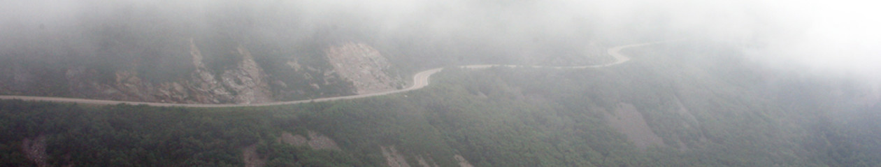
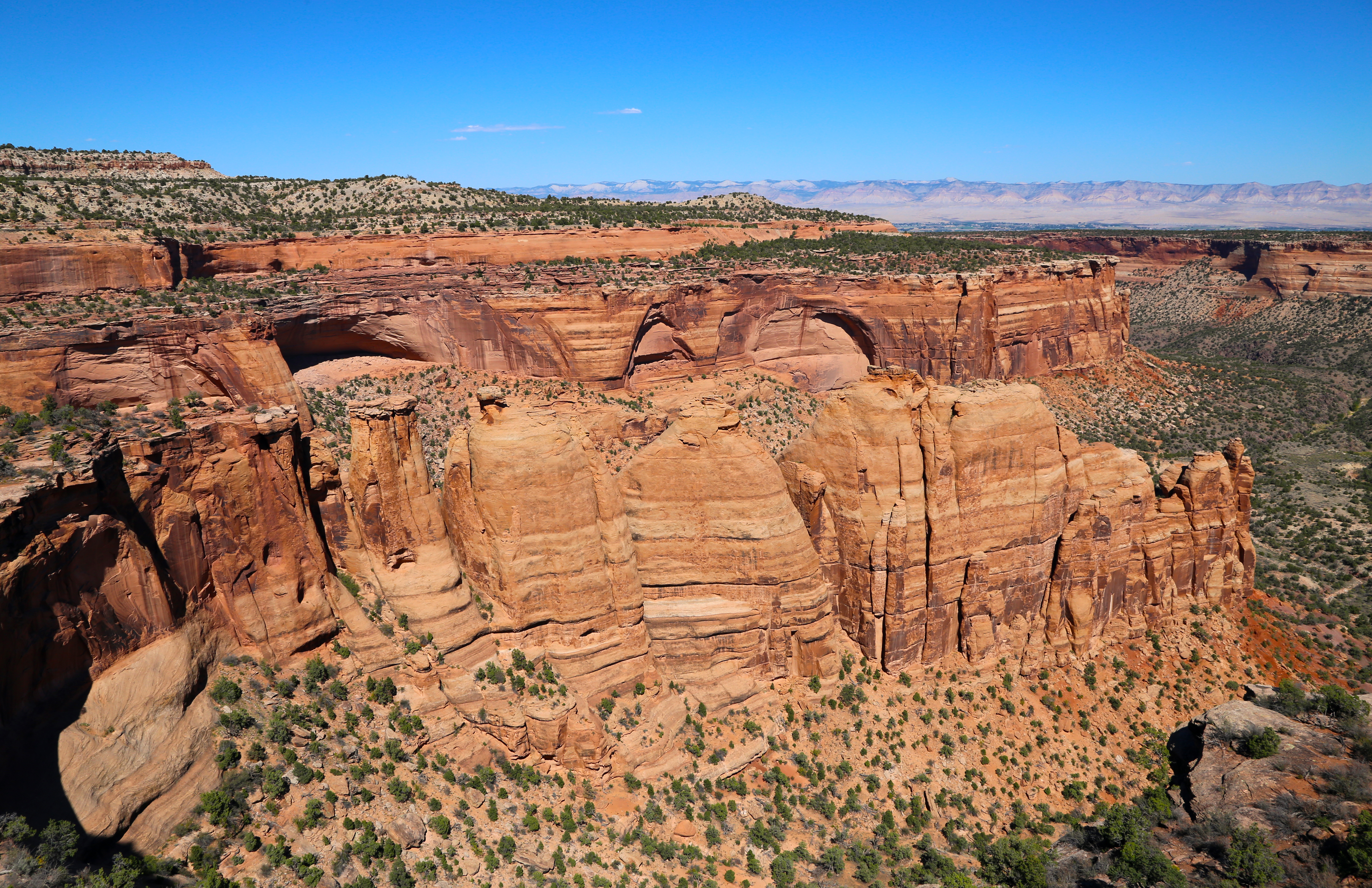
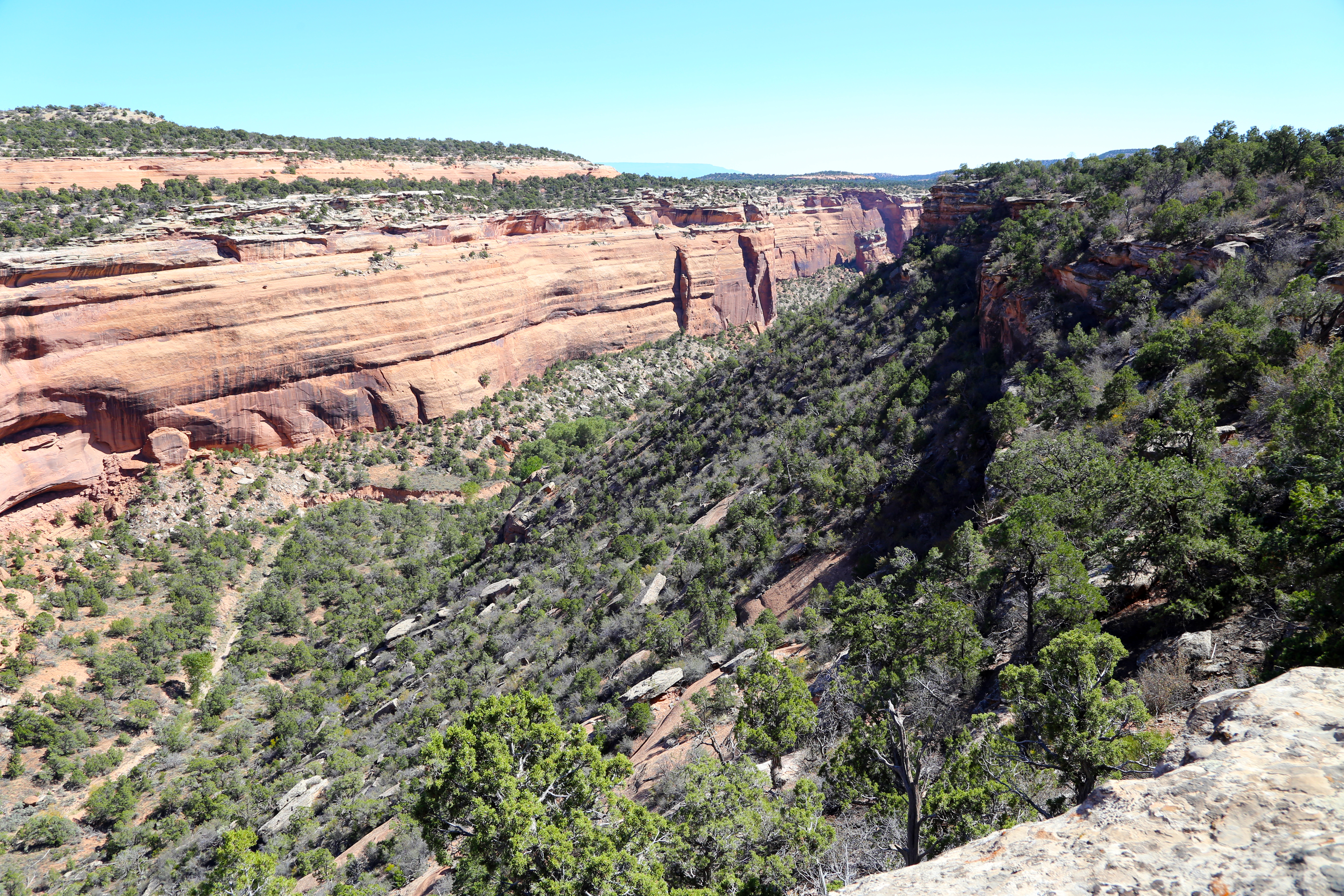
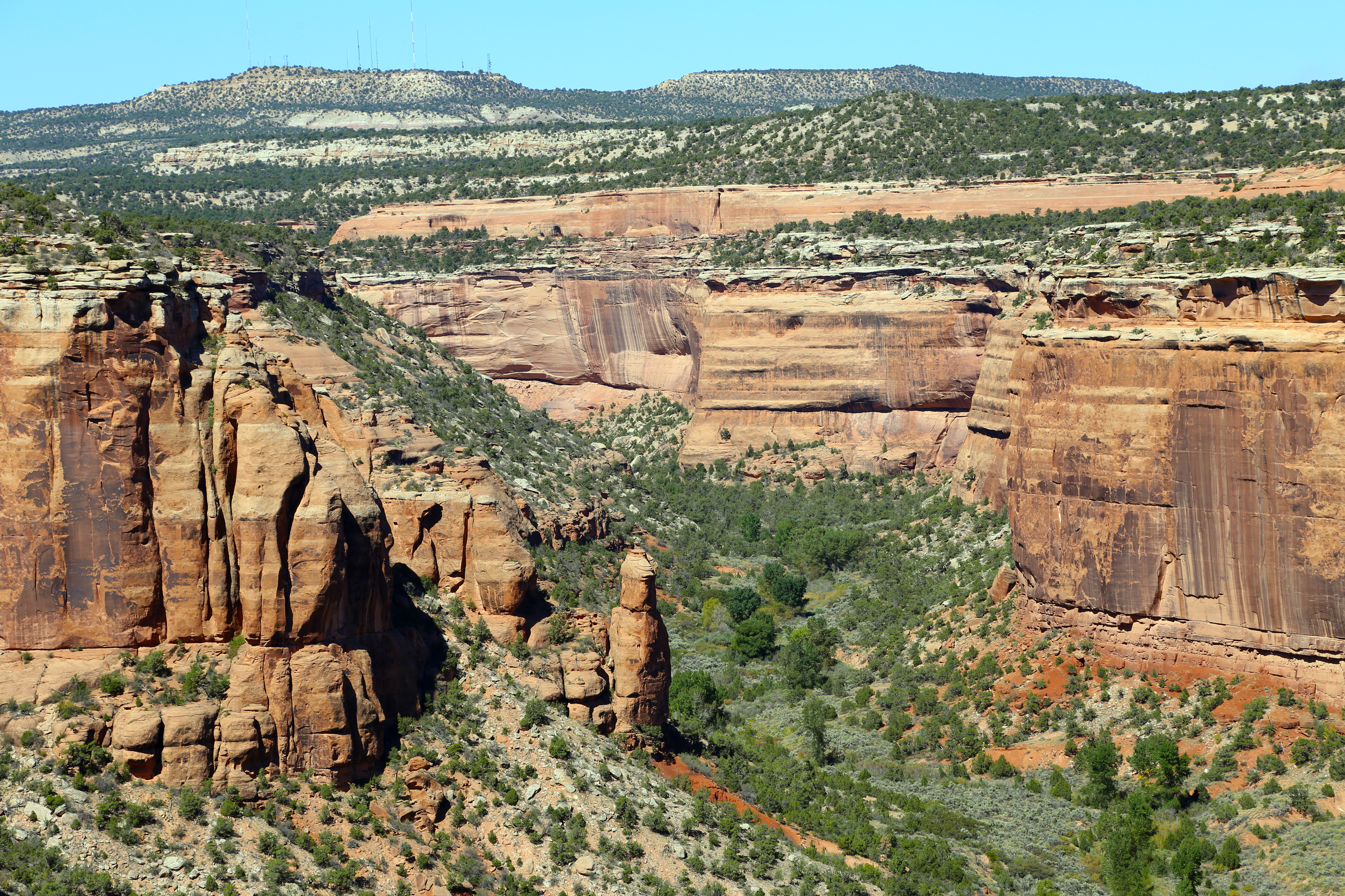
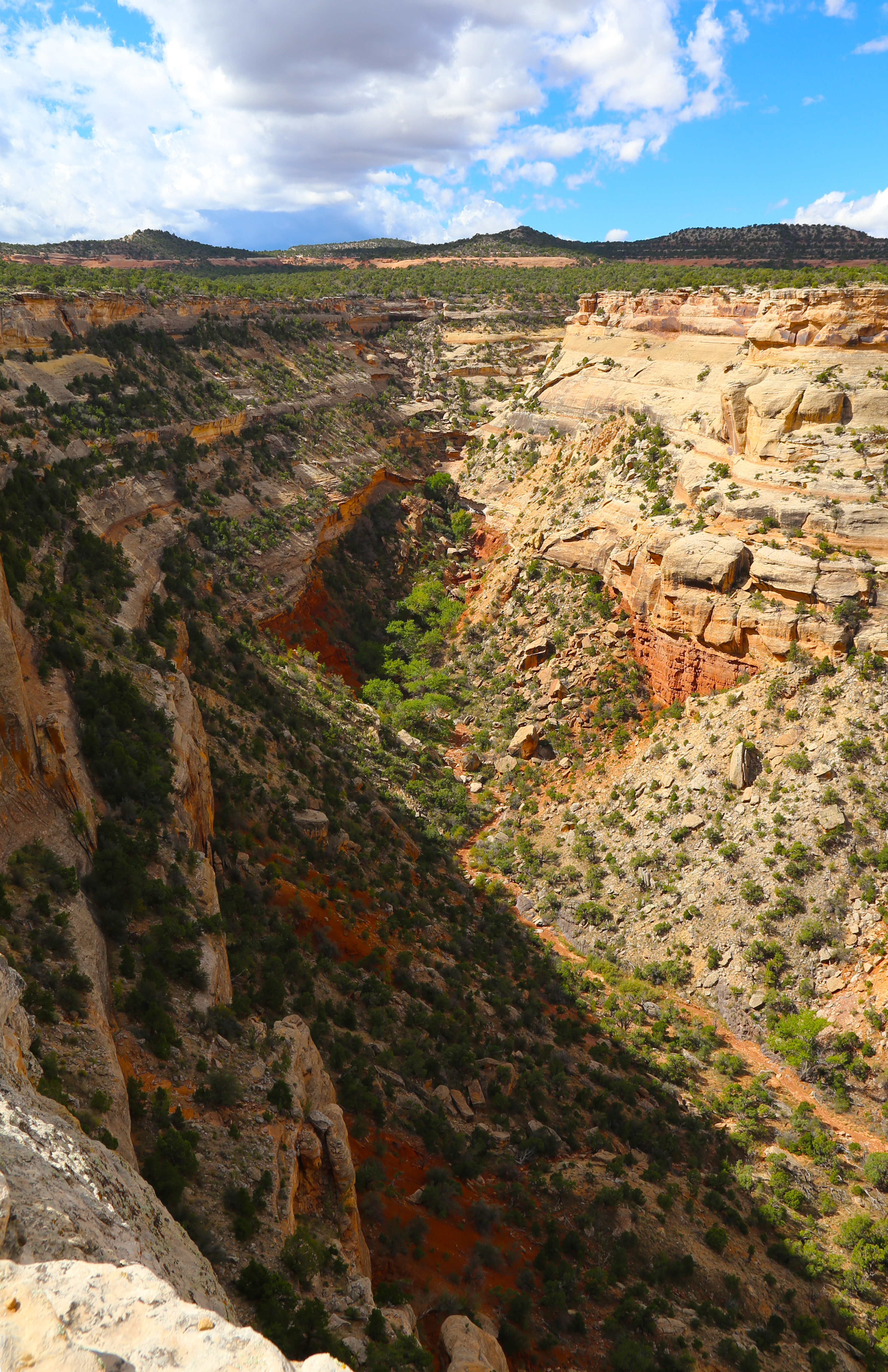
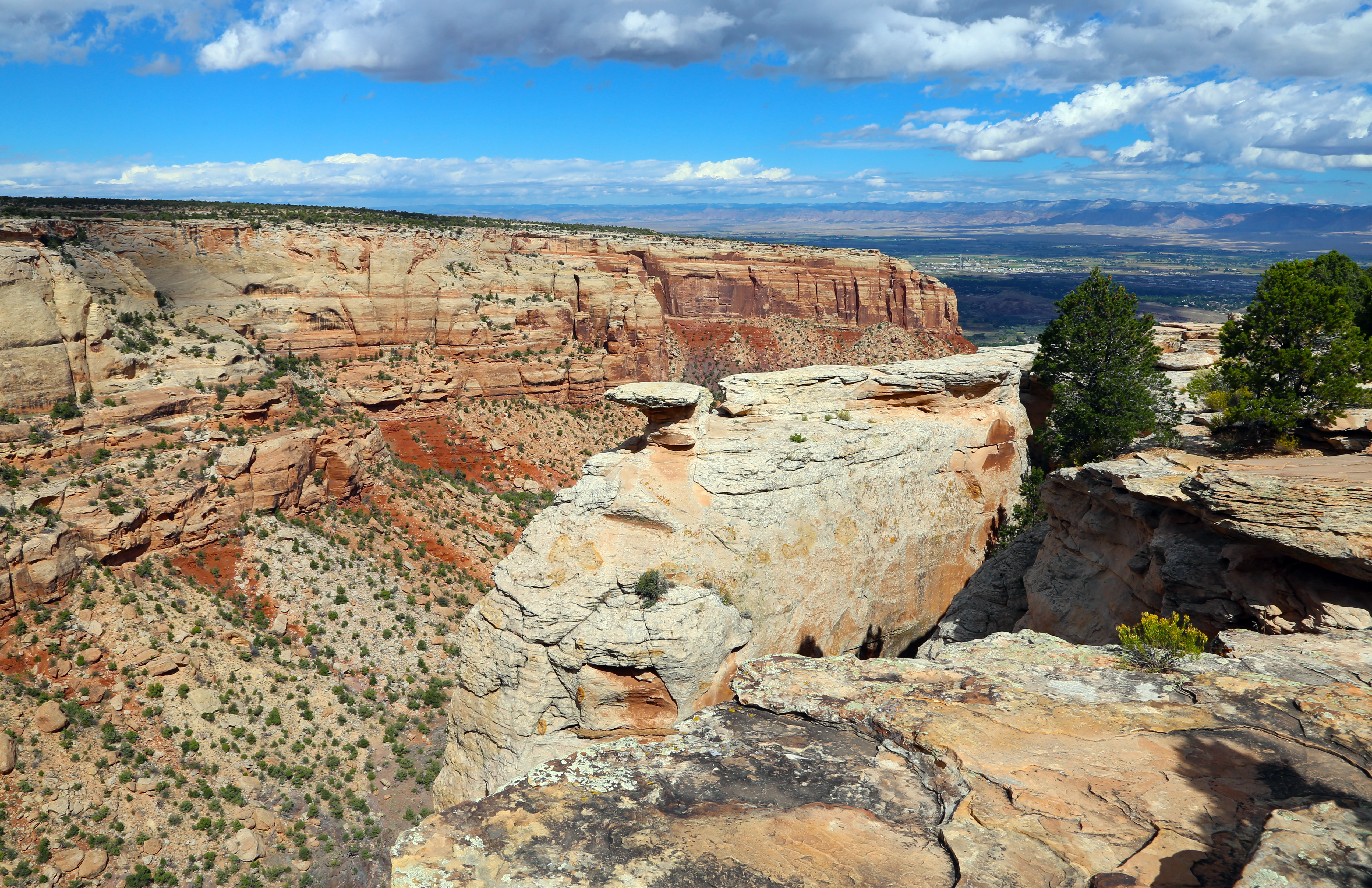
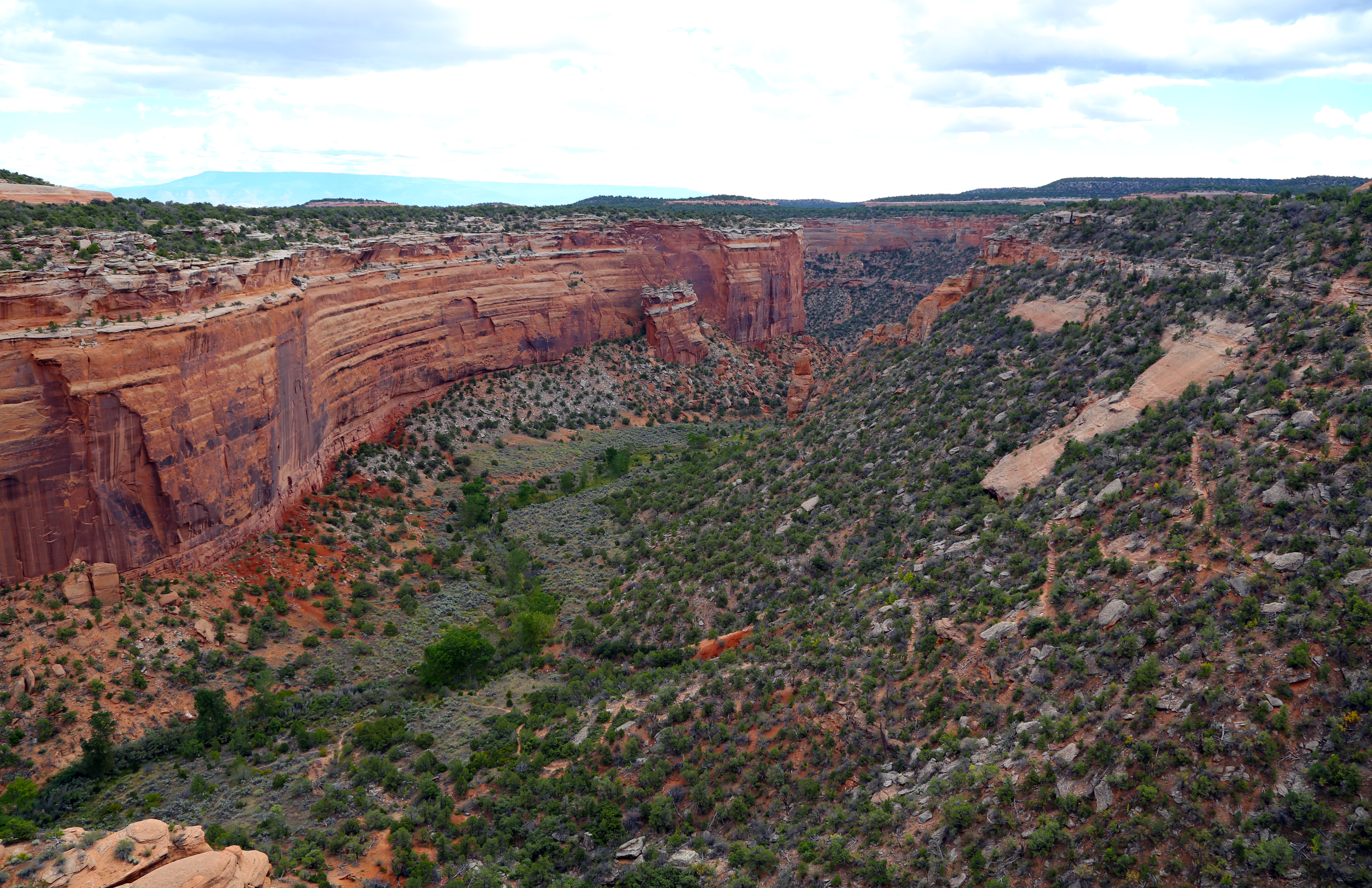
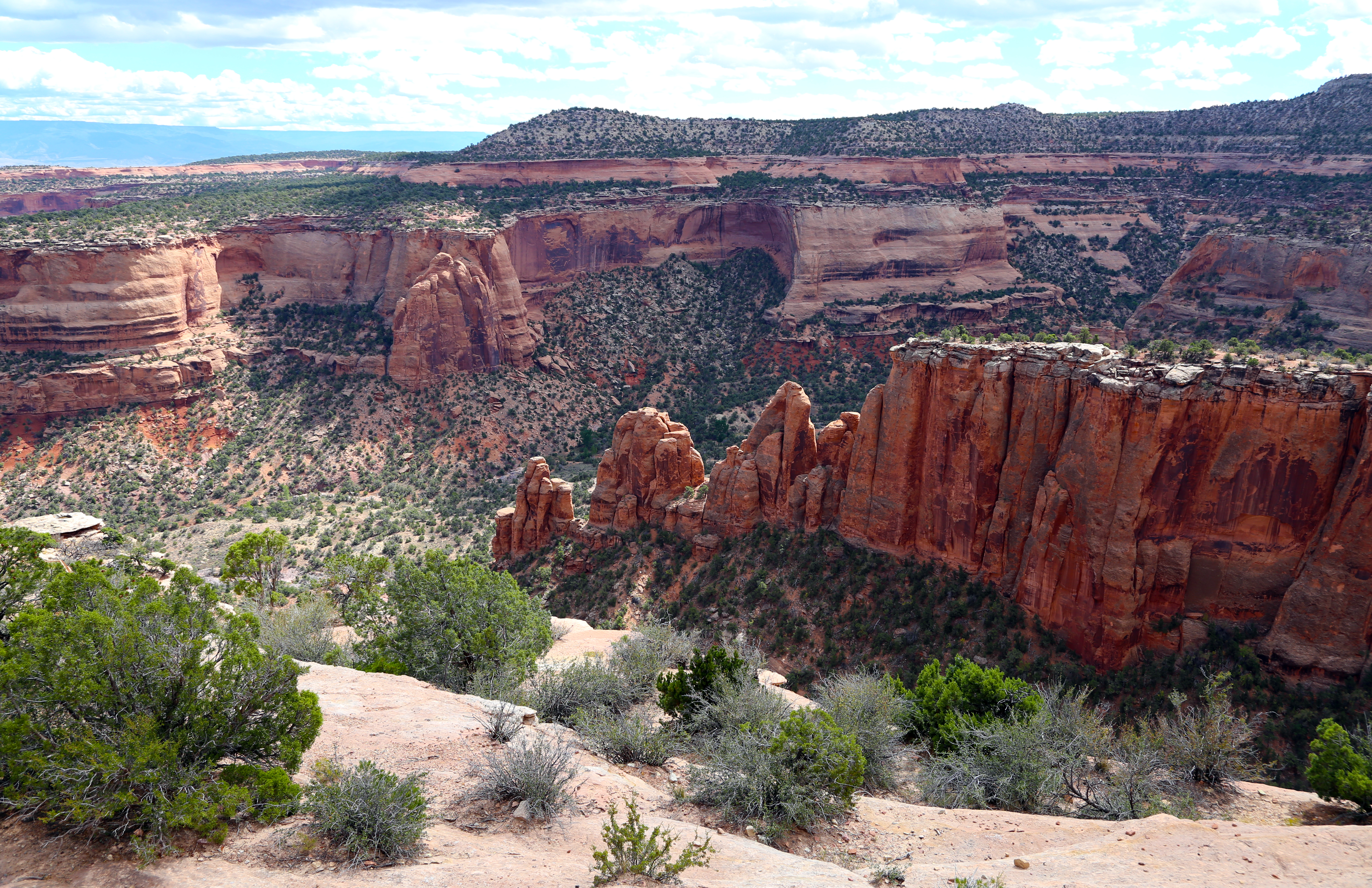
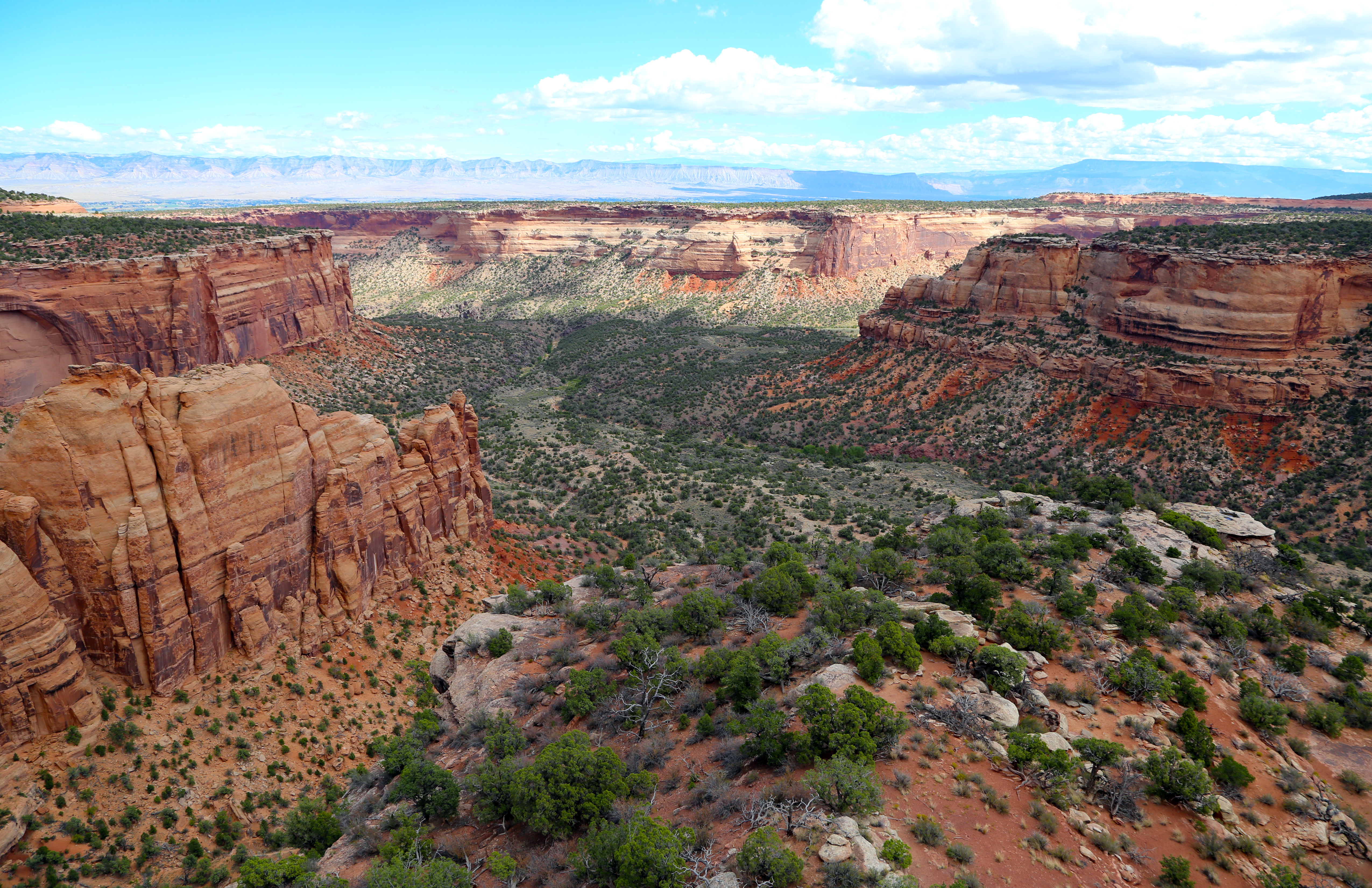
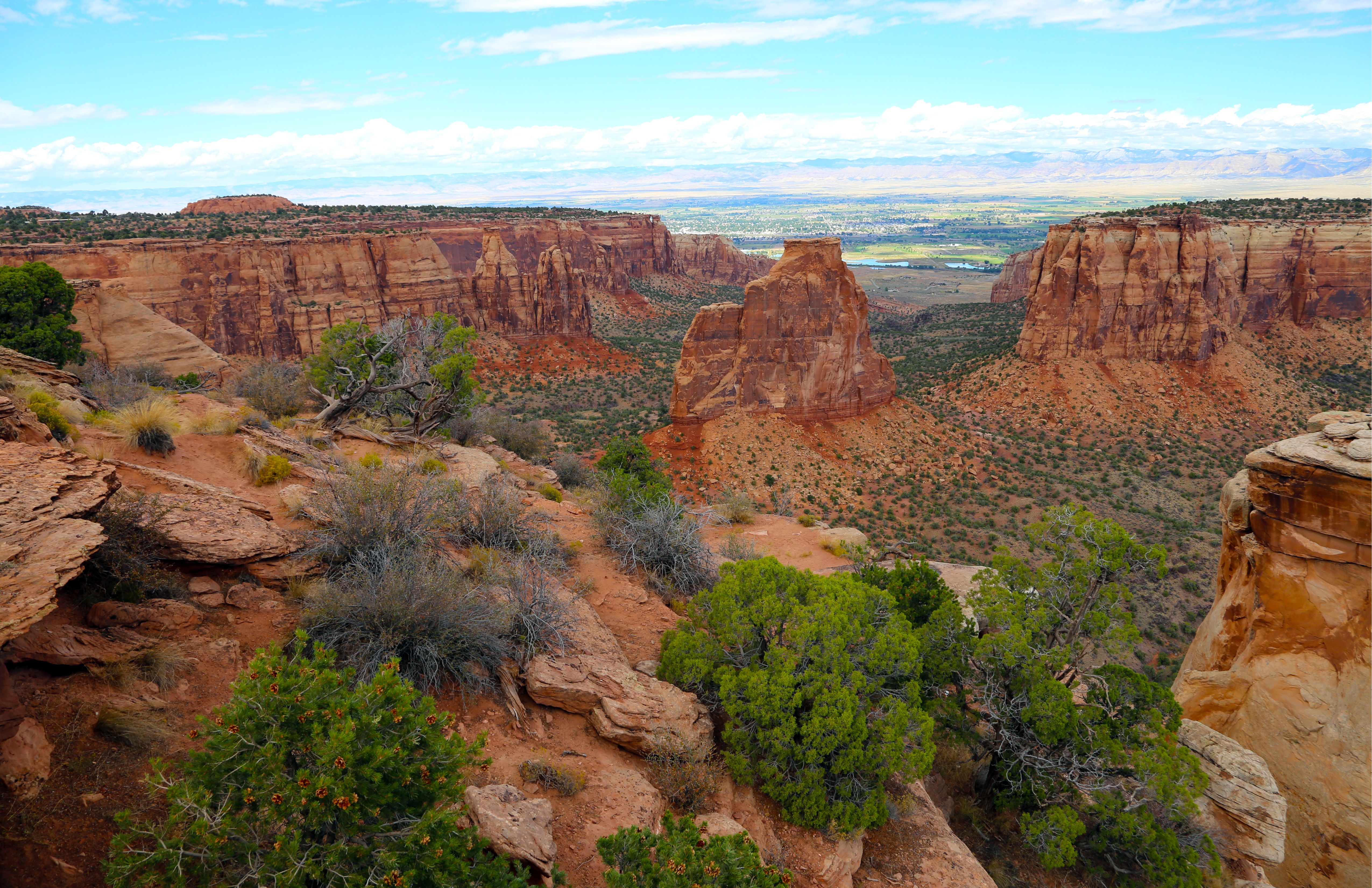
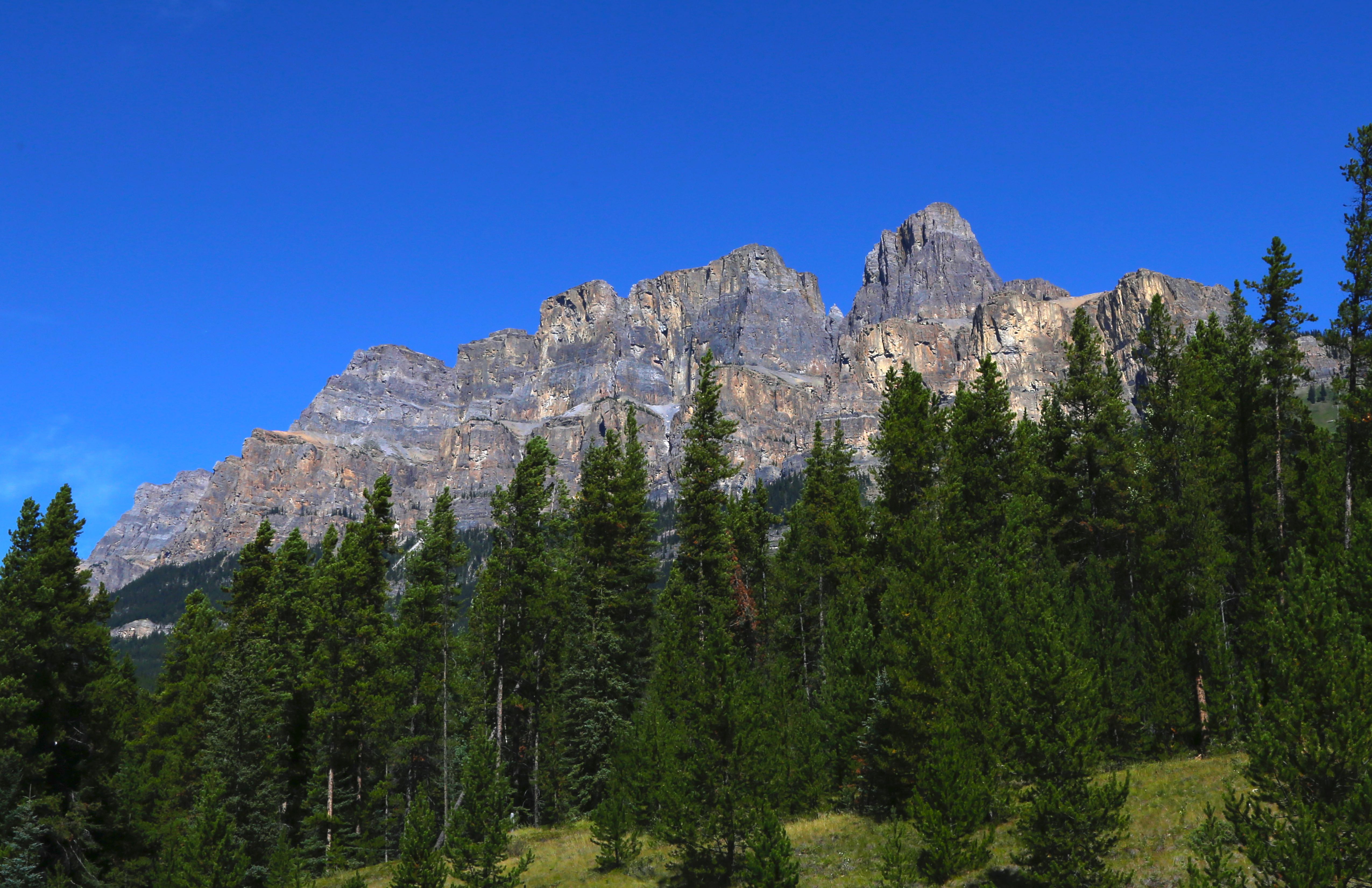
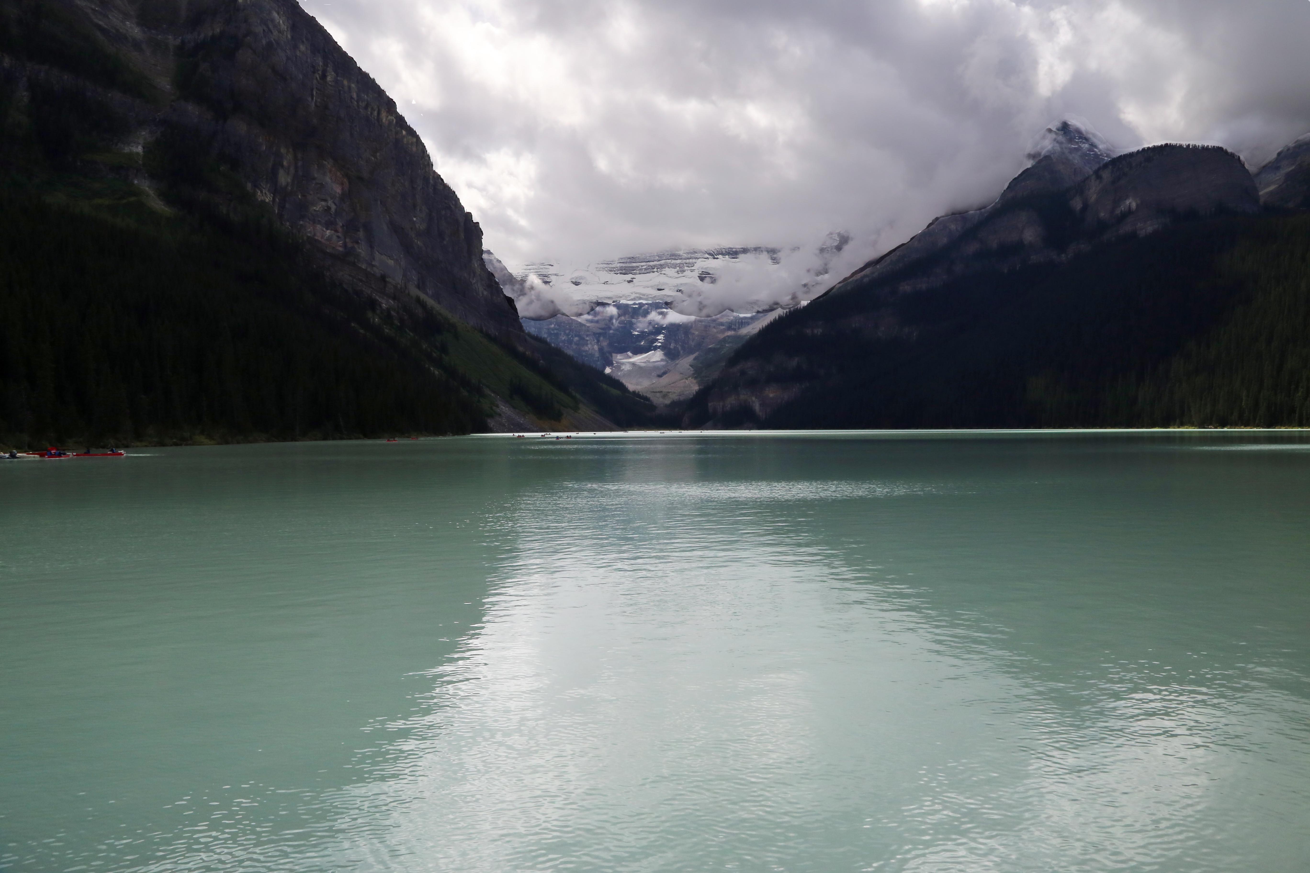
Grand Junction, Colorado – our location for RV repairs. We stayed here off and on during a two week period having work done on our motor home. While waiting for parts to be delivered, we spent the other time at Ridgeway State Park, about an hour outside Grand Junction. Both areas beautiful – so much to see! The Colorado National Monument located west of Grand junction is a large plateau with incredible red rock canyons and panoramic vistas. The Rim Rock Drive, with its many twists and turns and breath-taking drop offs, reminds me of the Going to the Sun road in Glacier.
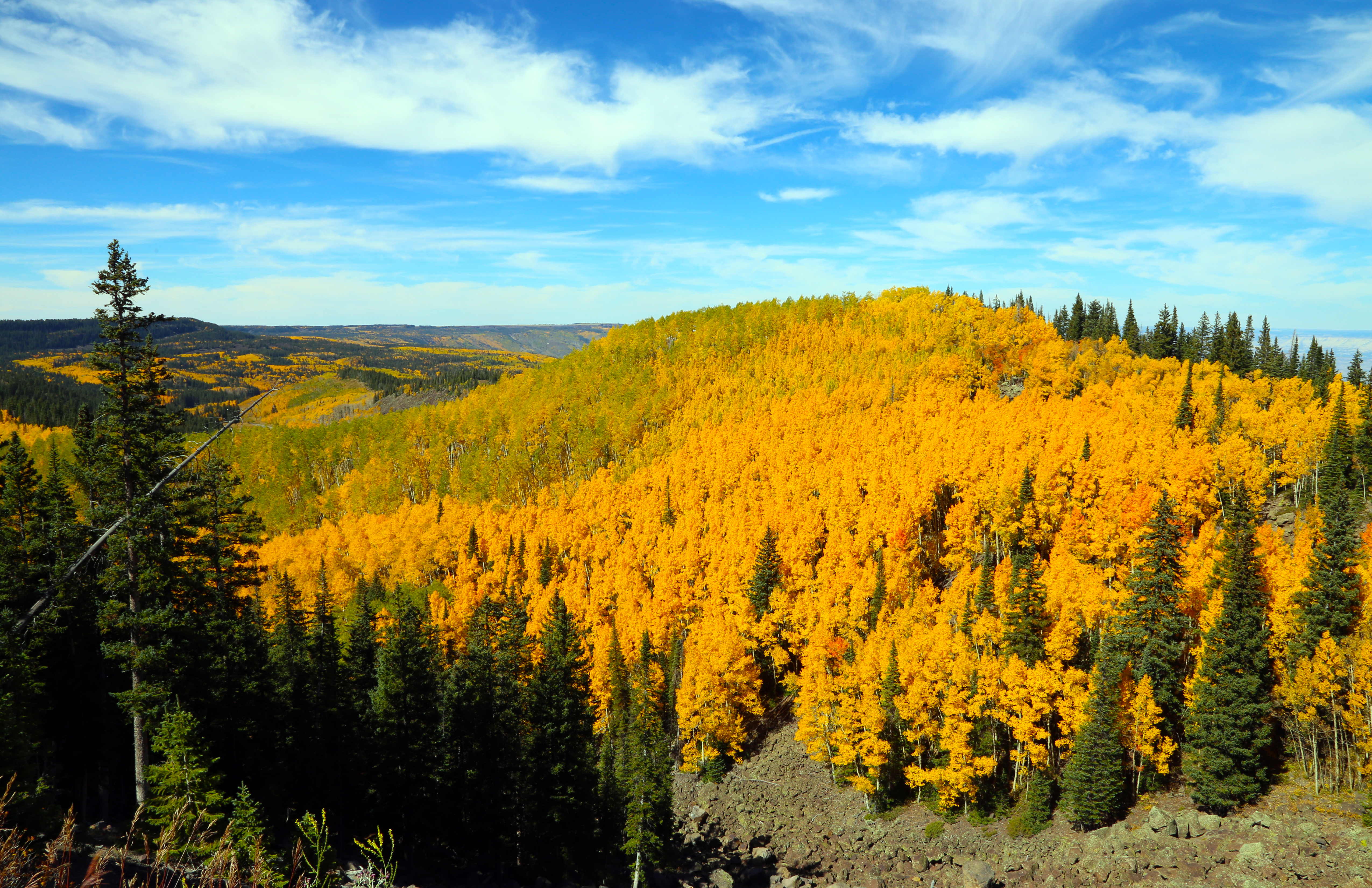
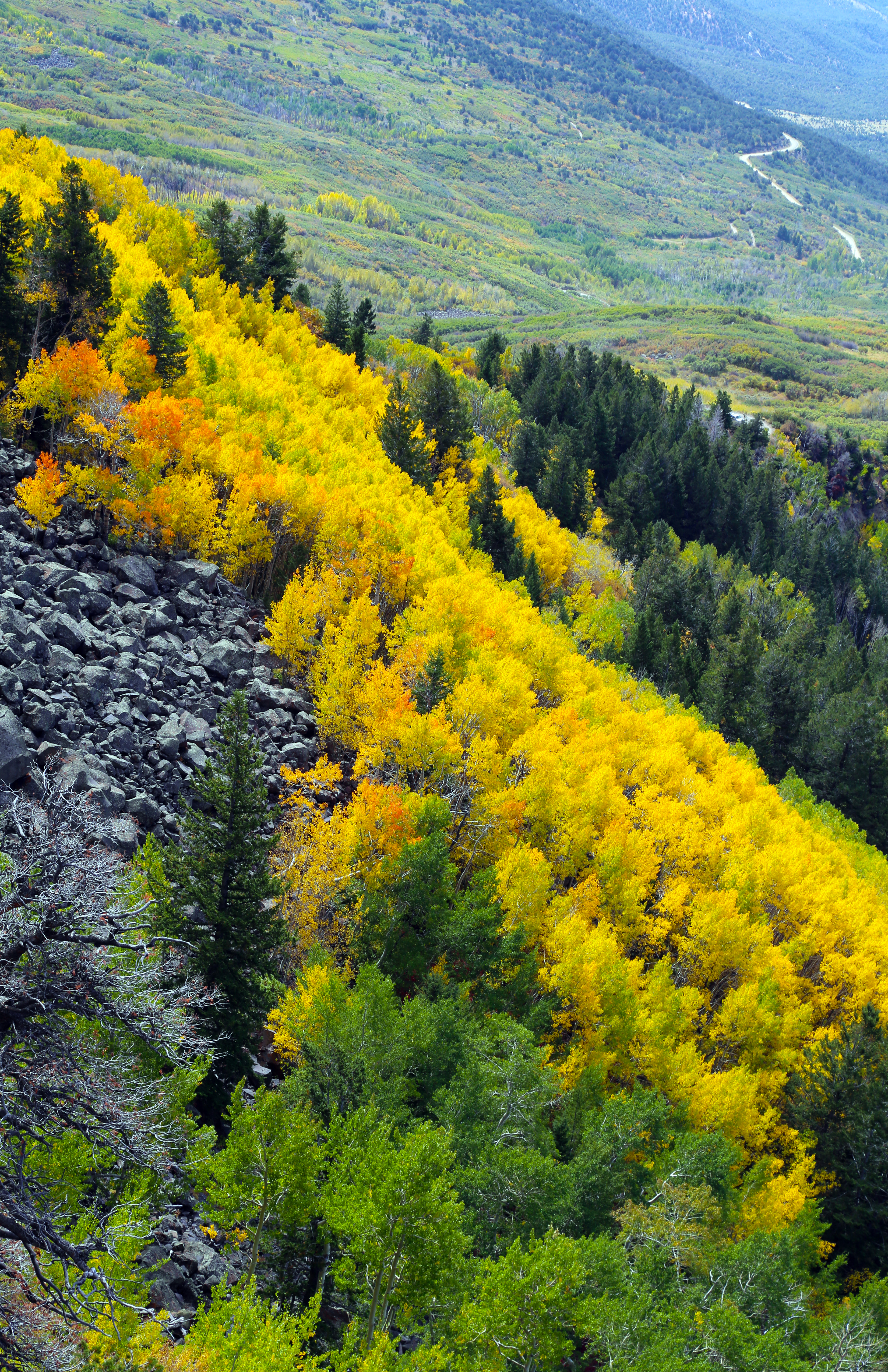
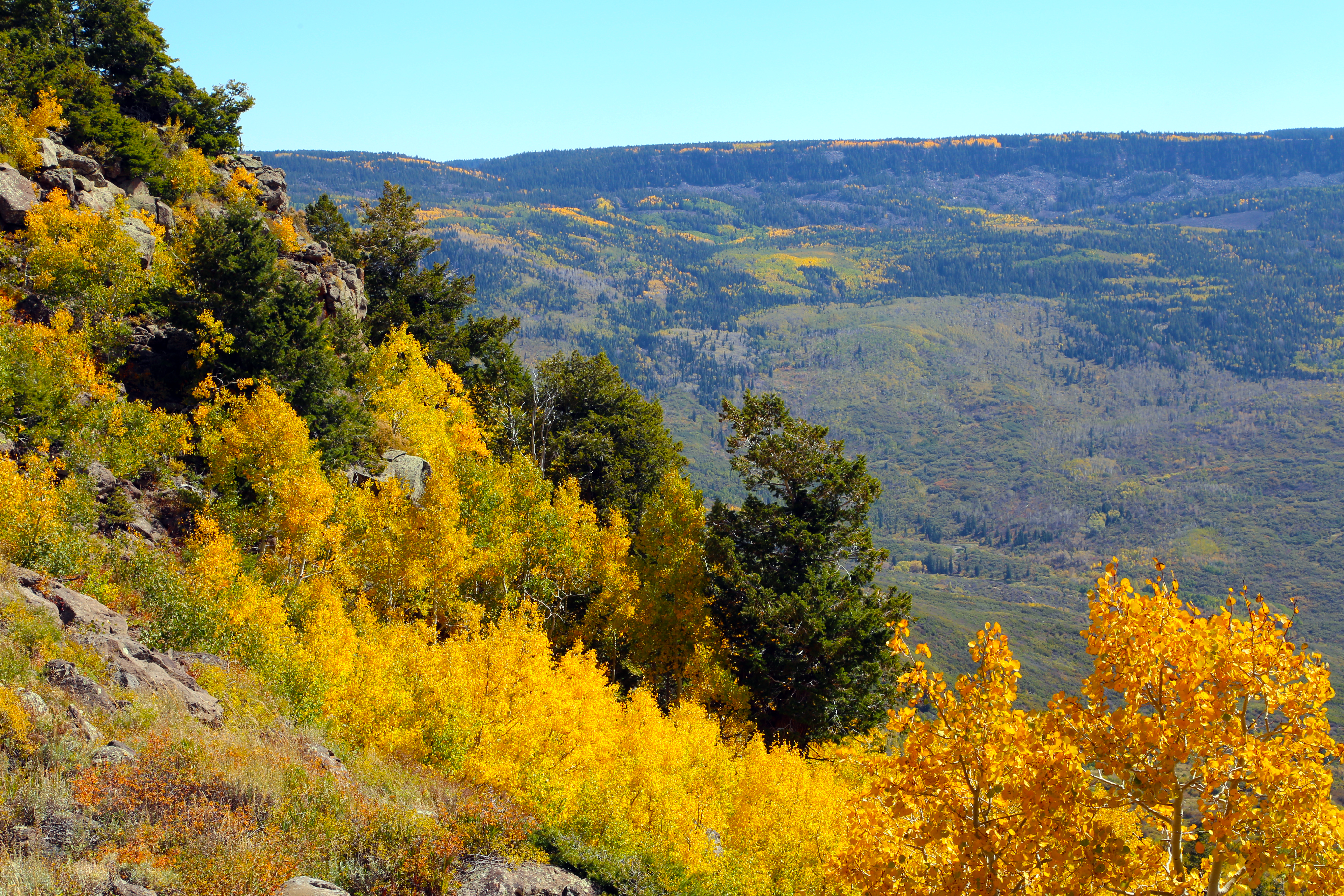
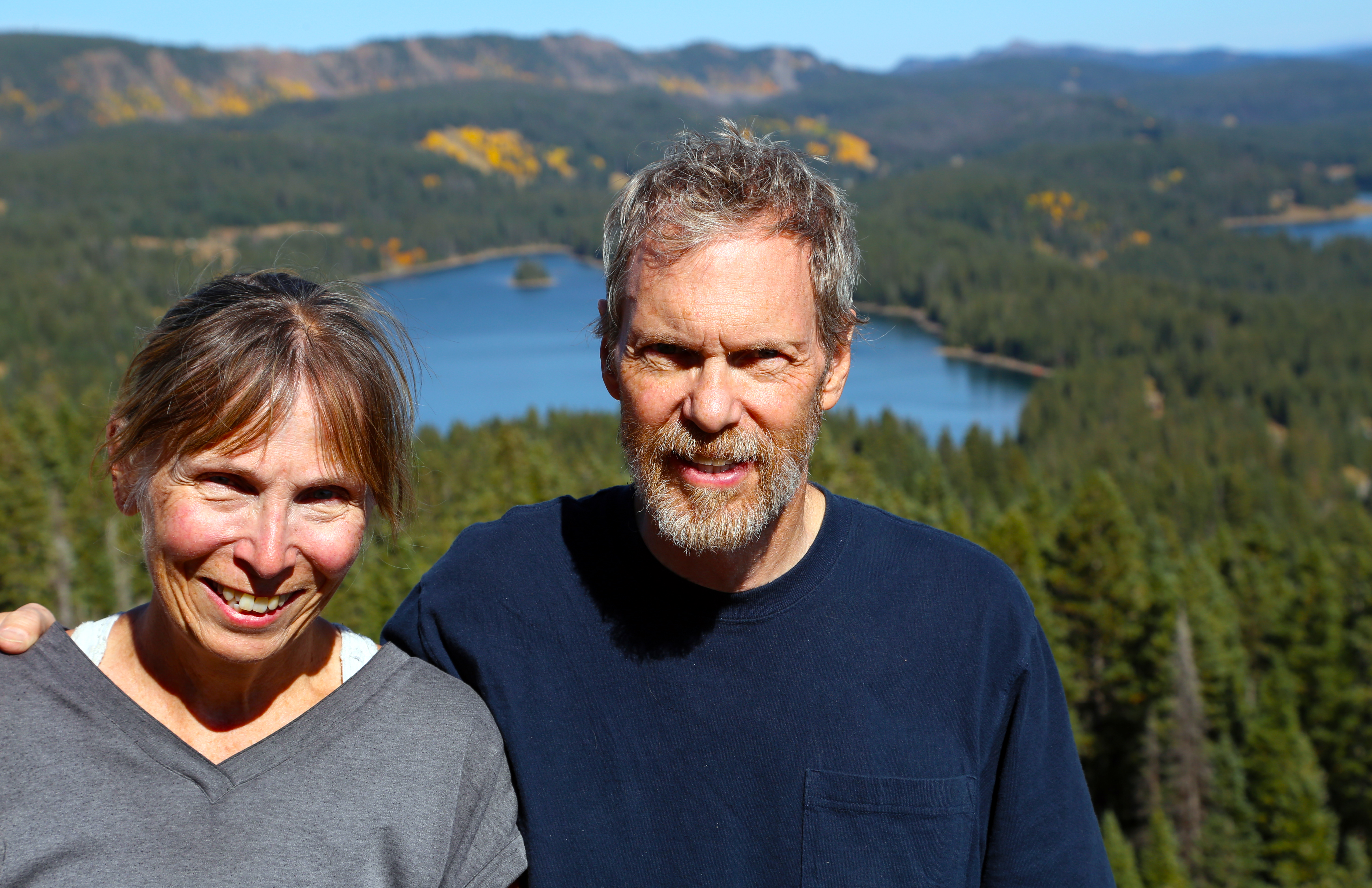
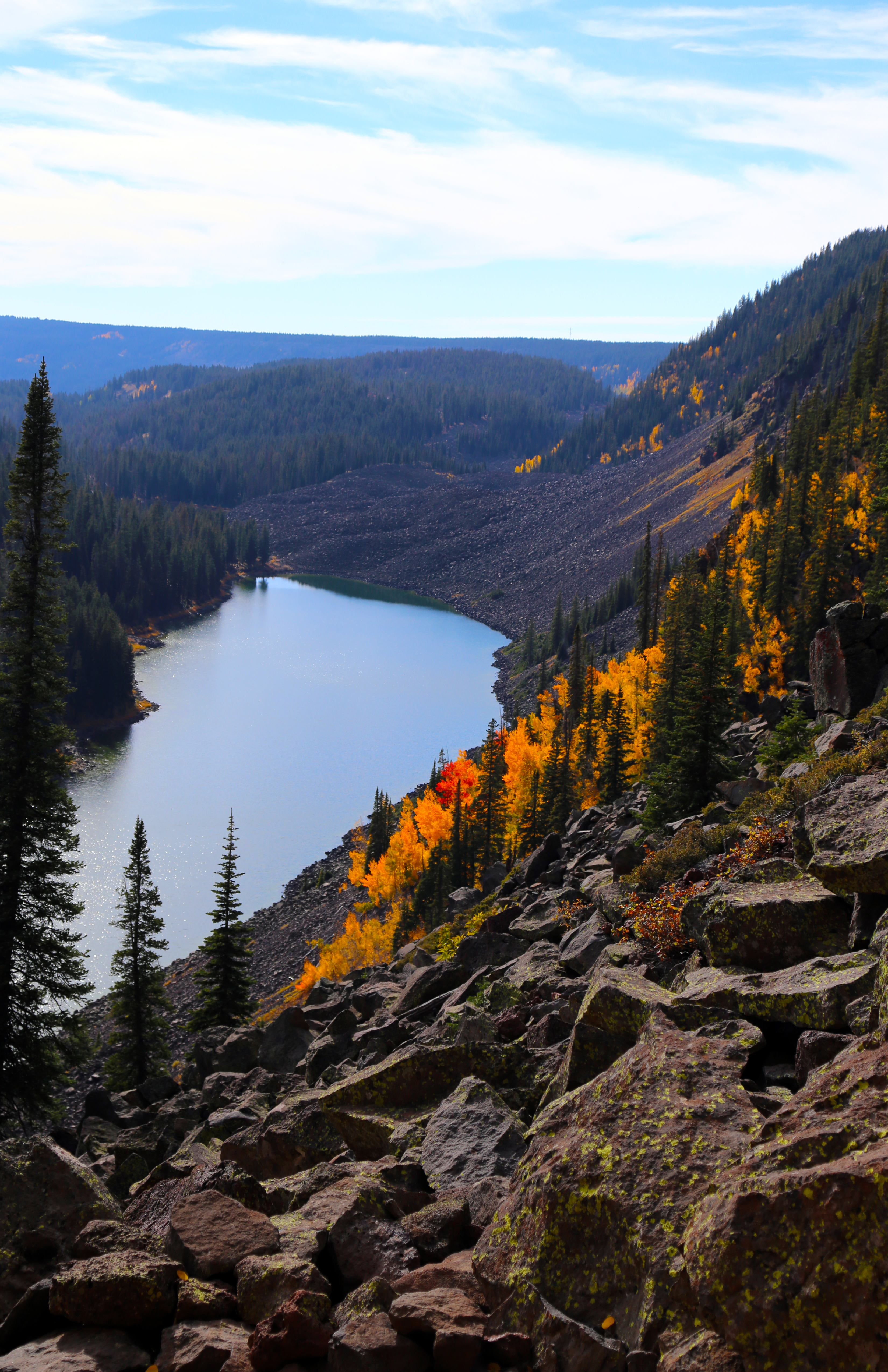
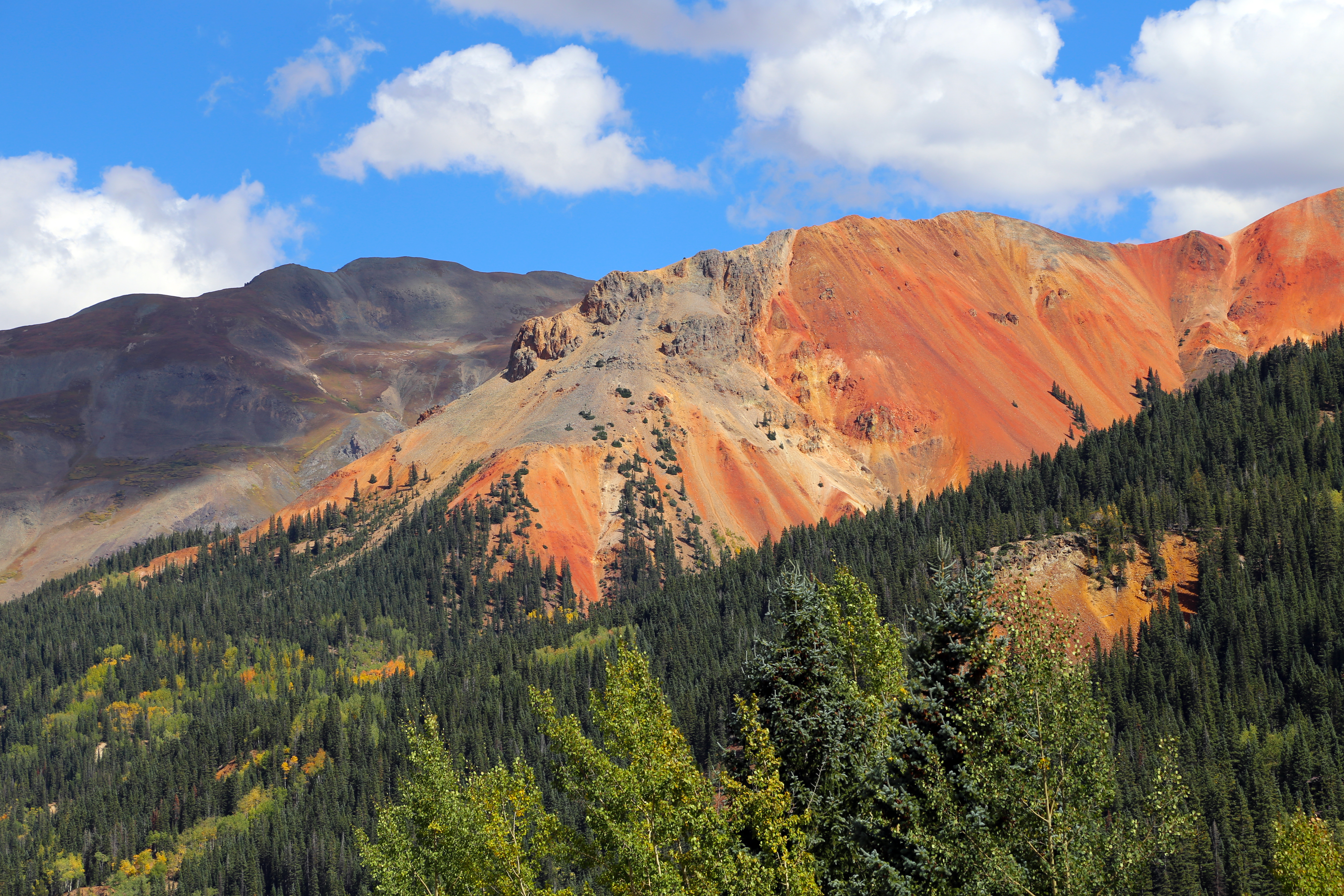
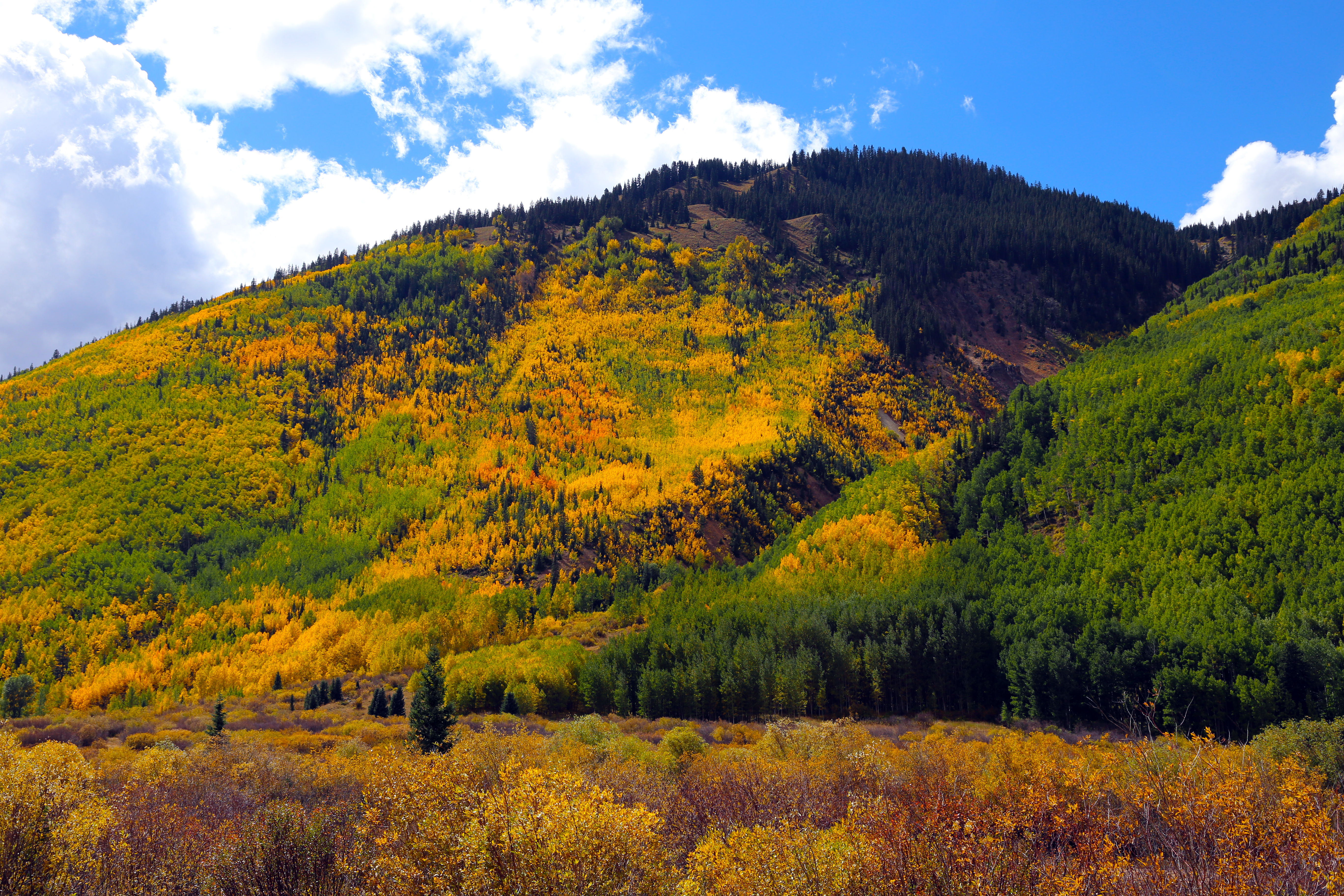
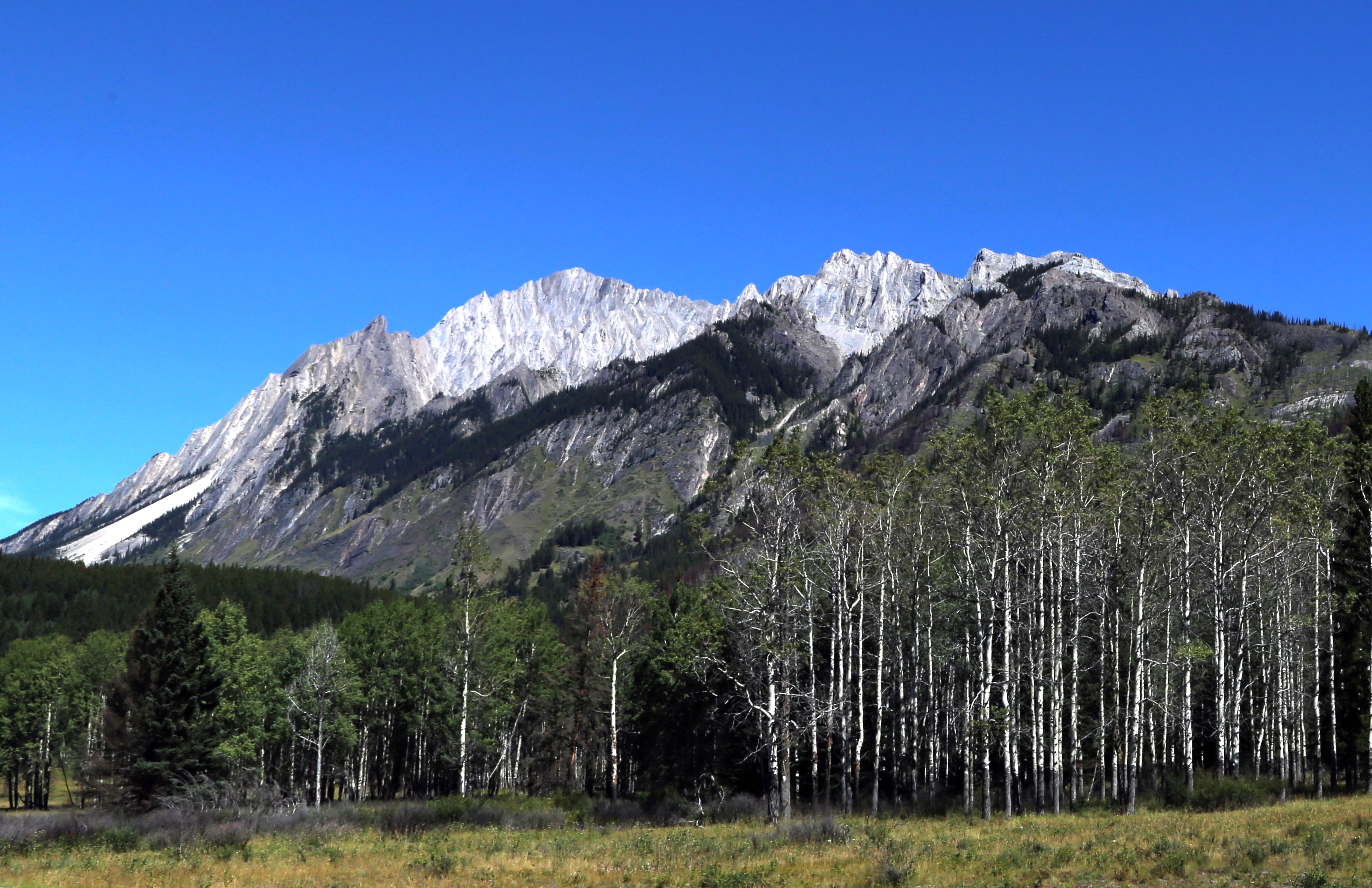
On the east of Grand Junction is Grand Mesa, the largest flat top mountain in the world with elevation reaching 11,000 feet. We visited Grand Mesa ‘Color Weekend’, when the aspens turn brilliant yellows and golds. Lots of great hiking in this area.
Fall Colors on Grand Mesa, ColoradoFall Colors on Grand Mesa, ColoradoFall Colors on Grand Mesa, ColoradoJoan and Steve Squinting at the Camera at Land O Lakes Overlook, Grand Mesa, ColoradoFall Colors on Grand Mesa, Colorado
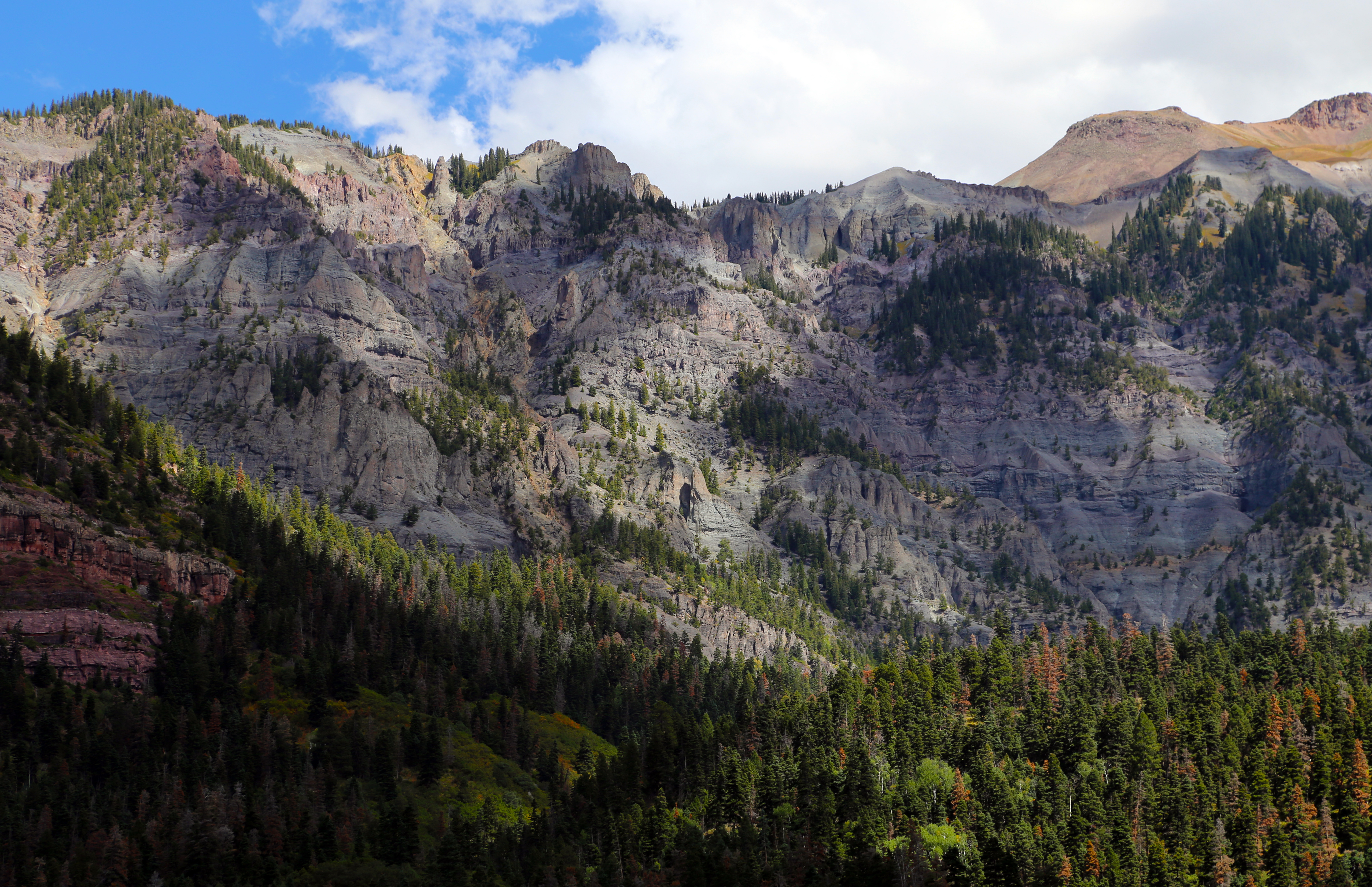
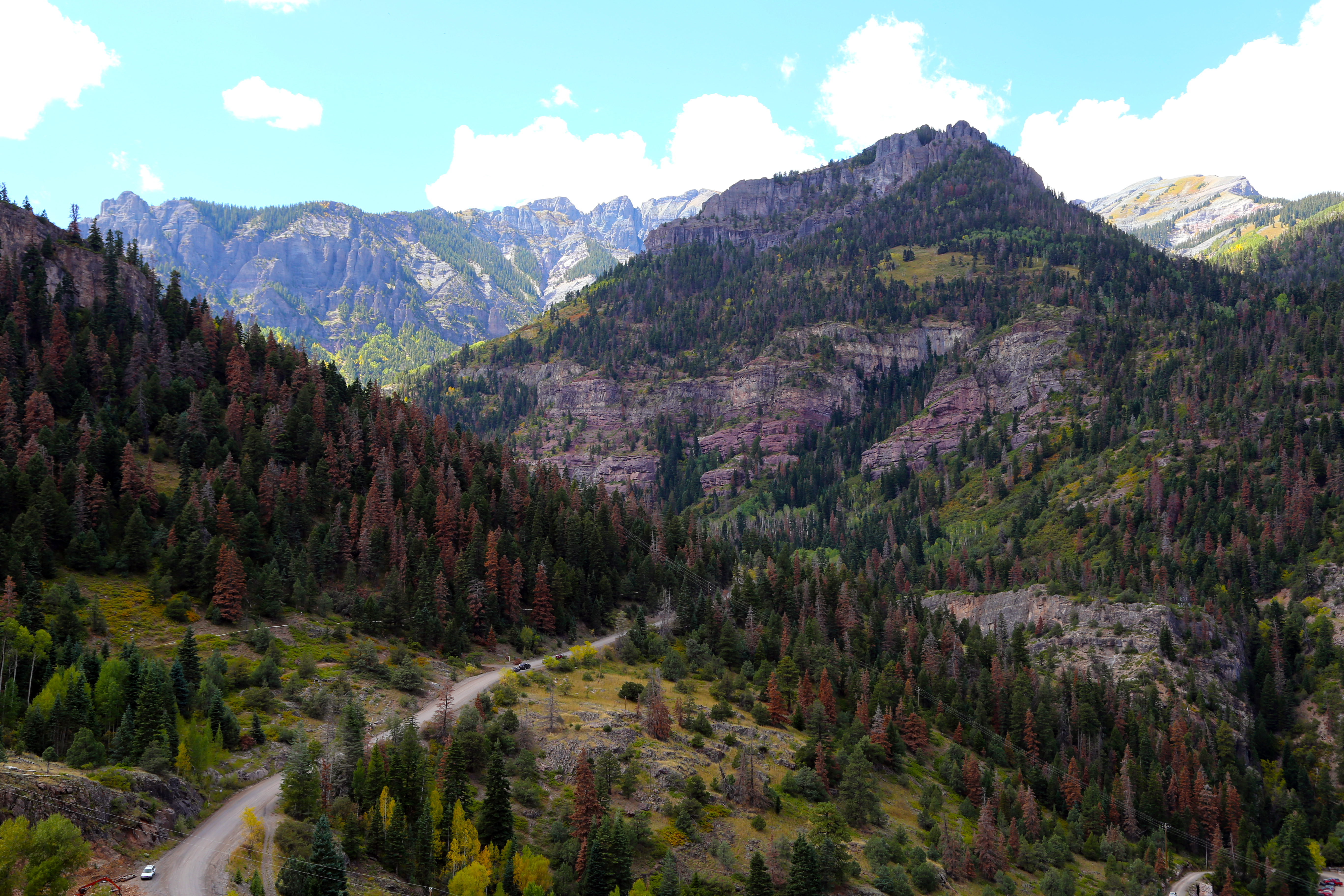
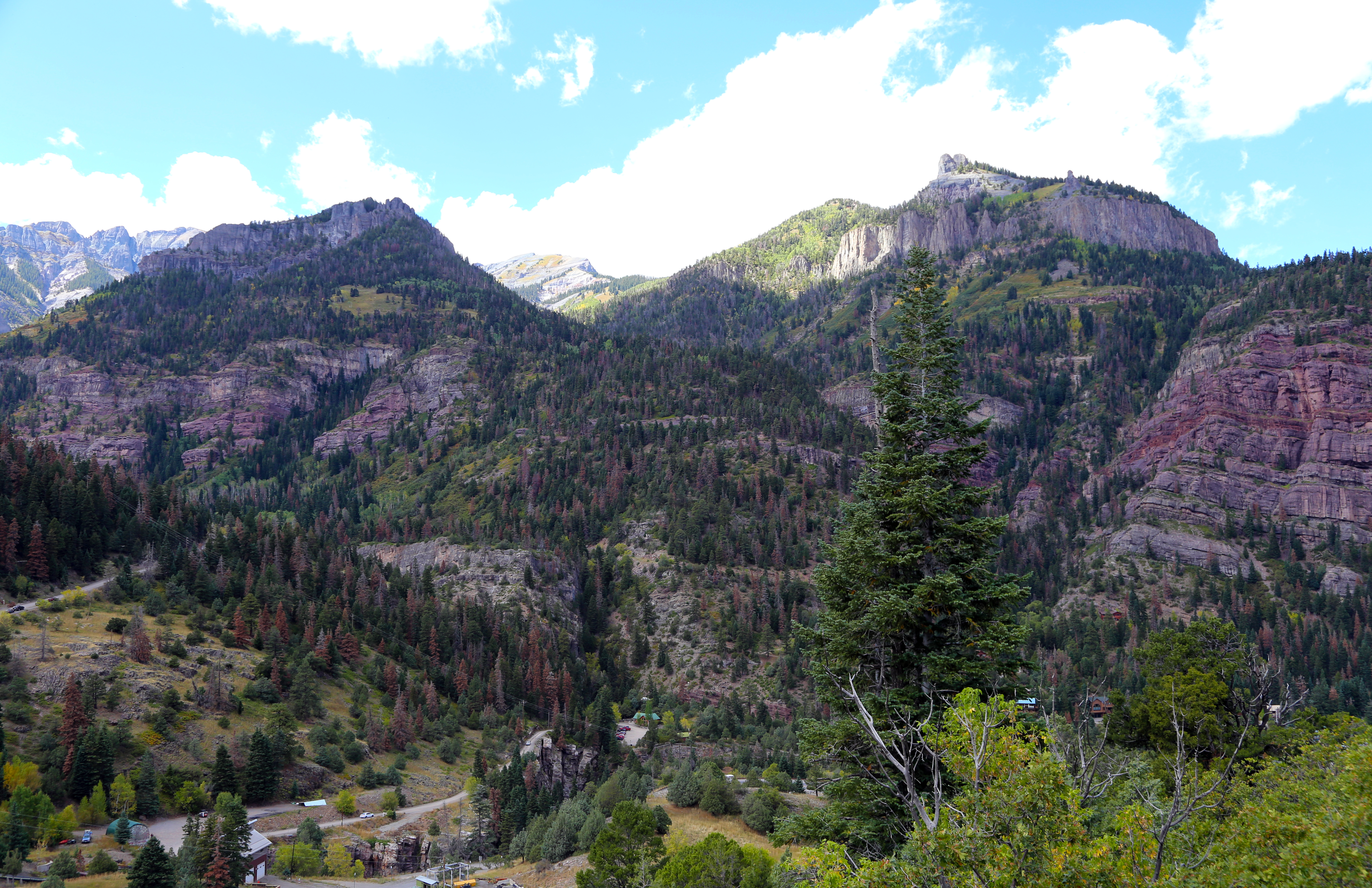
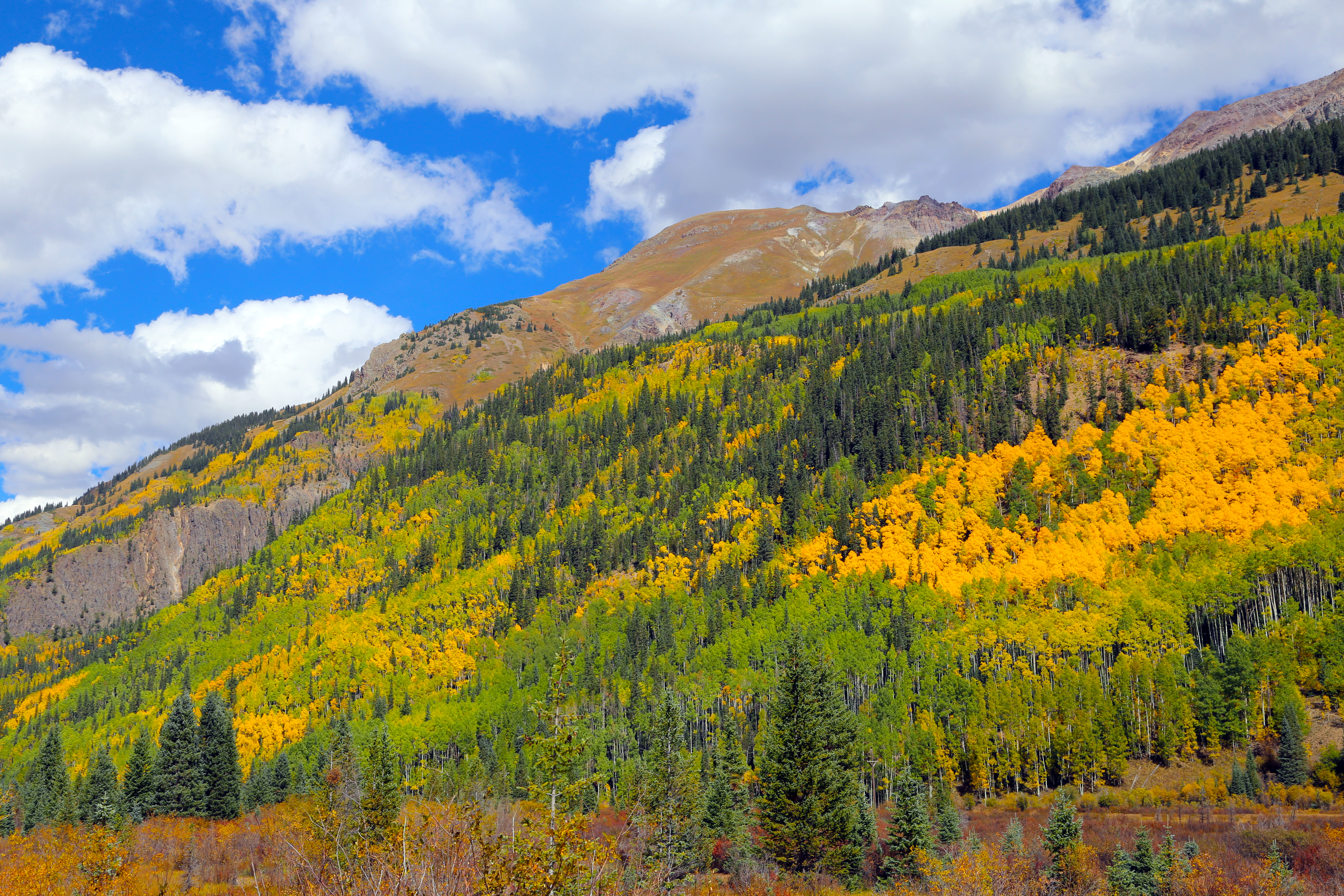
Ridgeway State Park, located near Ouray and Telluride, is another wonderful, quiet state park. Maybe a third of the campsites in use. In Ouray, a town considered ‘The Switzerland of America’, we fell in love with hot springs! The town owns and runs a public hot springs that has been in place since the 1920’s. The sulfur free pool is open year round. We spent three evenings there, relaxing in 97 degree waters, looking at the mountains and stars all around. The Ouray area is filled with unforgettable scenery – rugged mountains, once booming mining cities; True Grit and other old Hollywood westerns were filmed here, most roads are dirt.
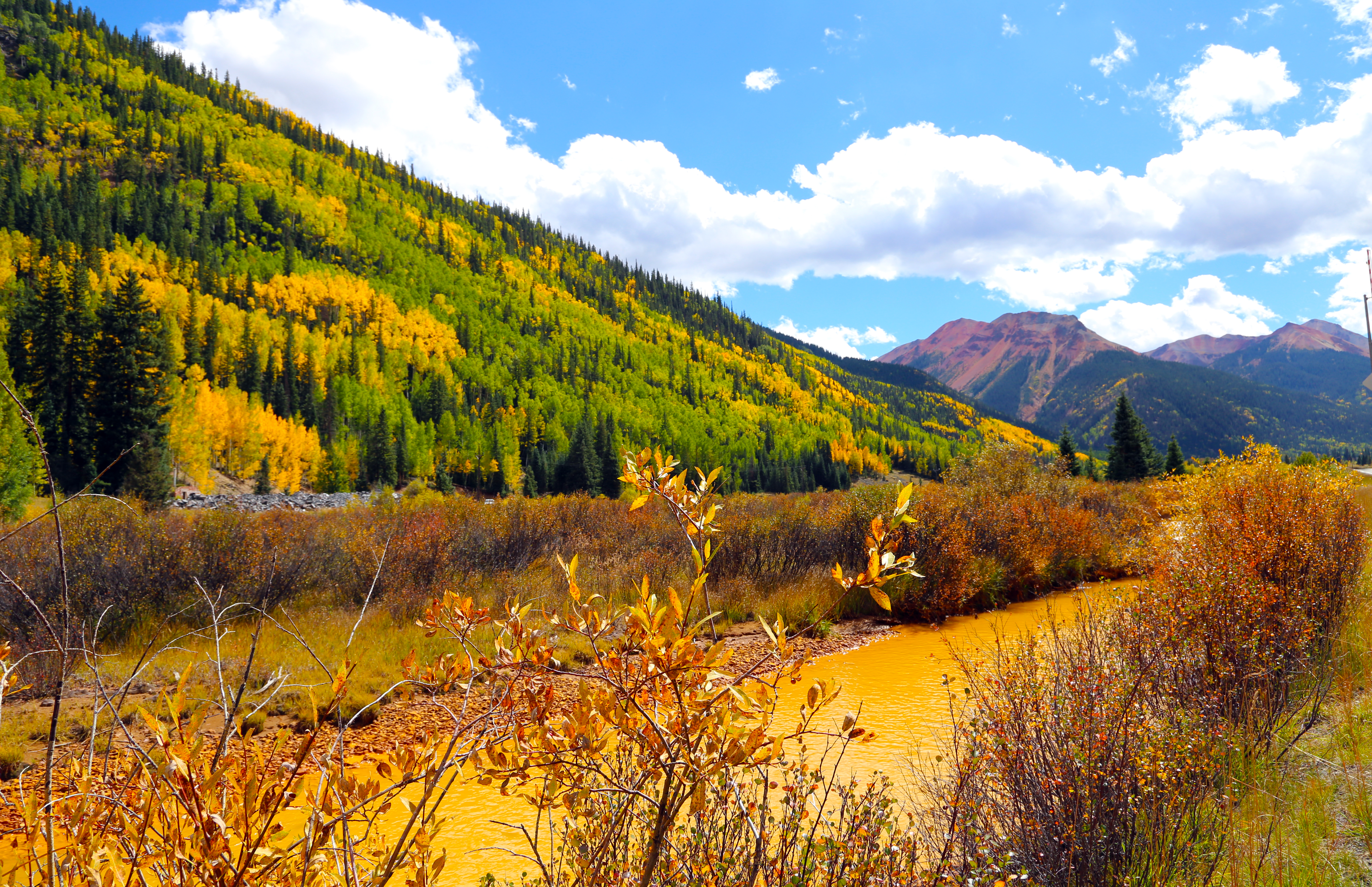
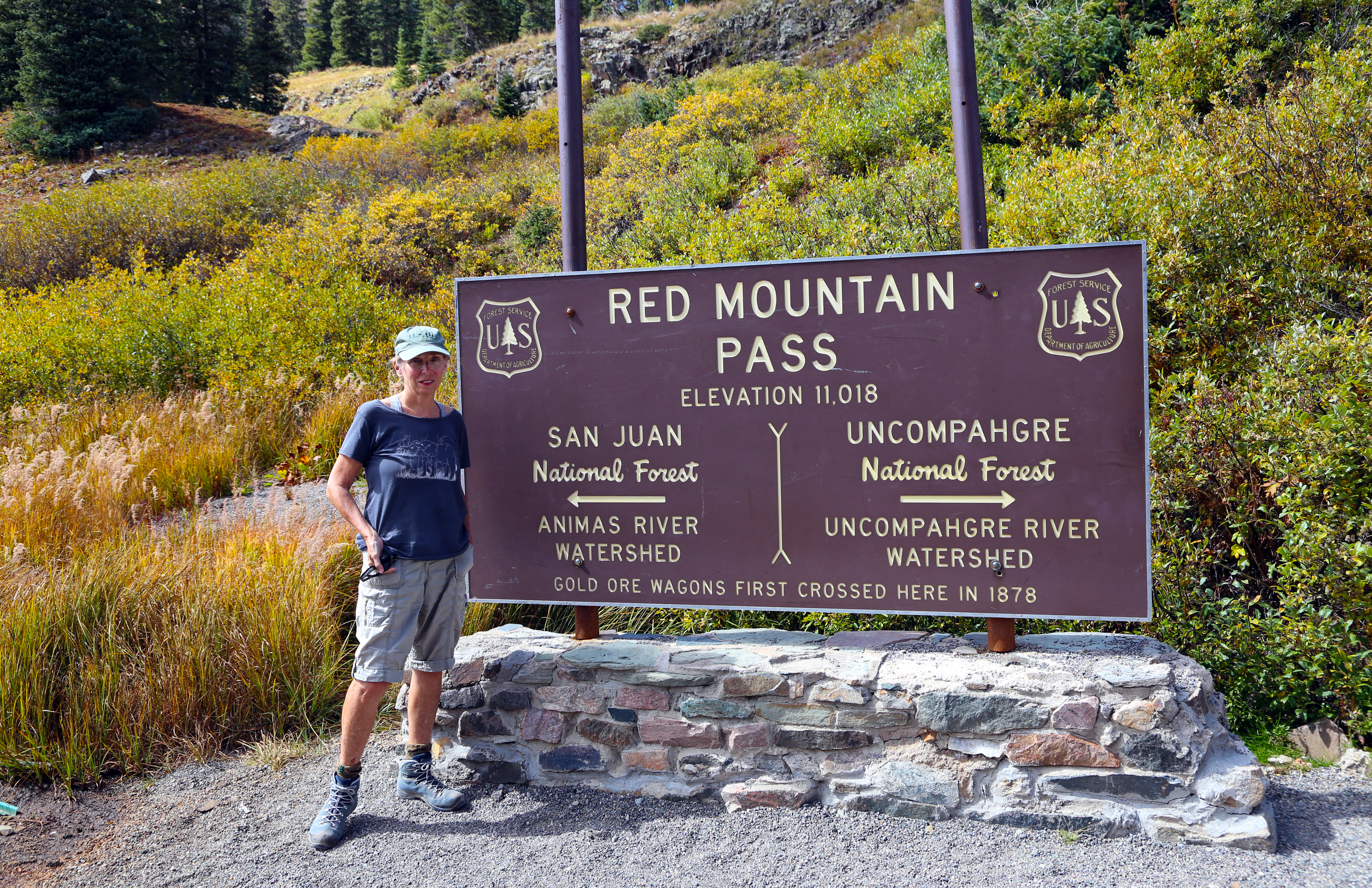
Million Dollar Highway South of Ouray, ColoradoMillion Dollar Highway, South of Ouray, MontanaMillion Dollar Highway, South of Ouray, MontanaFall Collors on the Million Dollar Highway, South of Ouray, MontanaRed Mountain Pass, Million Dollar HighwayMillion Dollar Highway, South of Ouray, MontanaFall Colors on the Million Dollar Highway, South of Ouray, MontanaFall Colors on the Million Dollar Highway, South of Ouray, Montana
Another town we visited in the area was Telluride, a popular ski resort town, located in a deep canyon. Here a route of three gondola rides connects the town to ski resort areas and the rides are free. Great way to see this area!
Thoughts:
– Aspens, trees located in the West and at higher altitudes, are fast becoming my favorite tree. They are the largest, single biological unit, with trees interconnected. They are beautiful, with their white bark that contrasts with other colors around them and their brilliant golden colors in the fall. The movie, Avatar, comes to mind when I think of aspens – a deep sense of community
Yellowstone National Park – Labor Day Weekend through September 13
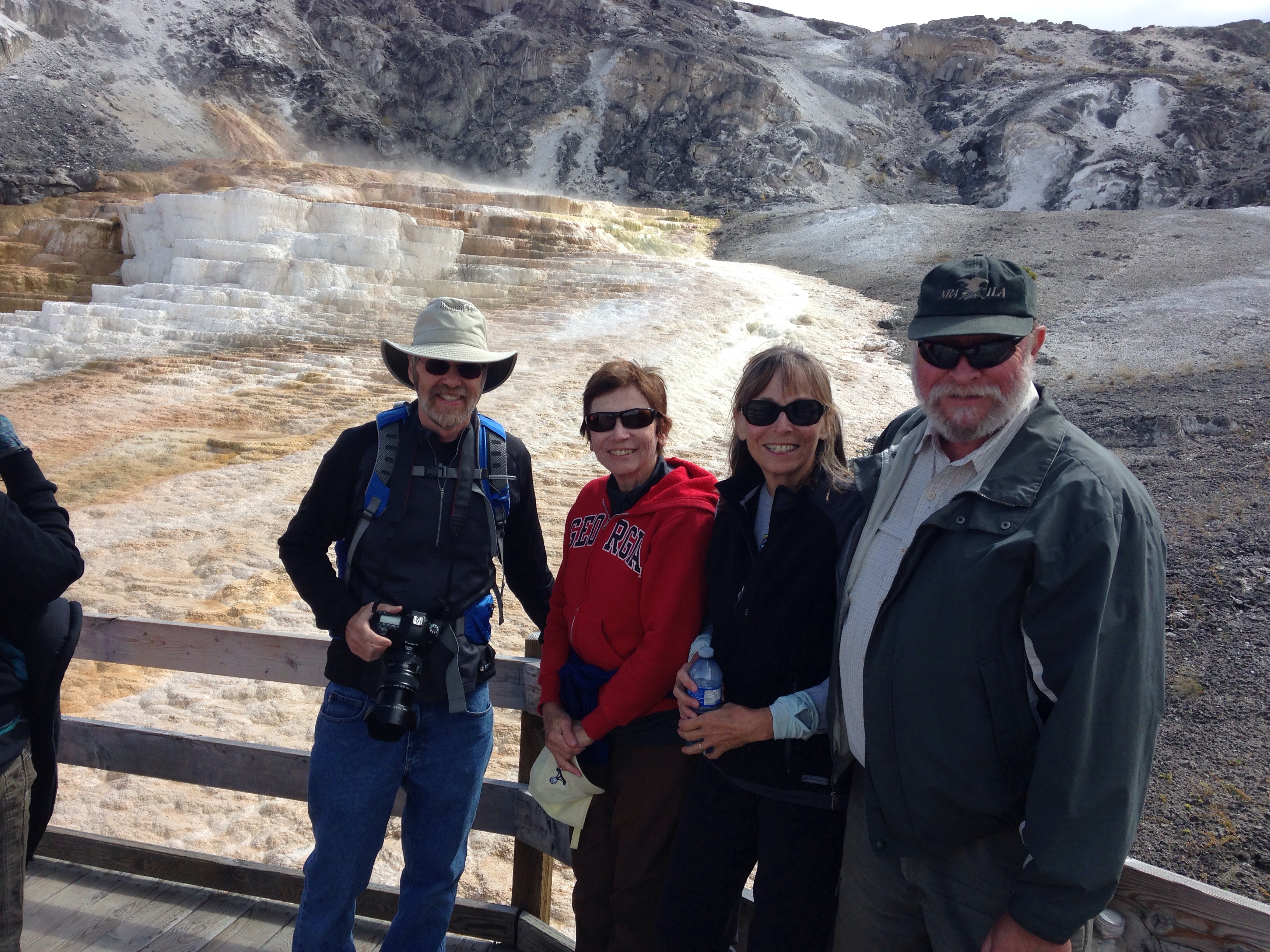
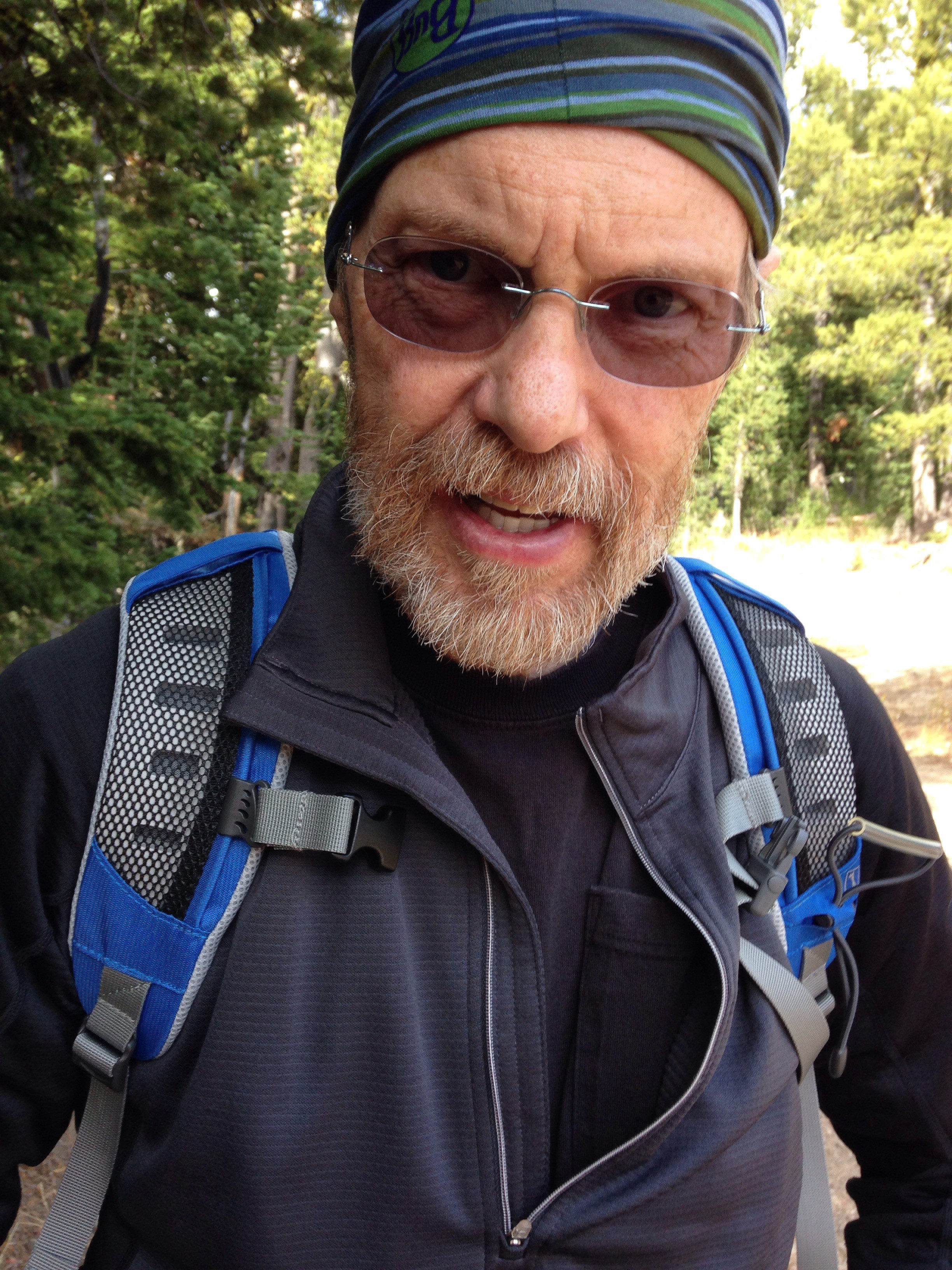
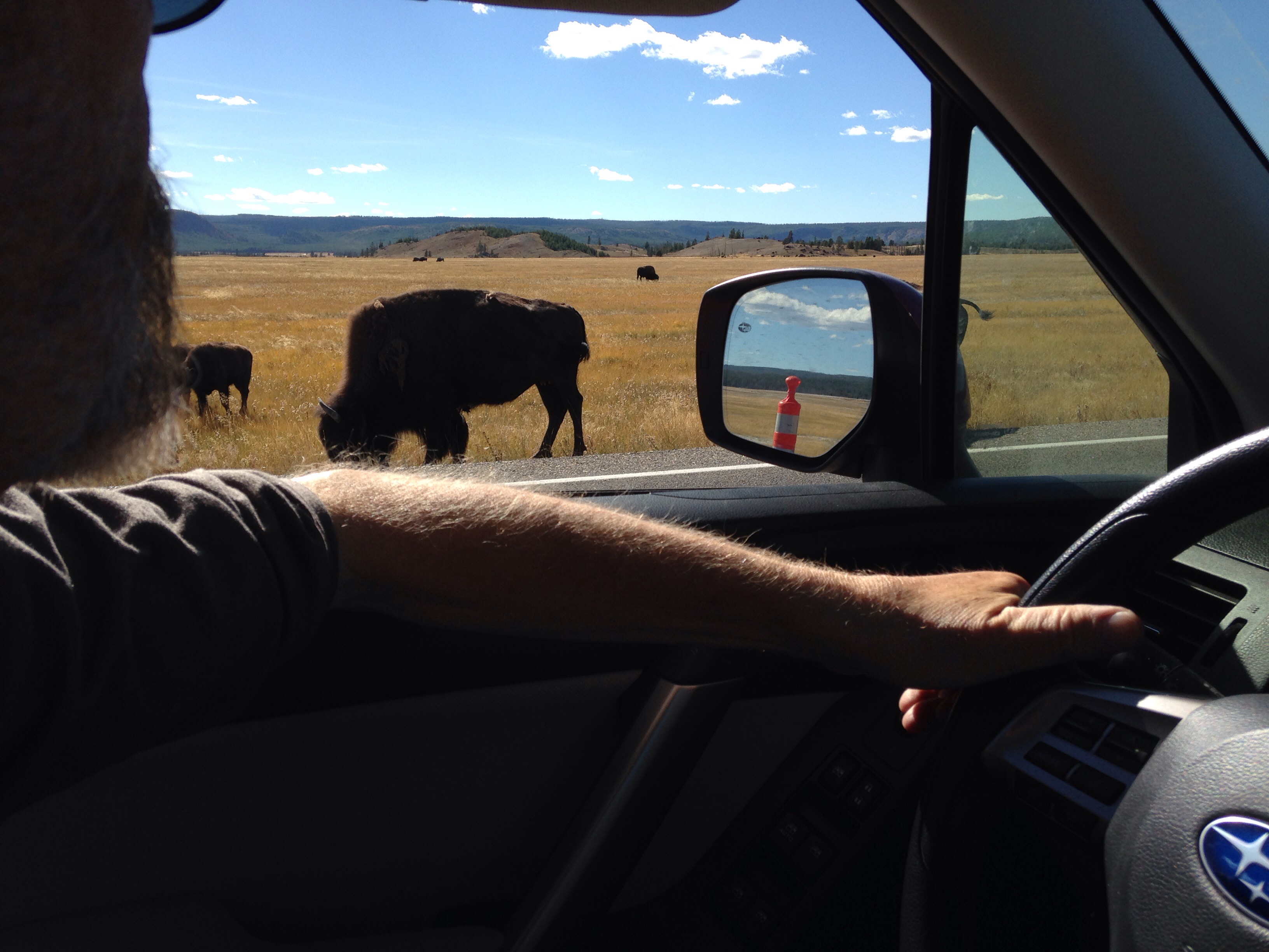
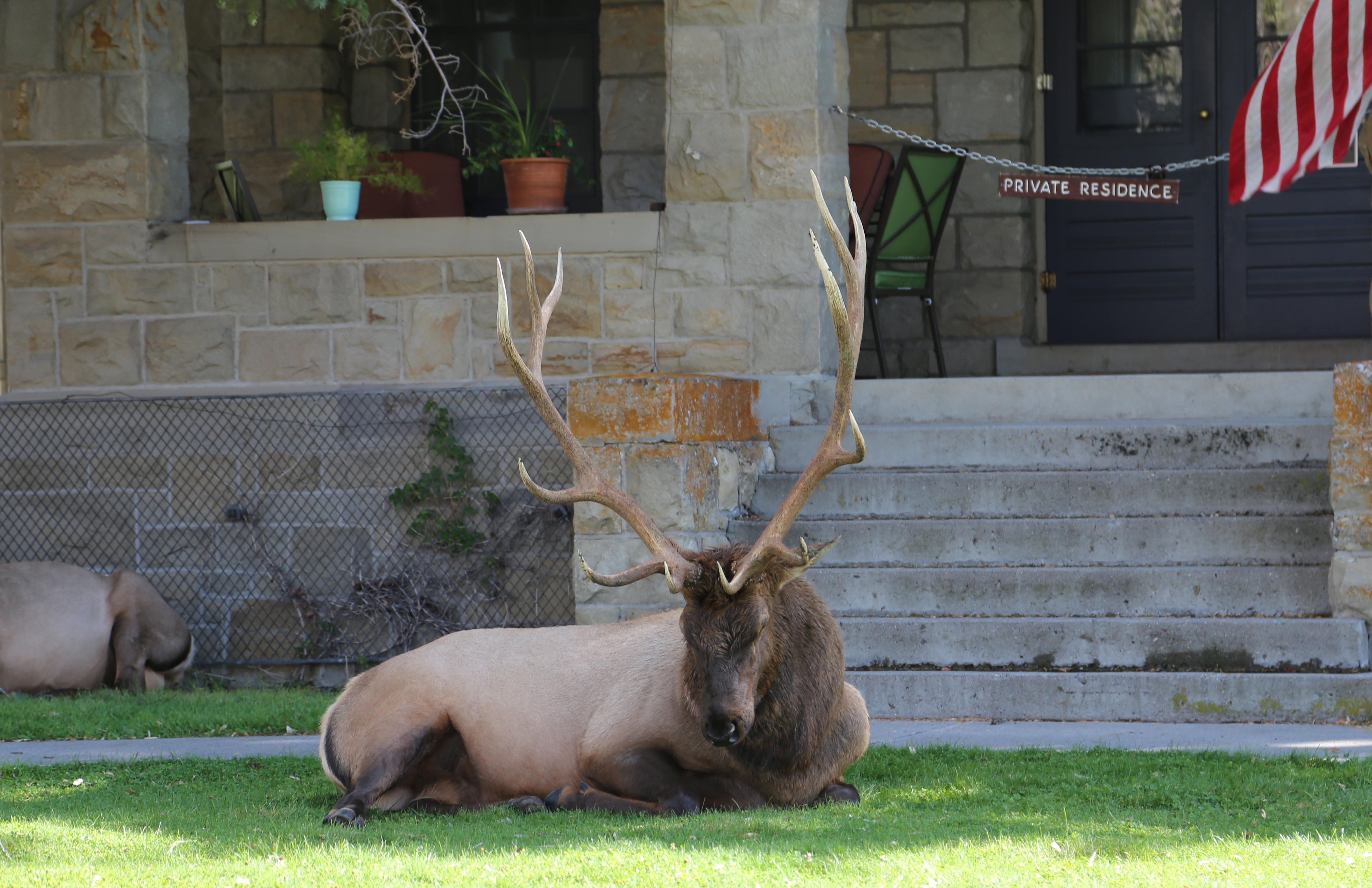
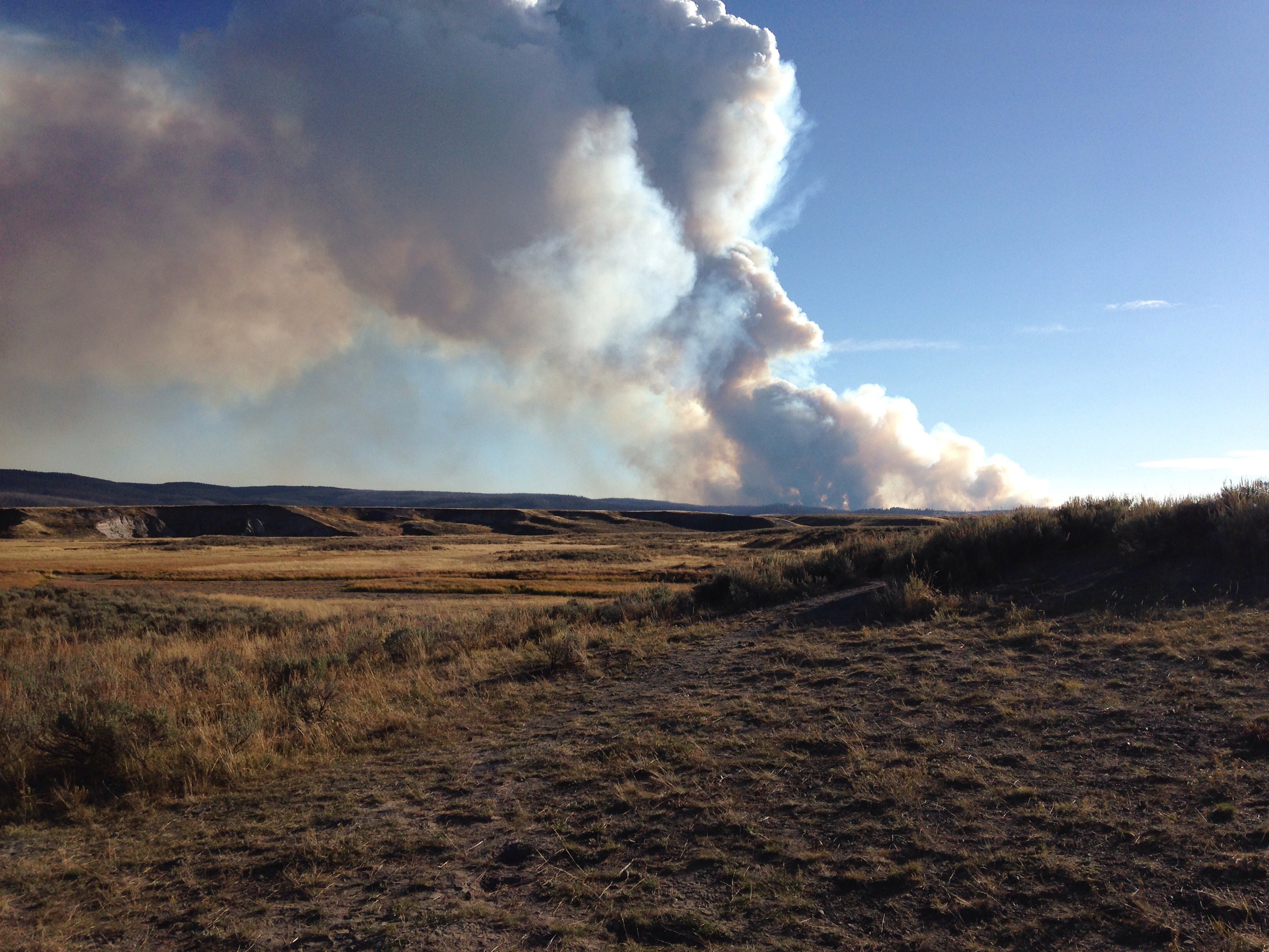
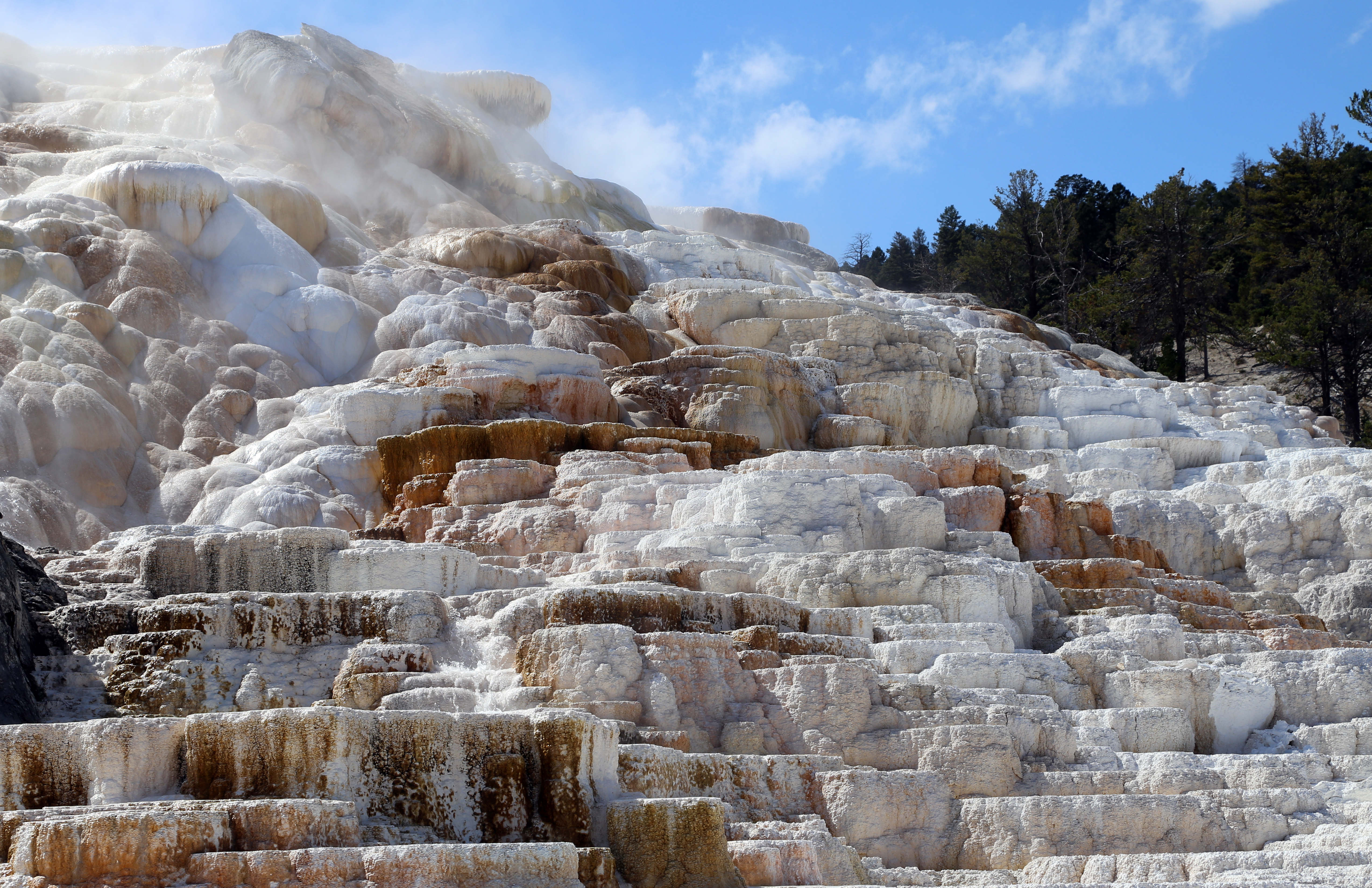
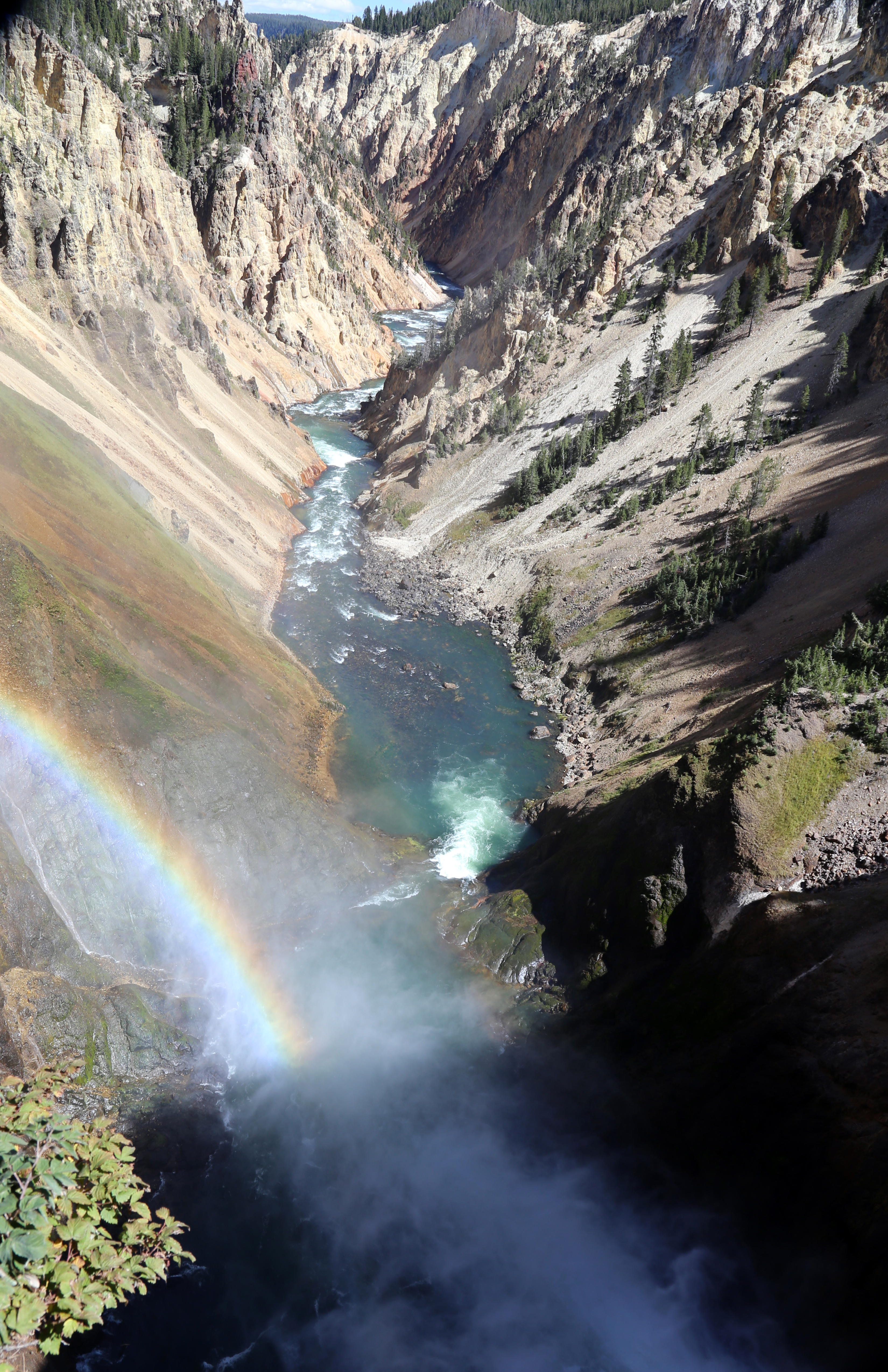
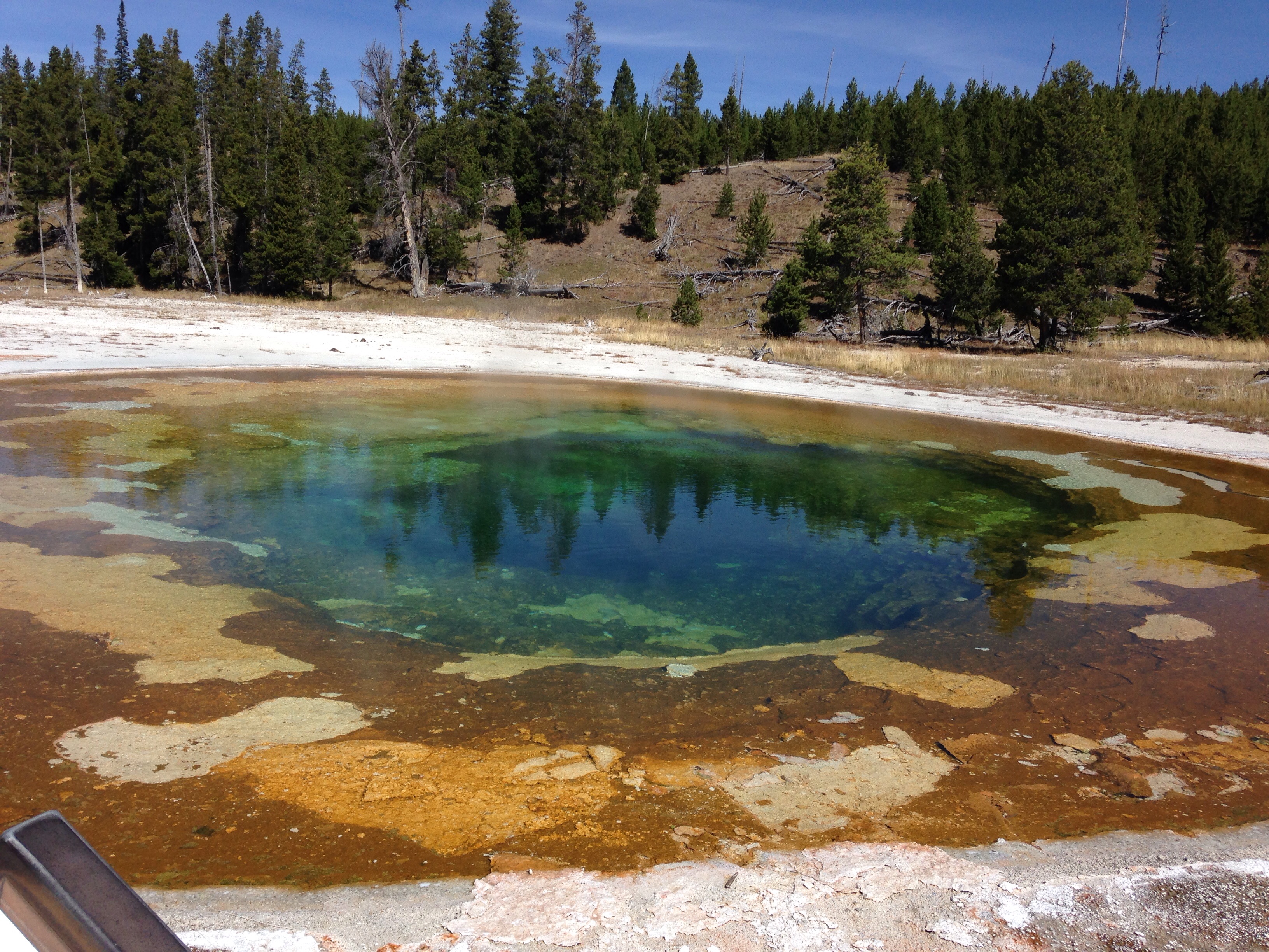
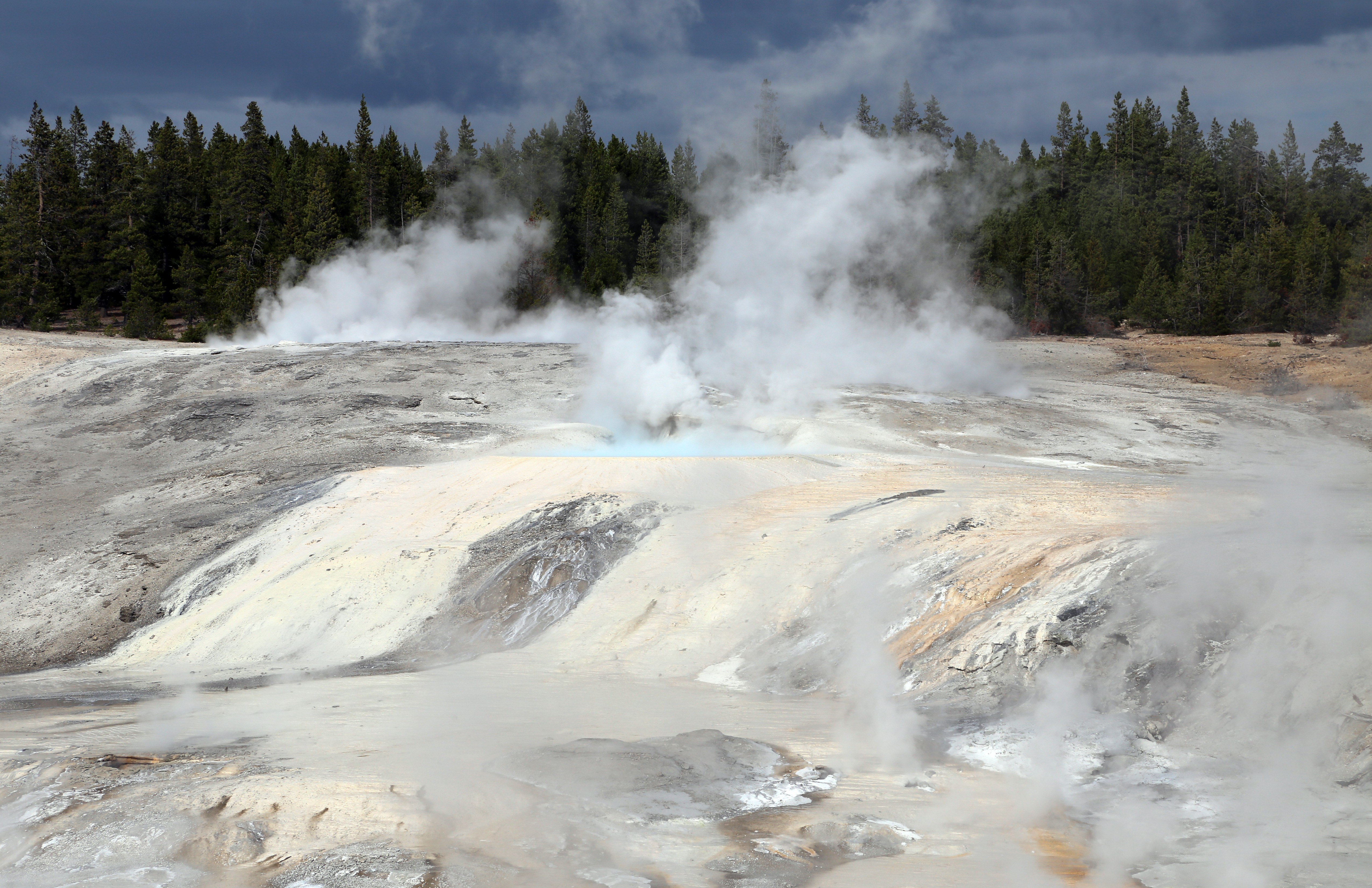
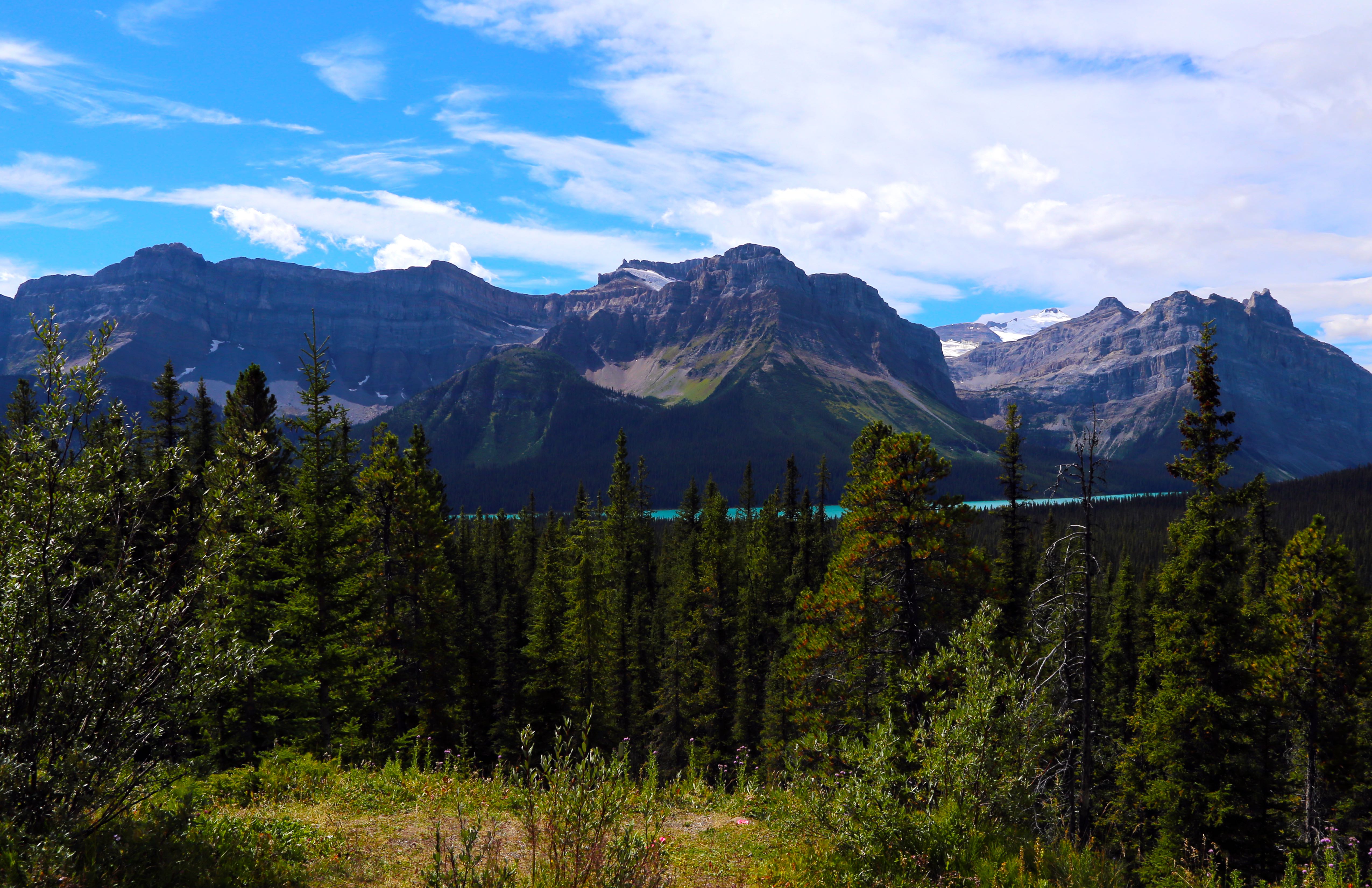
Magnificent Yellowstone National Park, where elk and bison own the roads, plains and rivers. Here we met up for a day with my sister Cathy and her husband, Ray (from Georgia!), as well as Bobbi and Diana (from WA state). So great to see family and so sad to say good bye…. So much to see at Yellowstone – the geysers, mud pots, hot springs, fumaroles…..an ever changing landscape, with volcanic activity ever near the surface. And such a large national park, we never made it to all parts of the park. Memorable events here, over and beyond family visit include the 5-6 mile round trip hike up Mount Washburn, with a Ranger residence above the look out tower on top. The Ranger lives there the full season May through early October, without leaving, checking for fires. Supplies are brought up. Also, learning about the smoke jumper community – a smoke jumping training center is located in West Yellowstone. Temperatures ranged from 20 degrees in morning to highs in the mid 70’s – perfect! Yellowstone may need a re-visit.
Thoughts:
Such a treat to see family while on this trip! And homesickness returned for a bit
Long lines/traffic to get in and out of Yellowstone. Definitely worth staying in the Park if possible
The sky is so expansive out west – it feels ‘bigger’ than the sky we have in the east. And the night stars feel so close and are so bright!
Family meet-up in Yellowstone. Steve, Cathy, Joan and RaySteve’s new look when hiking in cold weather. Just needs an earingBison all around!Bull elk in park superintendent front yardFire that started while we were at YellowstoneYellowstone hot springsGrand Canyon of the Yellowstone at Top of Upper FallsOld Faithful geyser at Yellowstonehot spring at YellowstoneFumerals and Hotsprings at Norris Basin, Yellowstone Park
Glacier National Park and a layover at Court Sheriff Campground outside Helena, Montana – Late August/early September
Our drive back into the States was through an entry that is only open during the summer months. And the ride to Glacier, which was only an hour or so away, was memorable. Our first introduction to free range cows! As we came around a bend, there were cows in the road!! And they were very clear they owned right of way and just hung out for a while in the road, looking at us. Too funny!
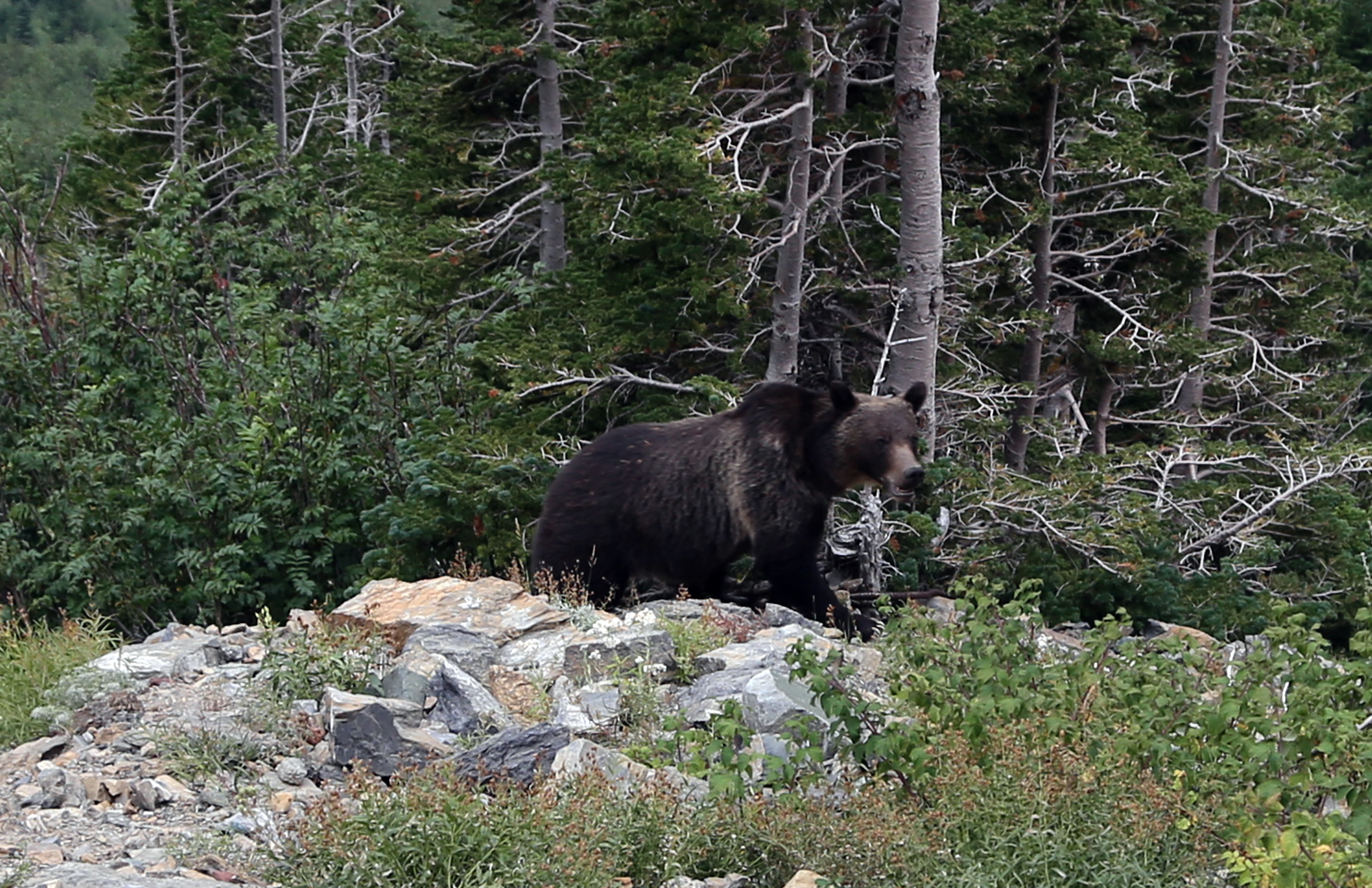
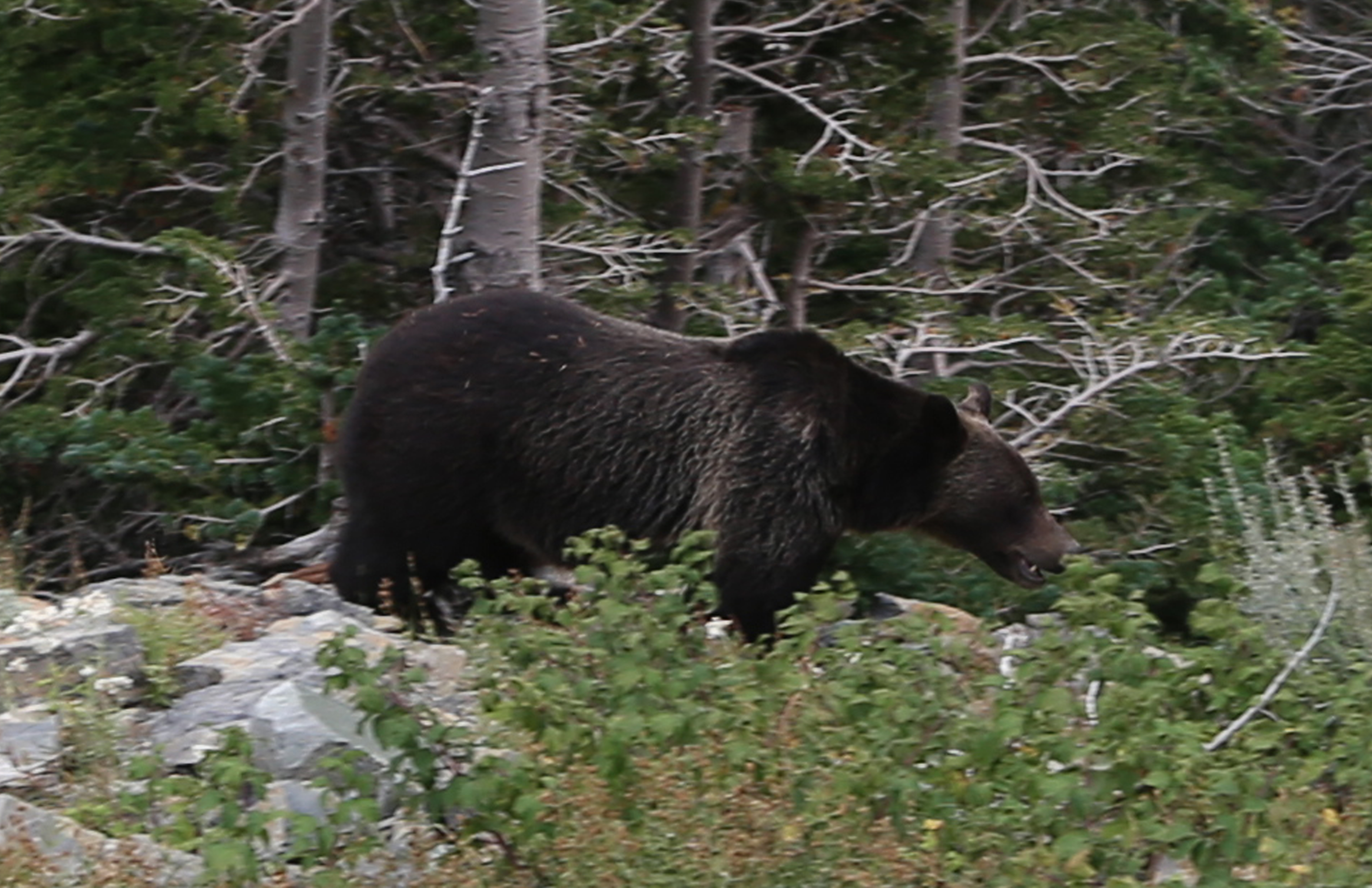
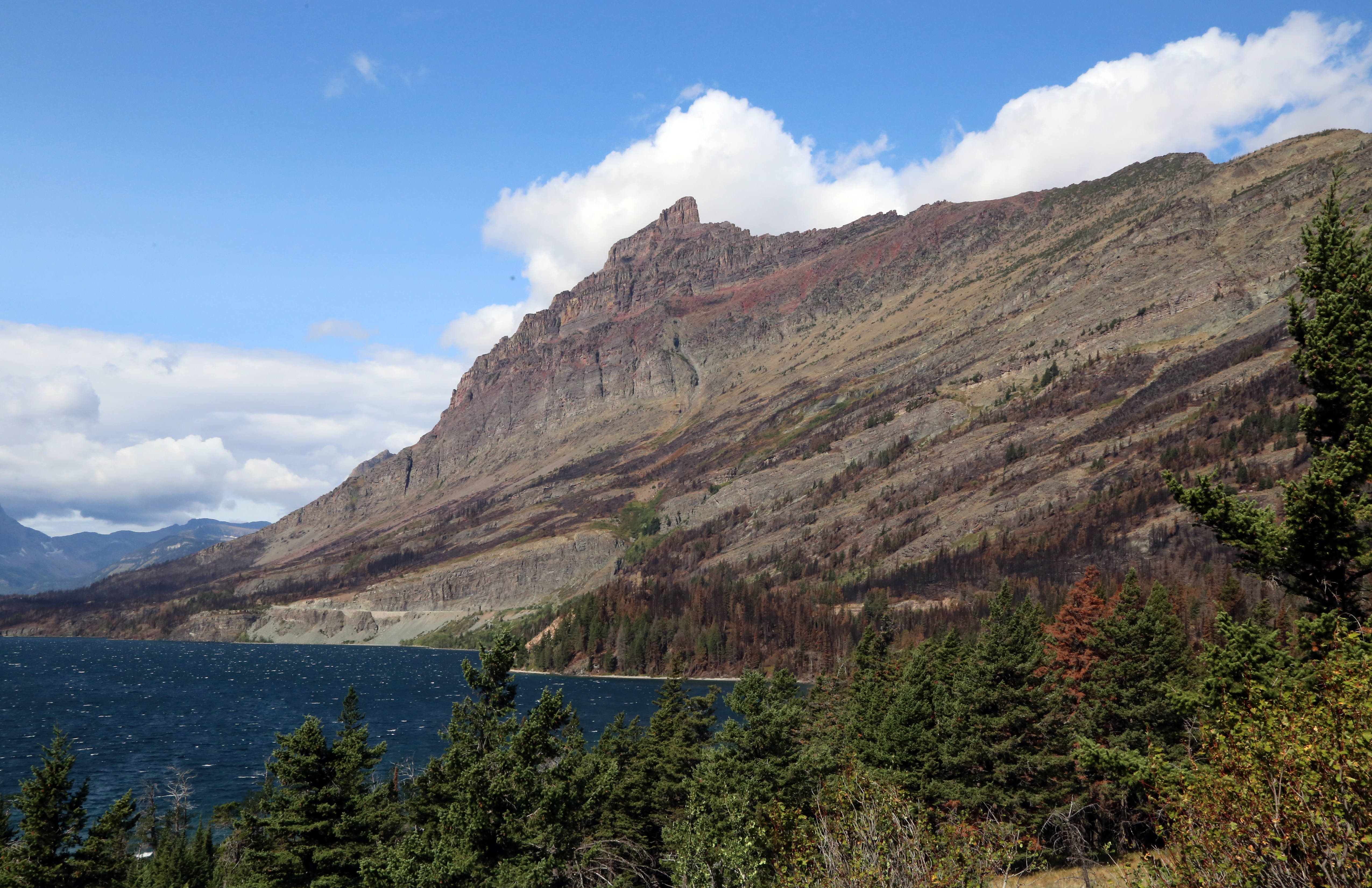
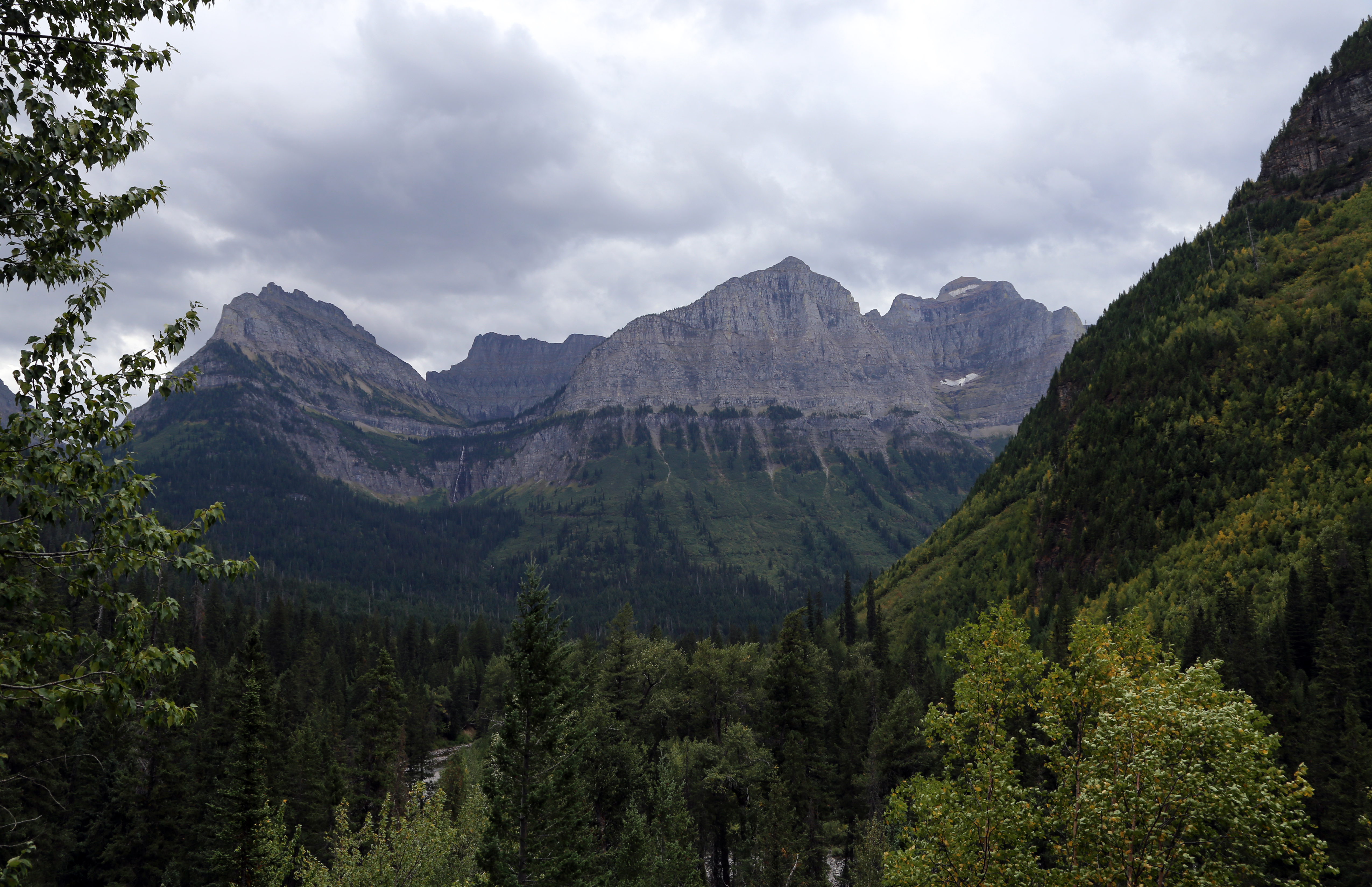
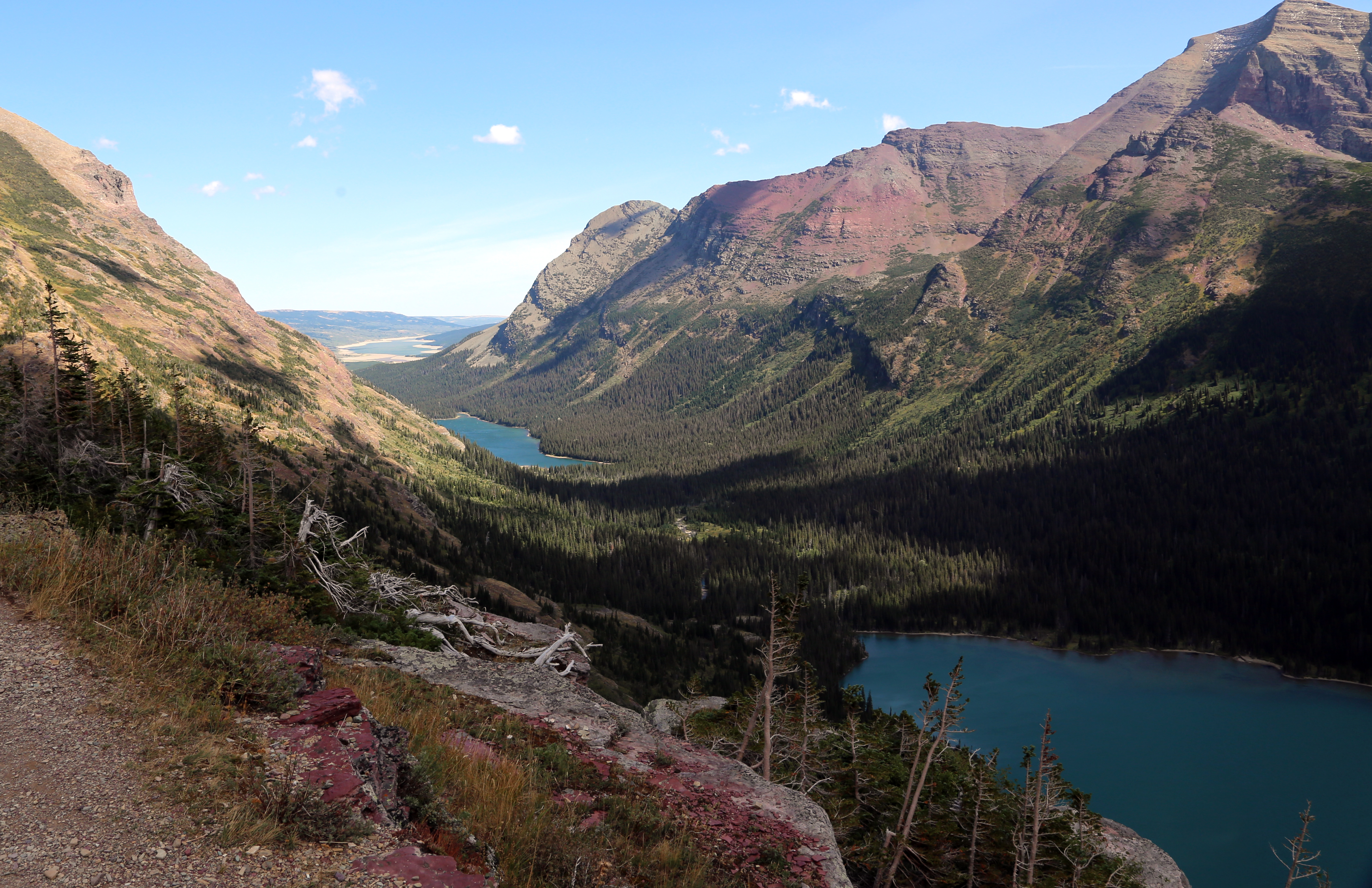
Glacier National Park, where the wind howled for several days, rocking and rolling our RV. Bears galore and we learned to distinguish black bears from Grizzlies! Definitely better to have a run in with a black bear. Many big horn sheep, mountain goats and deer.
Grizzly Bear Coming Out of the Woods, Glacier ParkGrizzly in Woods, Glacier Park
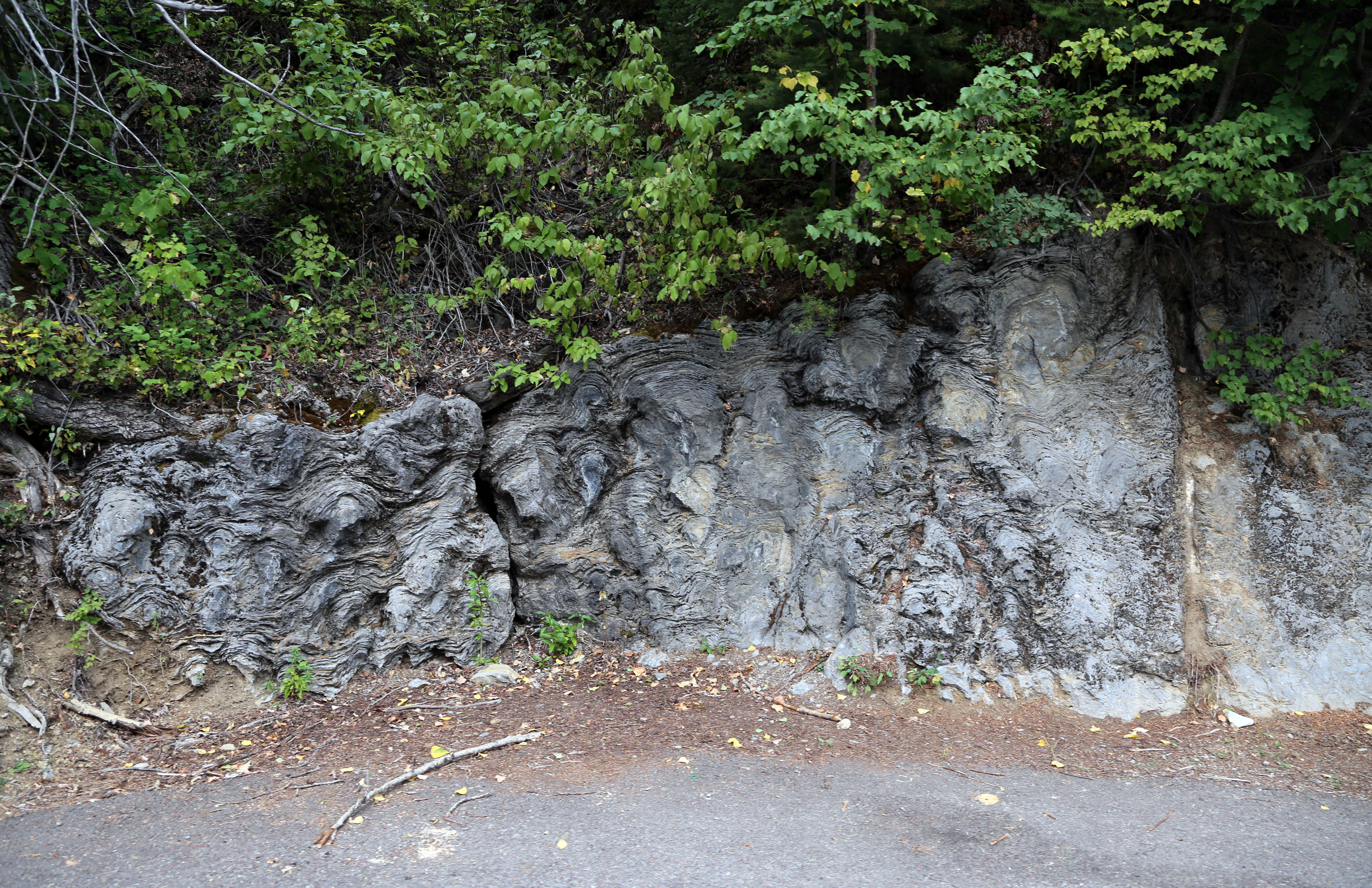
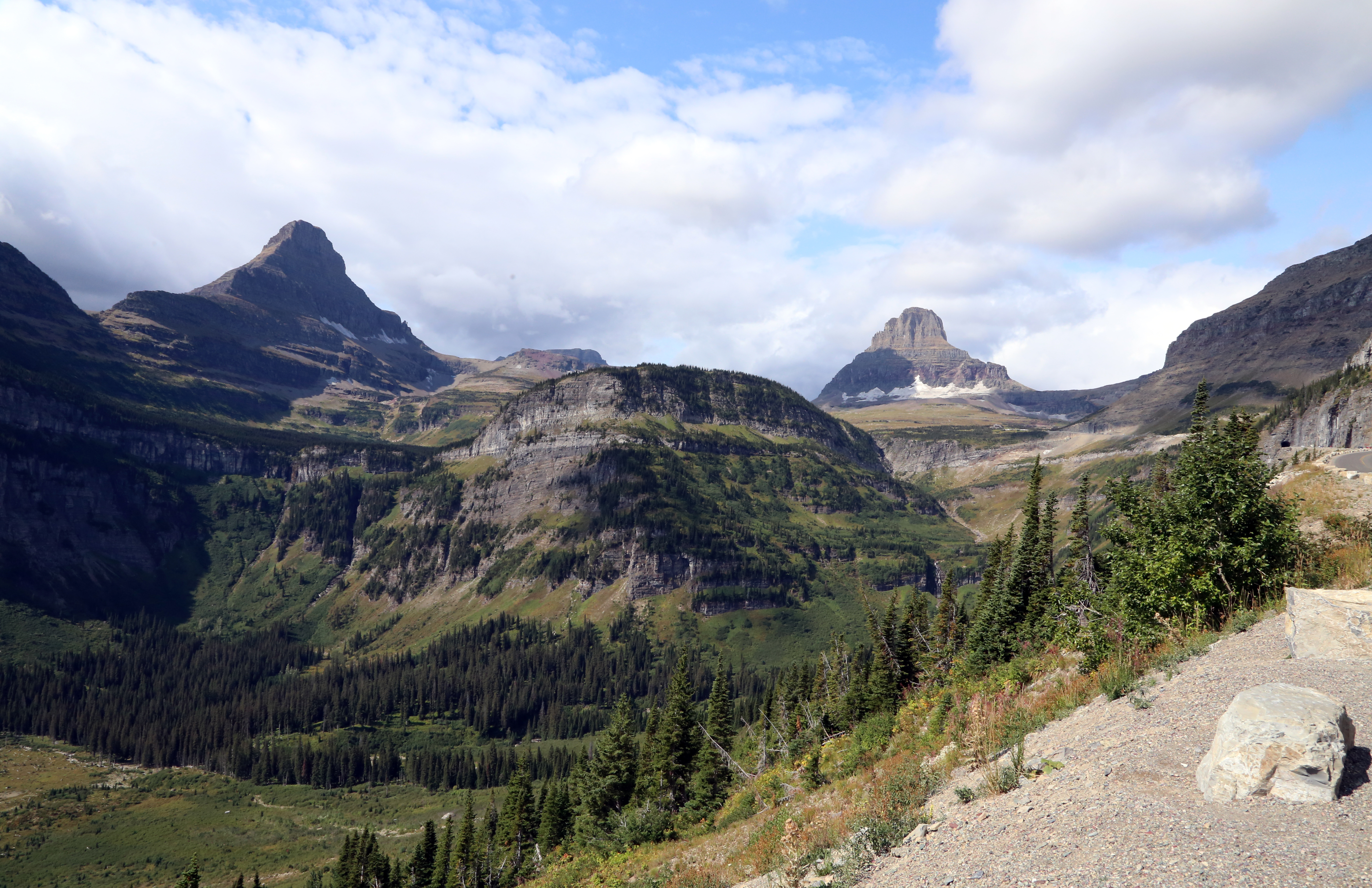
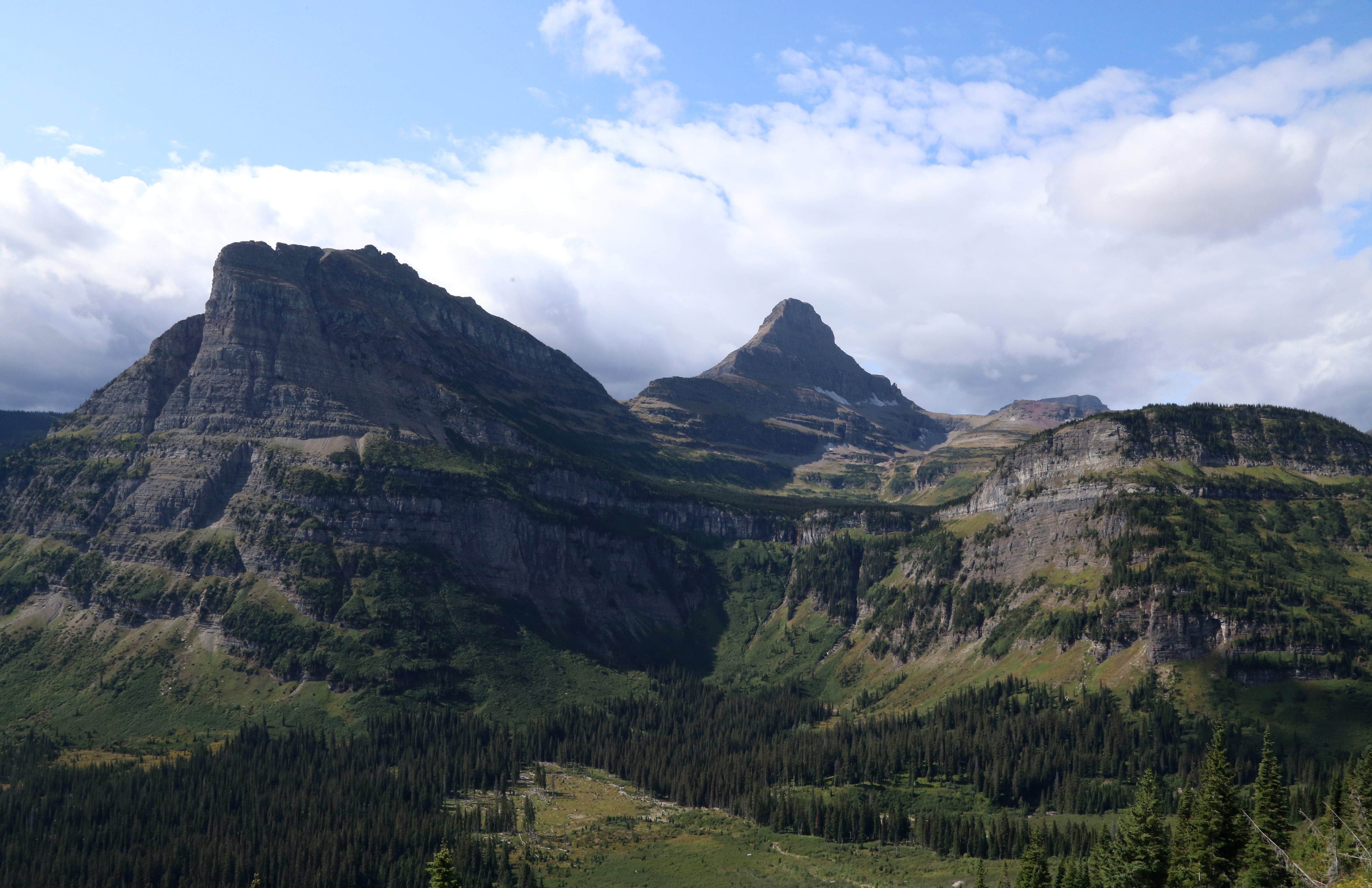
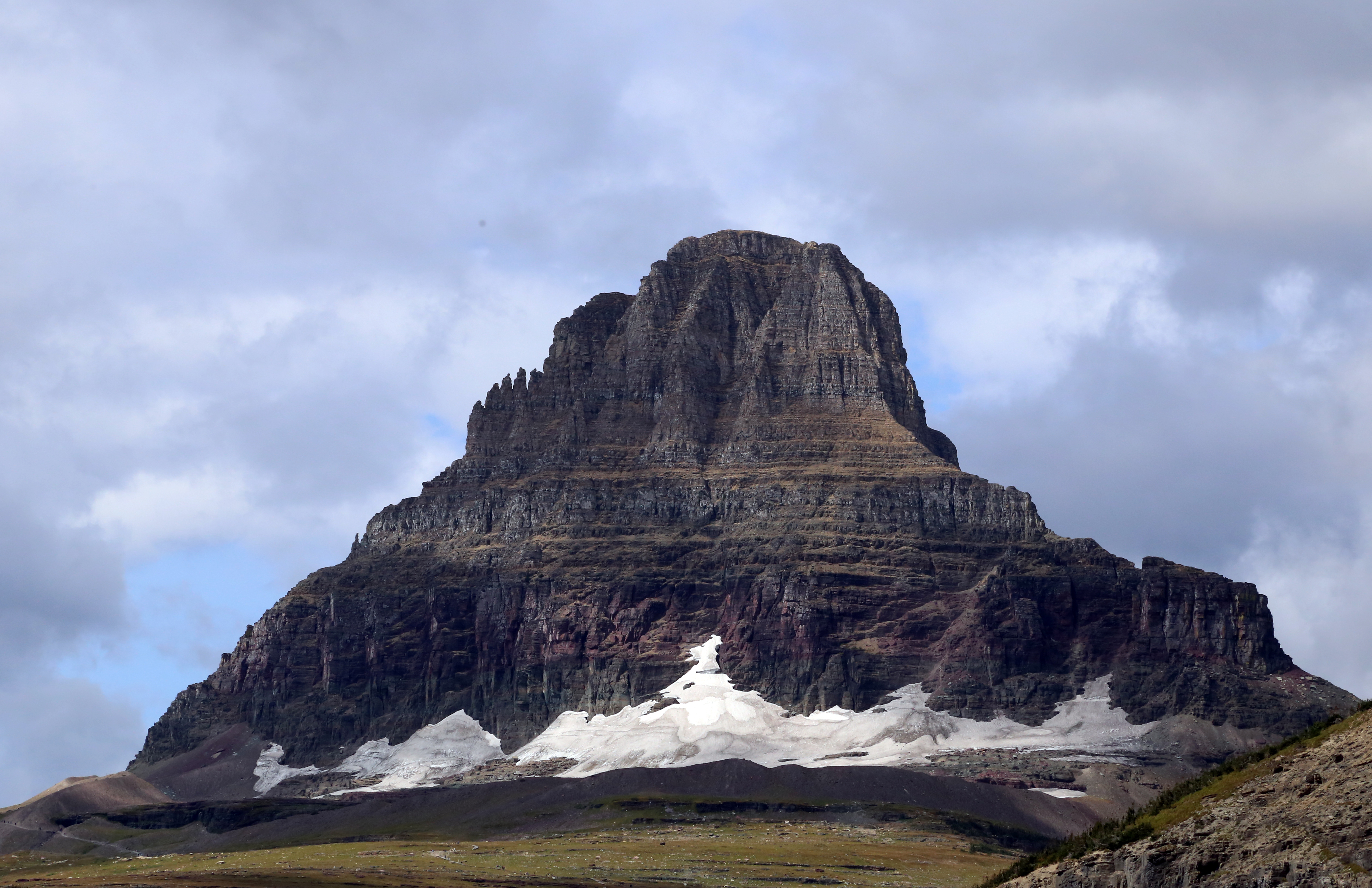
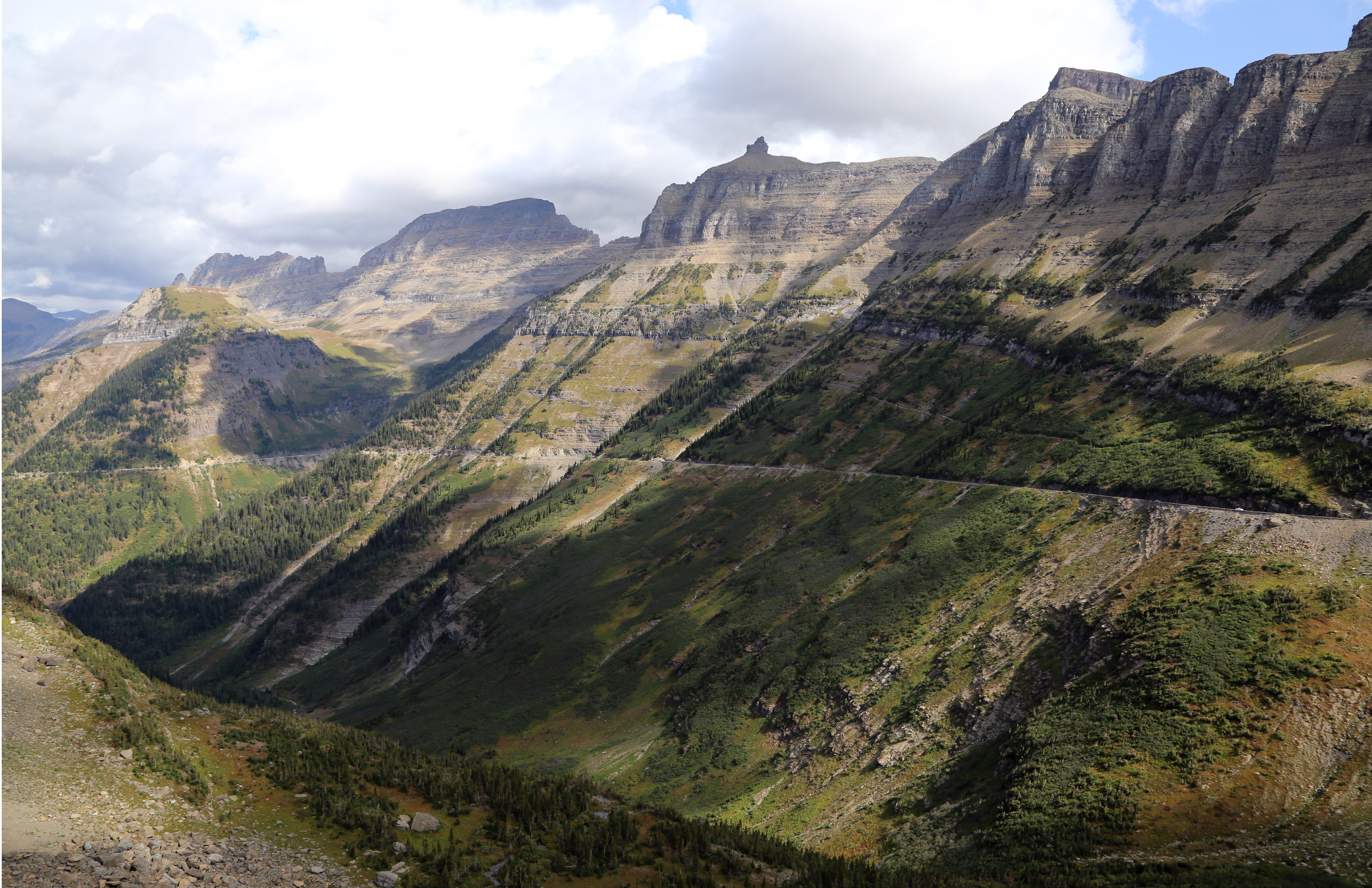
The Red Bus tour through the park was so worth it, introducing us to the ‘going to the sun’ road, park history, rock formations, etc….
Fossils at Glacier ParkAlong Glacier LakeAlong the Road to The Sun, Glacier ParkAlong the Road to The Sun, Glacier ParkAlong the Road to The Sun, Glacier ParkView from Logan Pass, Along the Road to The Sun, Glacier ParkAlong the Road to The Sun, Glacier Park
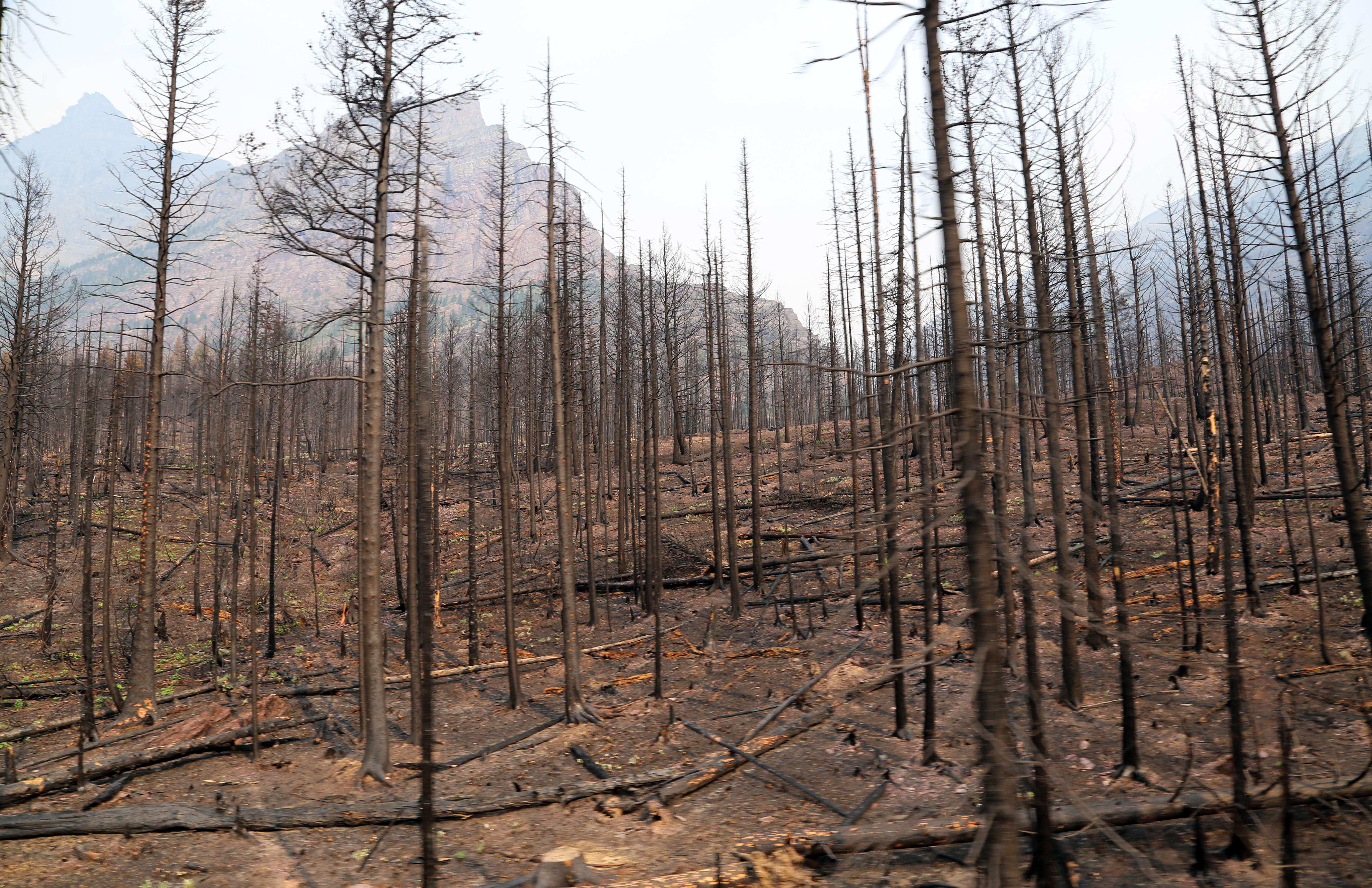
Some parts of the park were off limit due to fires that were mostly extinguished.
Glacier Area Burned the Day Before We Arrived
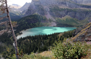
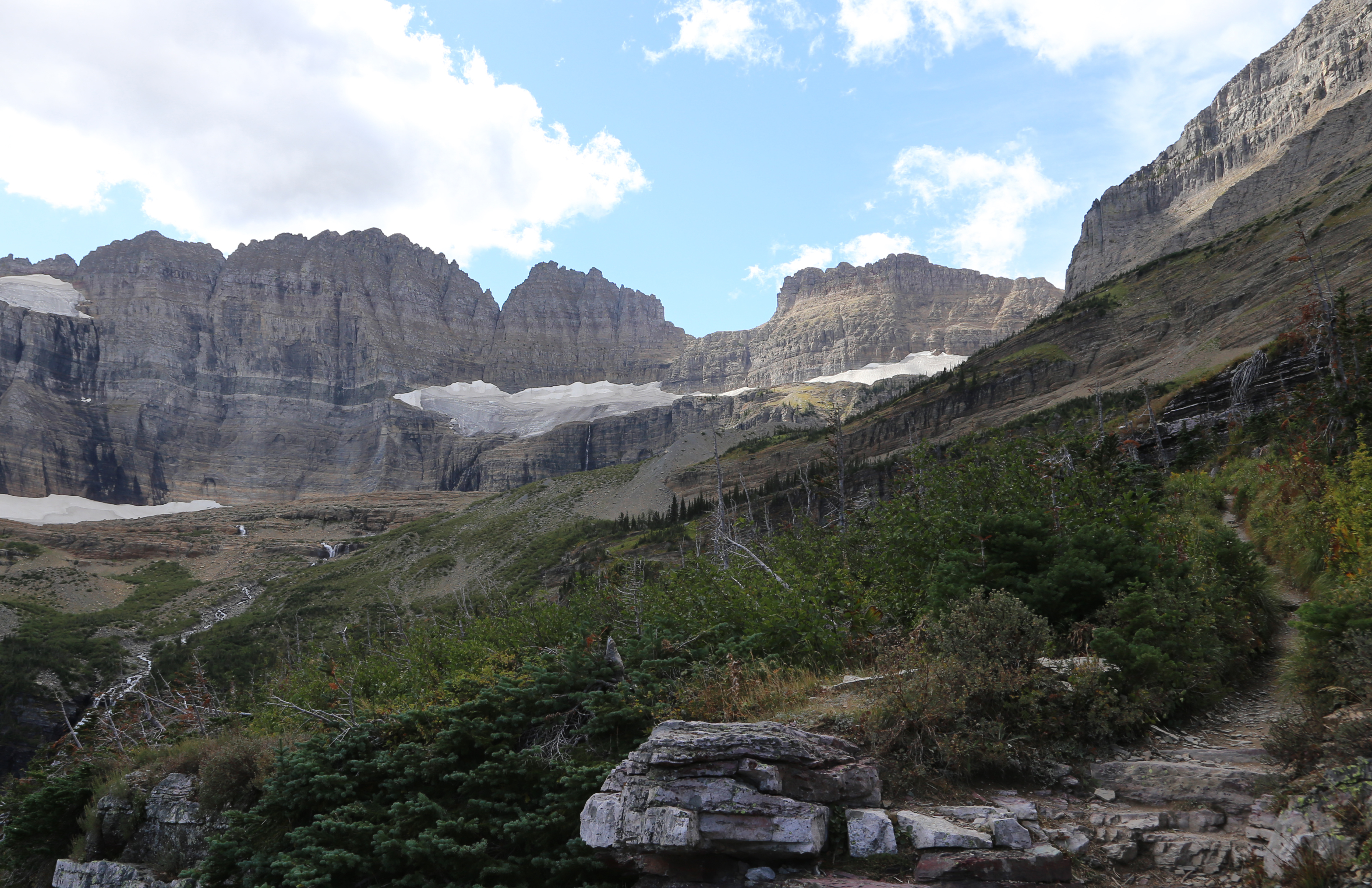
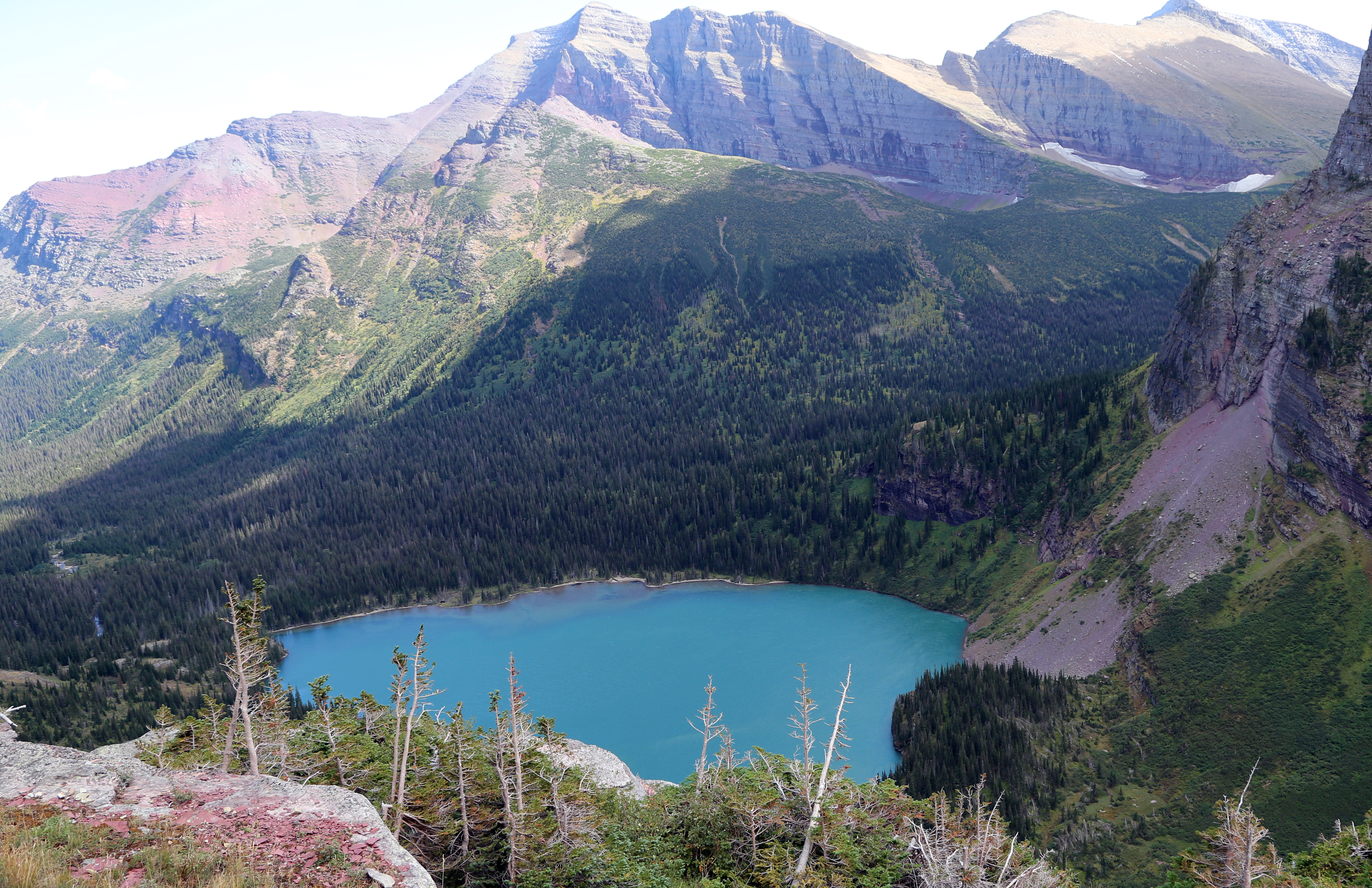
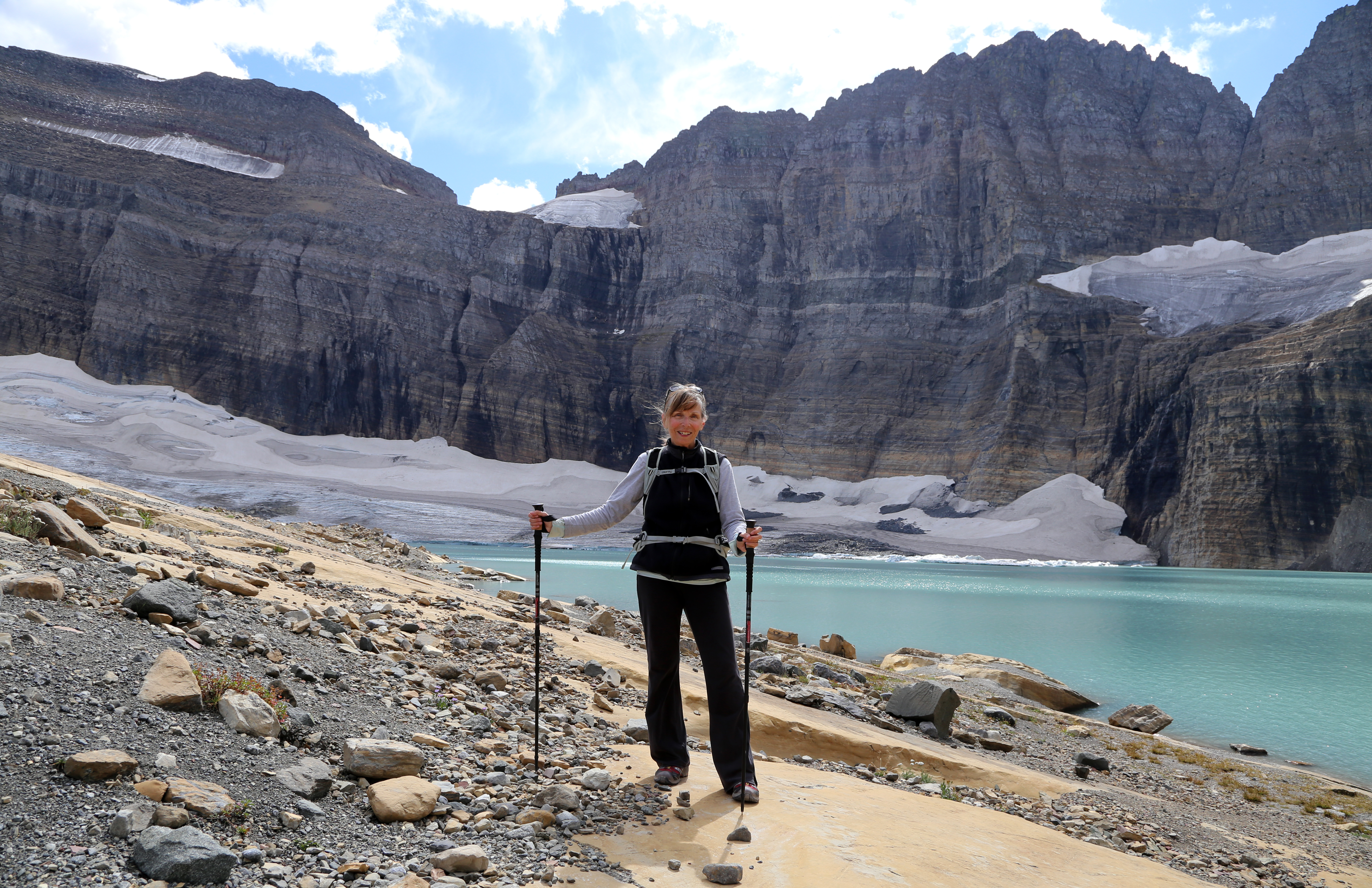
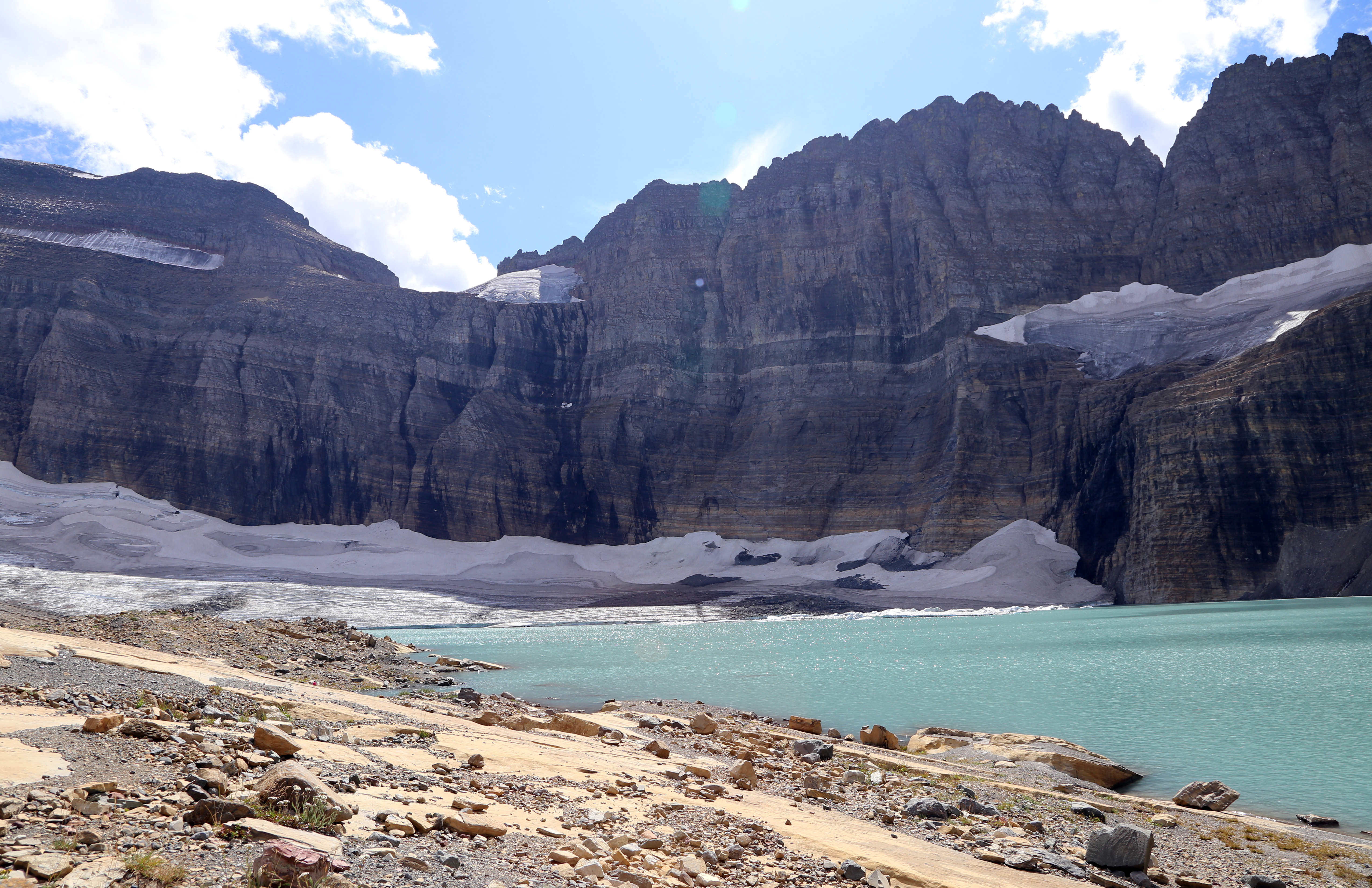
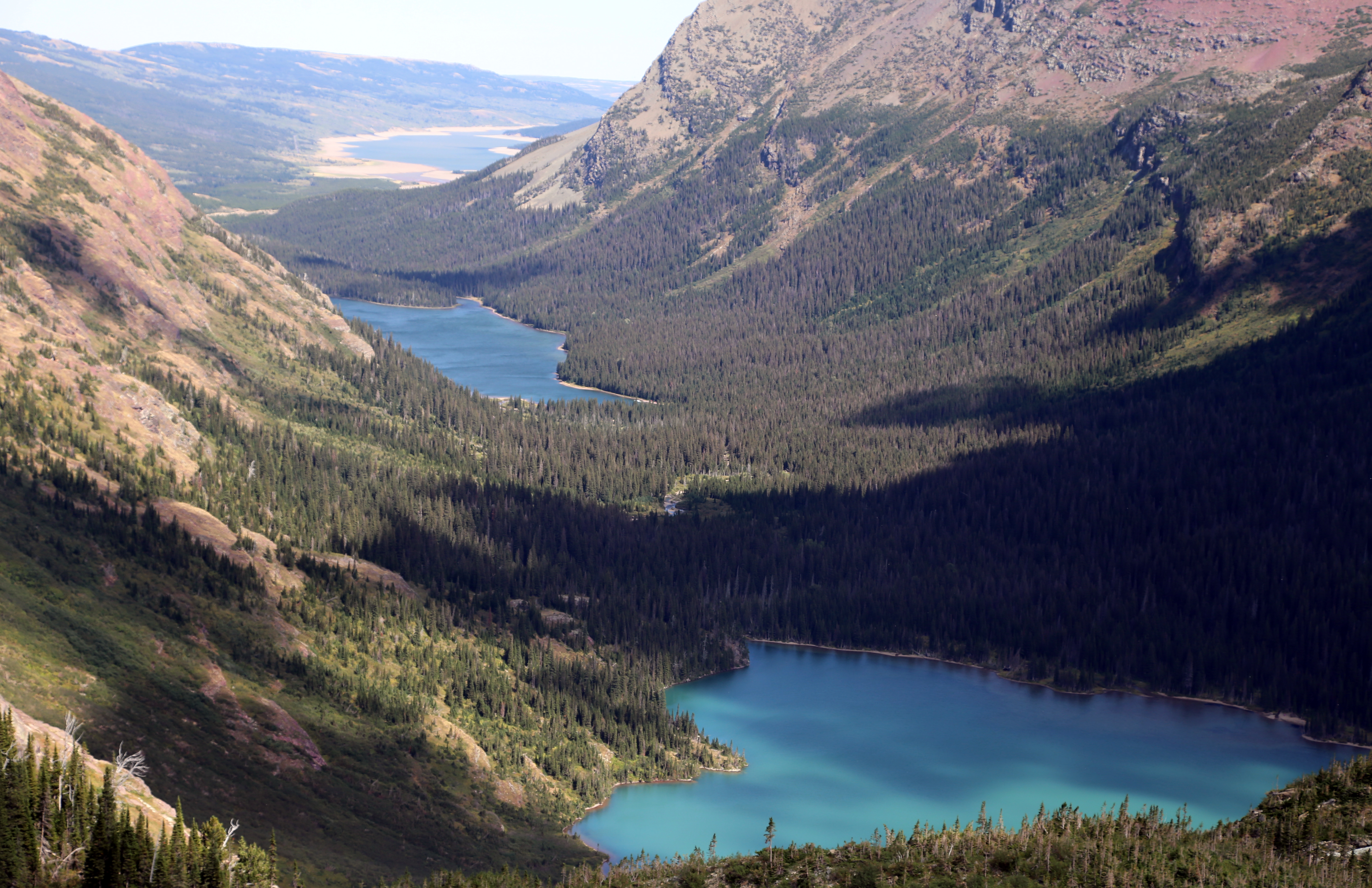
The 4.2 mile long, 1,840 feet of elevation hike up to Grinnell Glacier was truly memorable, hiking under waterfalls on slippery rocks, incredible birds-eye views of three lakes, having my hiking shoes fall apart, seeing the glacier up close and melting into a lake and racing the last .6 mile down to make the boat that takes you back. (Denise, thanks for recommending this hike!)
View from Our First Break on Hike to Grinnell GlacierView from Second Break on Hike to Grinnell GlacierView of Grinnell Glacier from our Third Break on HikeView of Third Lake on Trail to Grinnell Glacier in Glacier ParkJoan With Grinnell Glacier in BackgroundGrinnell GlacierView of Lakes on Our Way Back from Grinnell Glacier
Steve and I traveled into the park a couple of nights to see if we could find wildlife and we always did! Usually bears, sometime mule deer… By the way, driving the ‘Going to the Sun’ road takes patience, is very doable and provides incredible views of the mountains way above and canyons way below.A few days layover in Helena, Montana…..at the small, lovely and quiet Court Sheriff campground. Replaced my broken hiking shoes, replenished supplies and enjoyed laying low.
thoughts:
Montana wins our award as having the straightest roads of any state. They also have 80-90 MPH speed limits!
Glaciers are disappearing. The glaciers in Glacier National Park are expected to be gone in 10-15 years; a few years later in Banff
Free range cows are common in the West. Coming around a corner to find 2-3 cows in the road staring at you is unnerving and just not something seen in the East!
My favorite campgrounds so far are generally county, state or national parks or on BLM public lands. More space, further removed from towns, more connected to nature
My fear of heights shows up when on narrow trails (less than 18″ wide) with sheer, steep drop offs on one or both sides.
Need to be discriminating is selecting a Laundromat!
It’s been since mid August that I’ve last updated our ‘Brown About’ blog. And there is a good reason – me and ‘shoulds’ have been fighting a lot recently. When feeling like I’m doing something because I ‘should’, I resist, think about it and then think about it some more. Long/short, the last several weeks, updating the blog felt like a ‘should’ and now it feels like a ‘want to’. So I hope to be posting a couple of updates today. The title will describe the area we are traveling (I hope!) and the next few updates should catch up to where we are currently traveling.
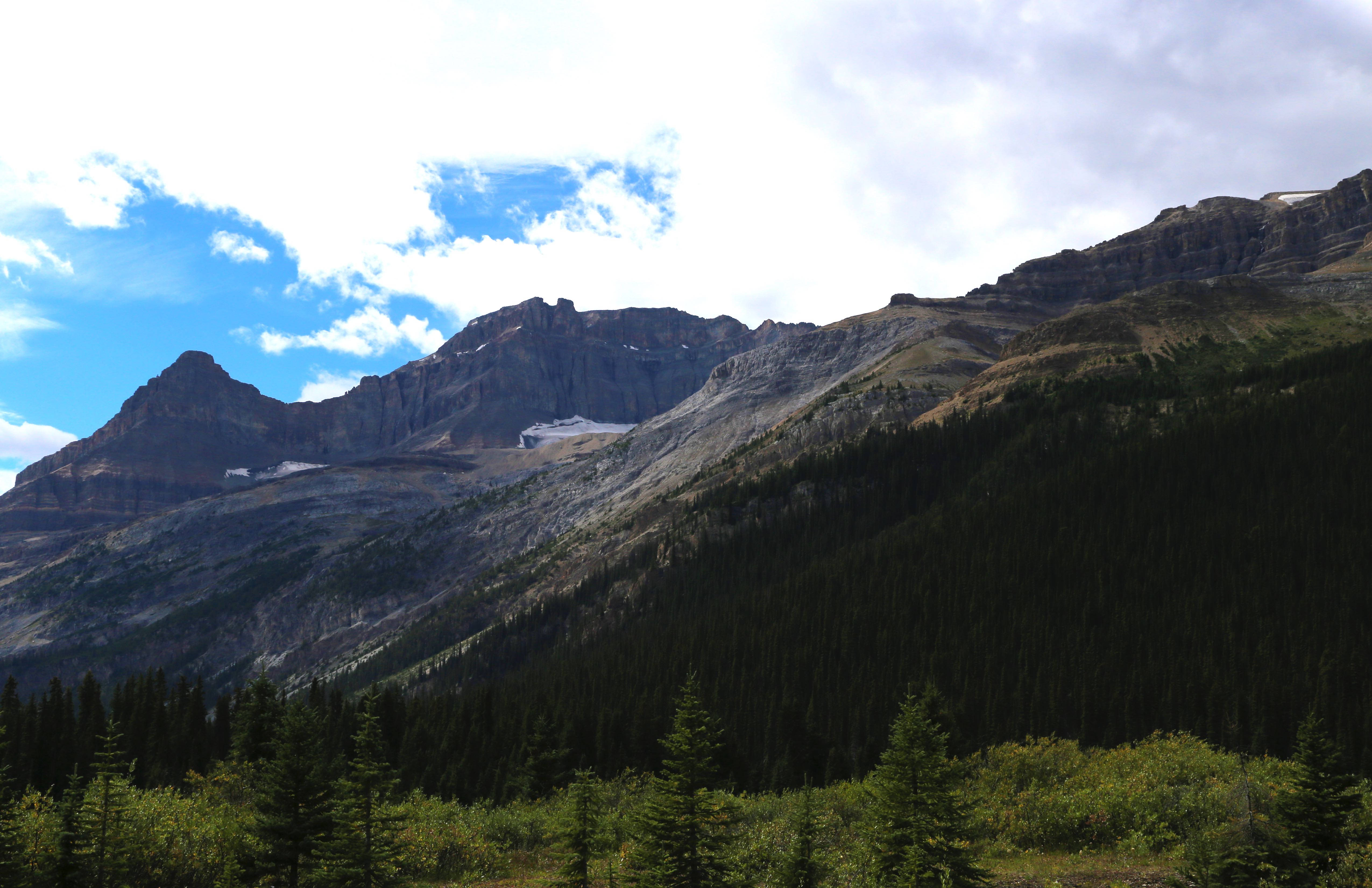
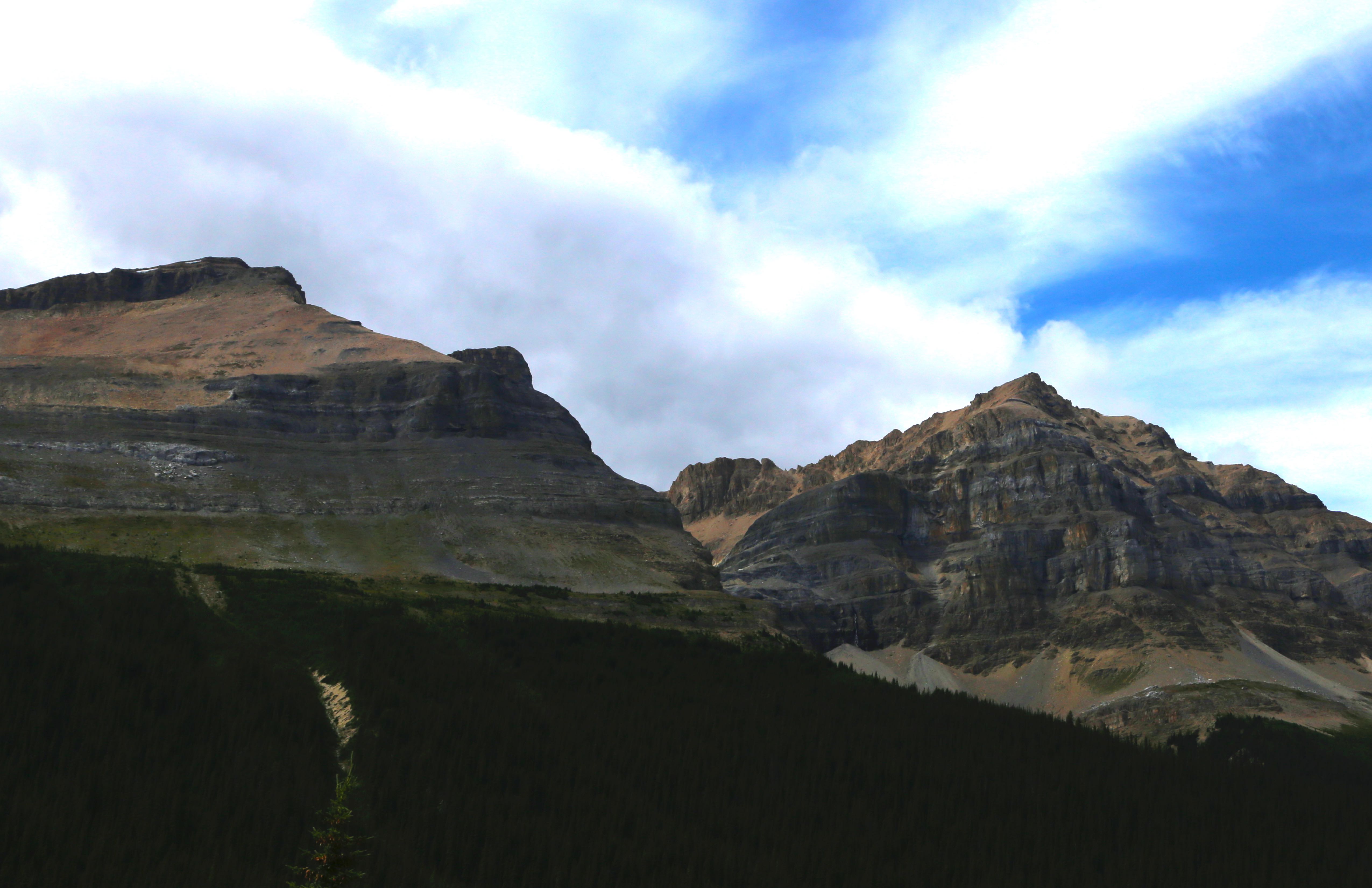
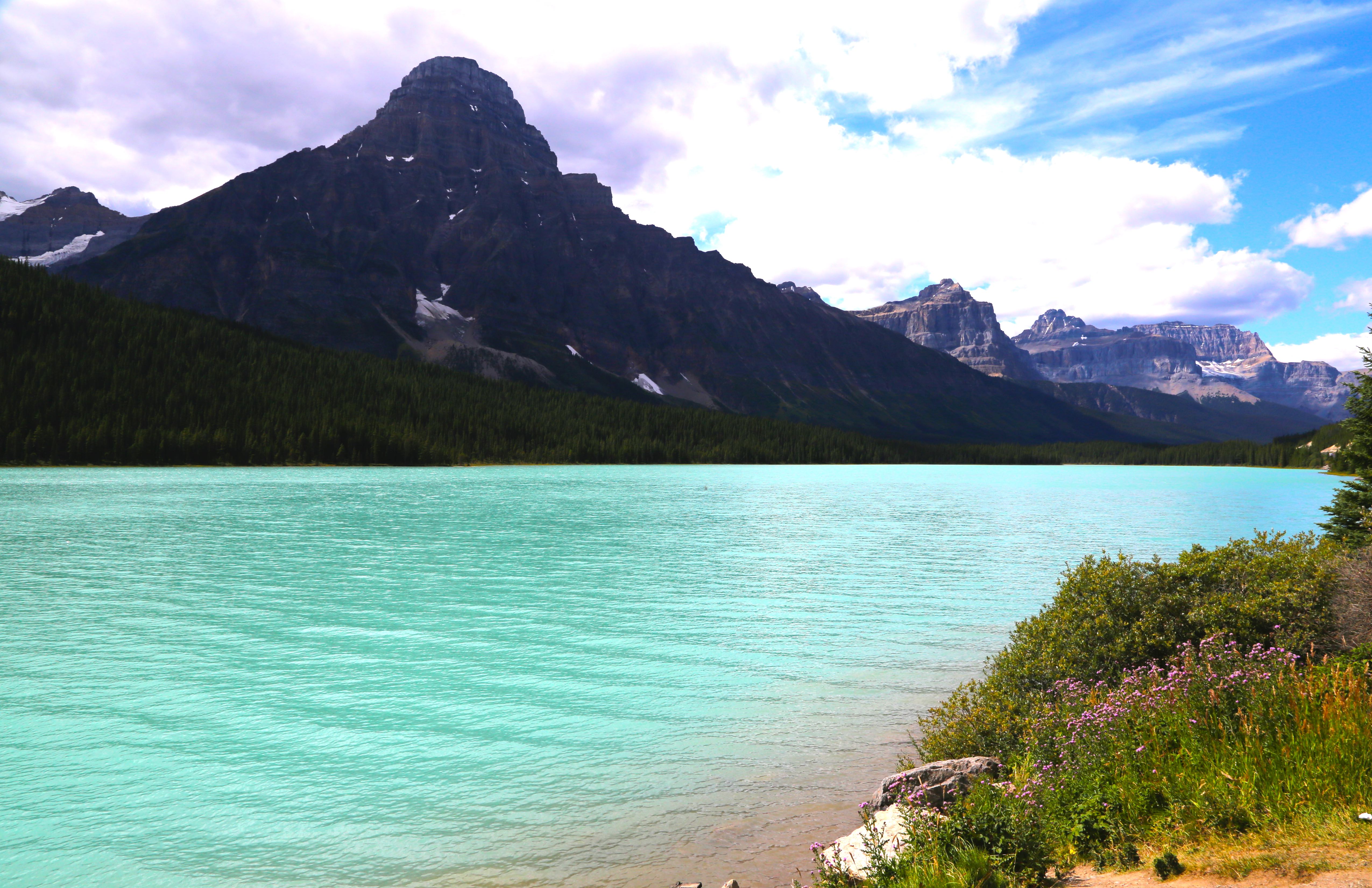
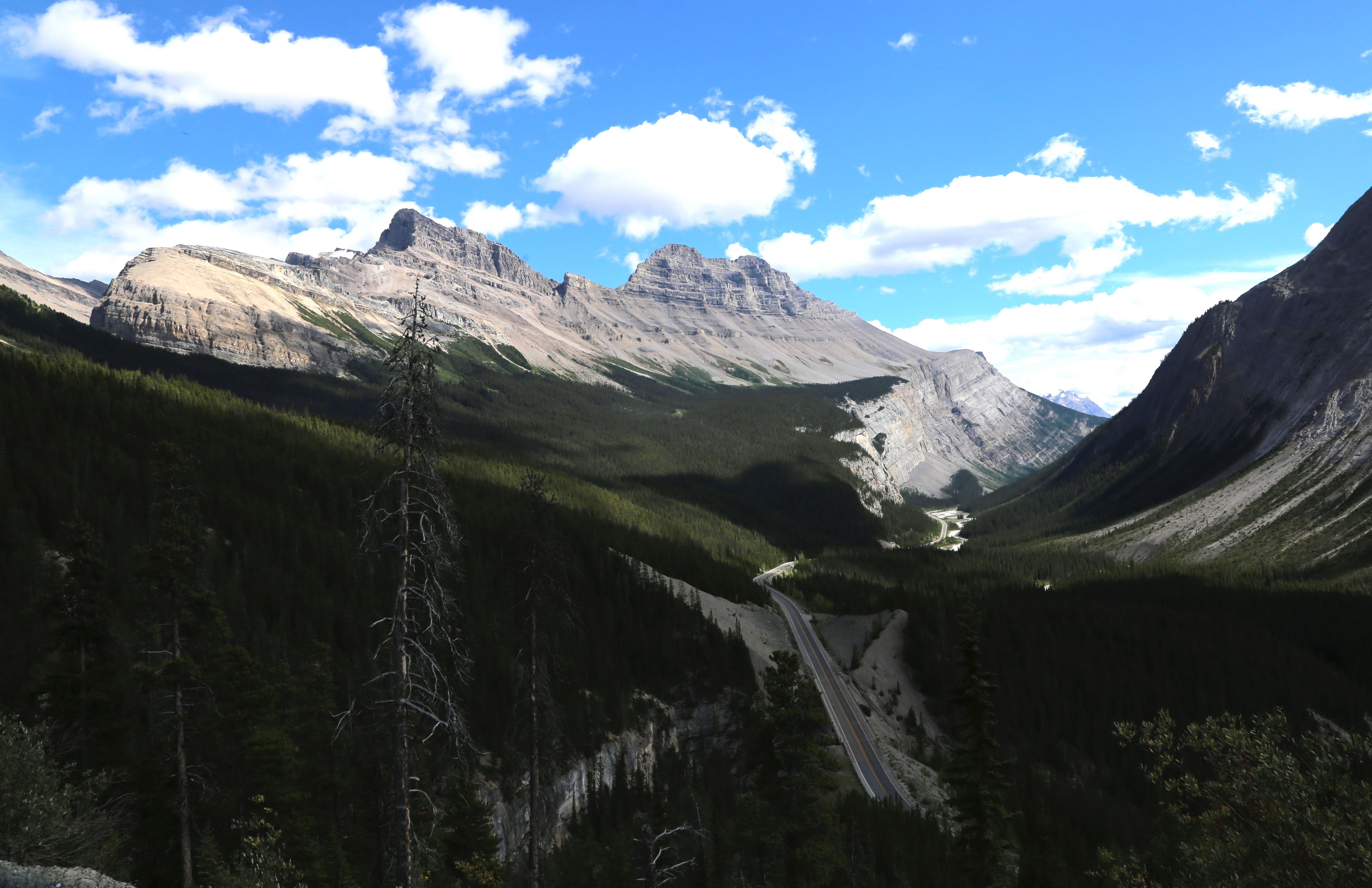
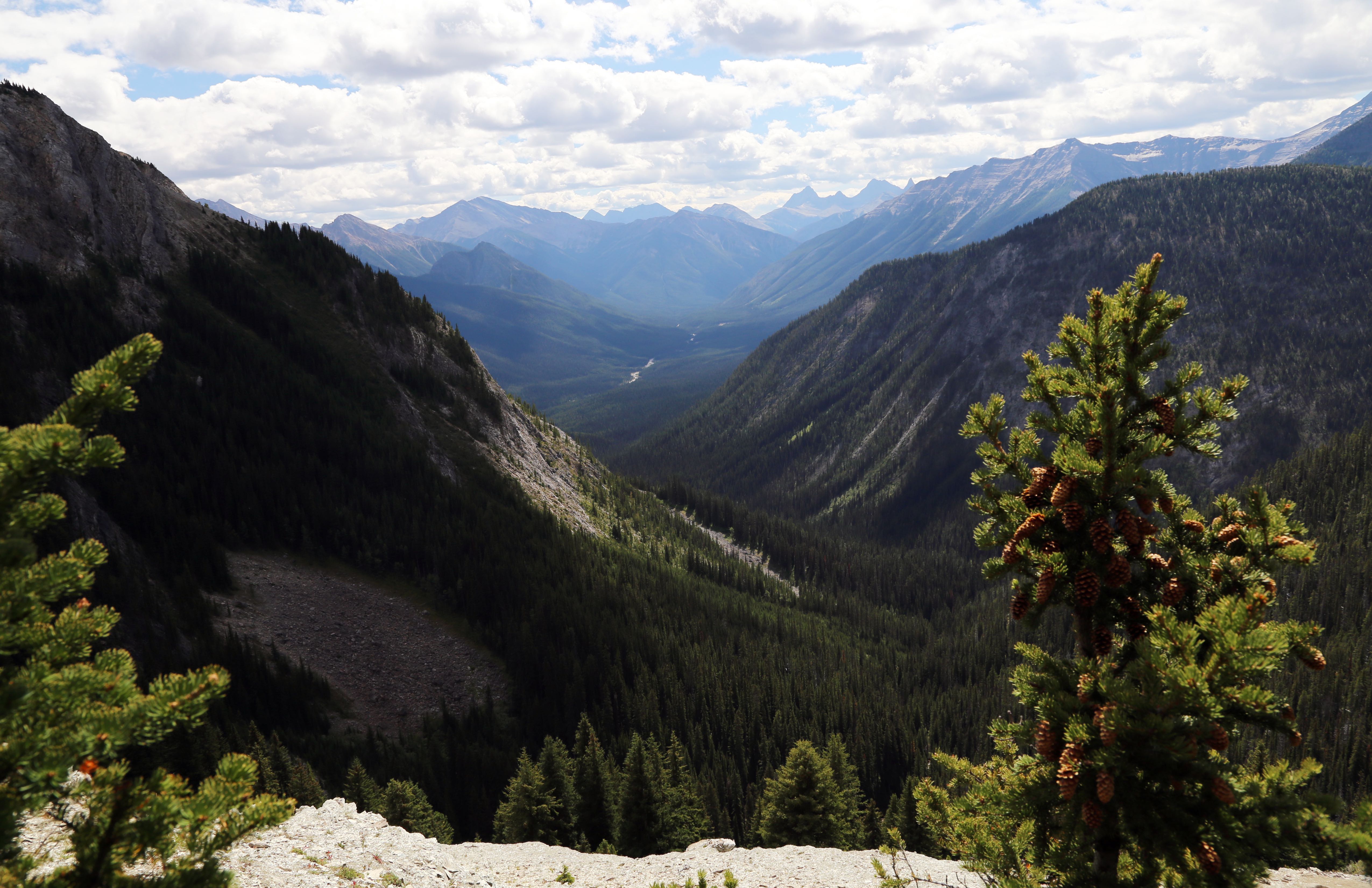
Oh, Canada – Banff and Waterton Provincial Parks Mid to End of August
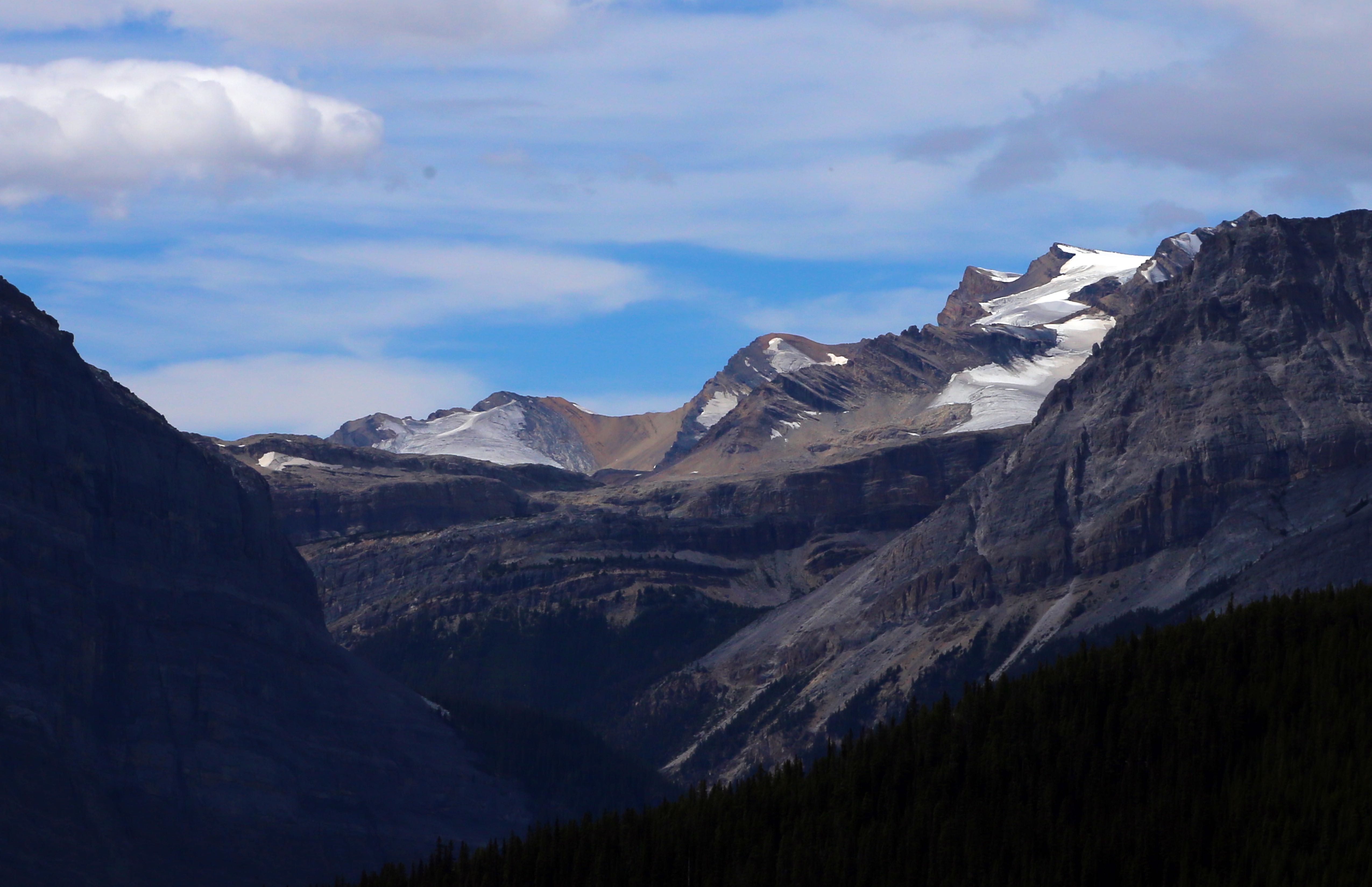
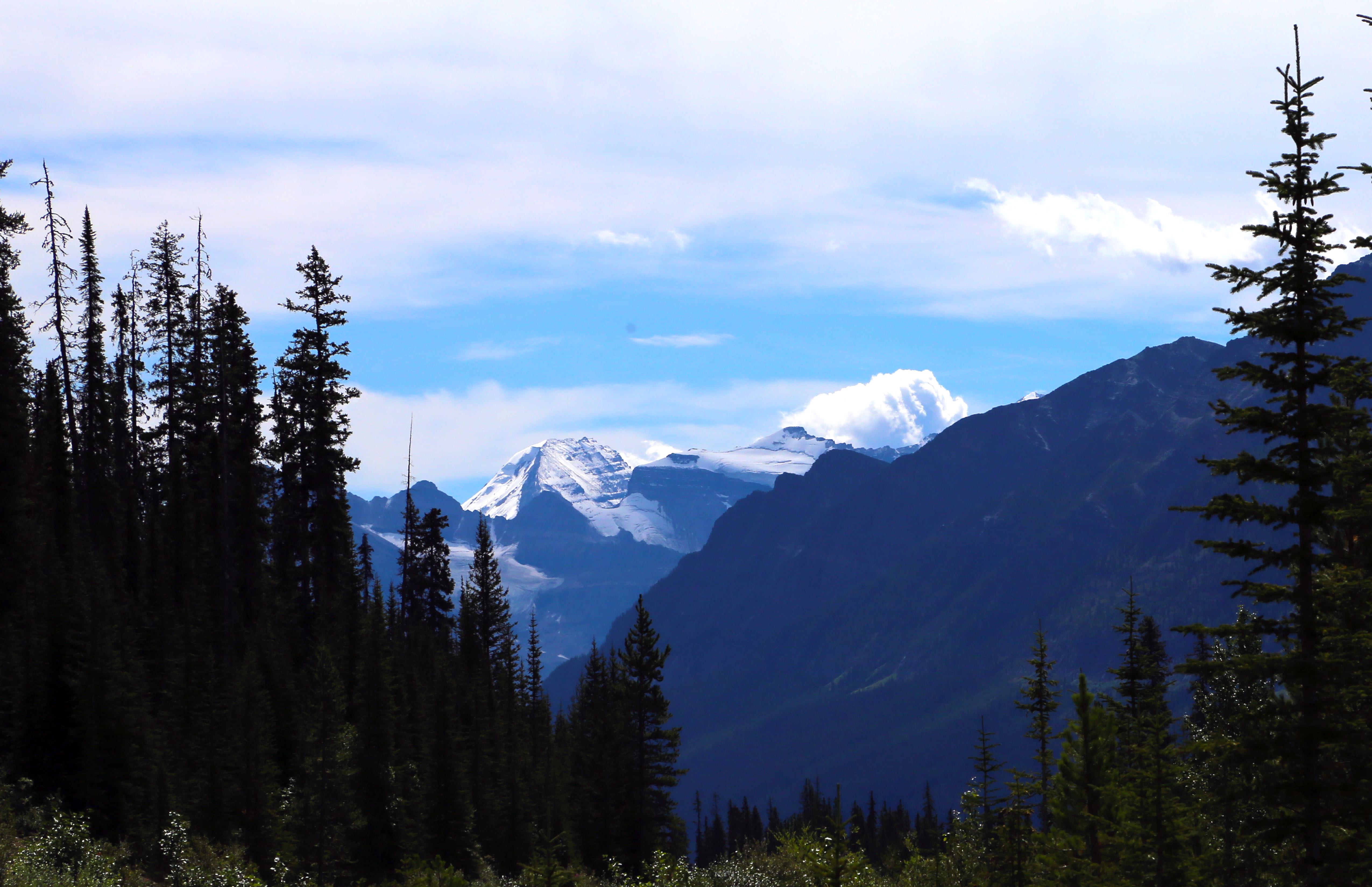
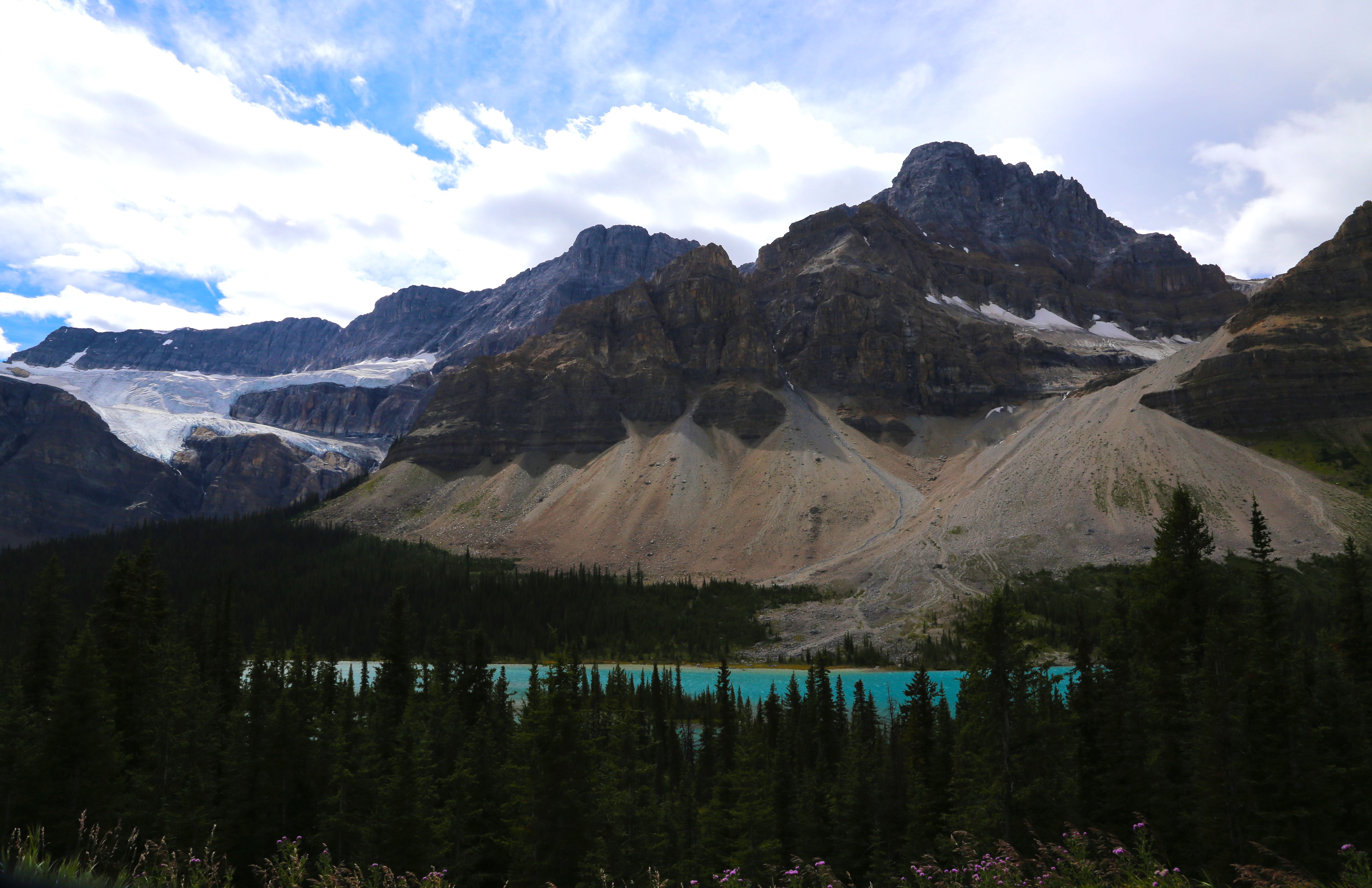
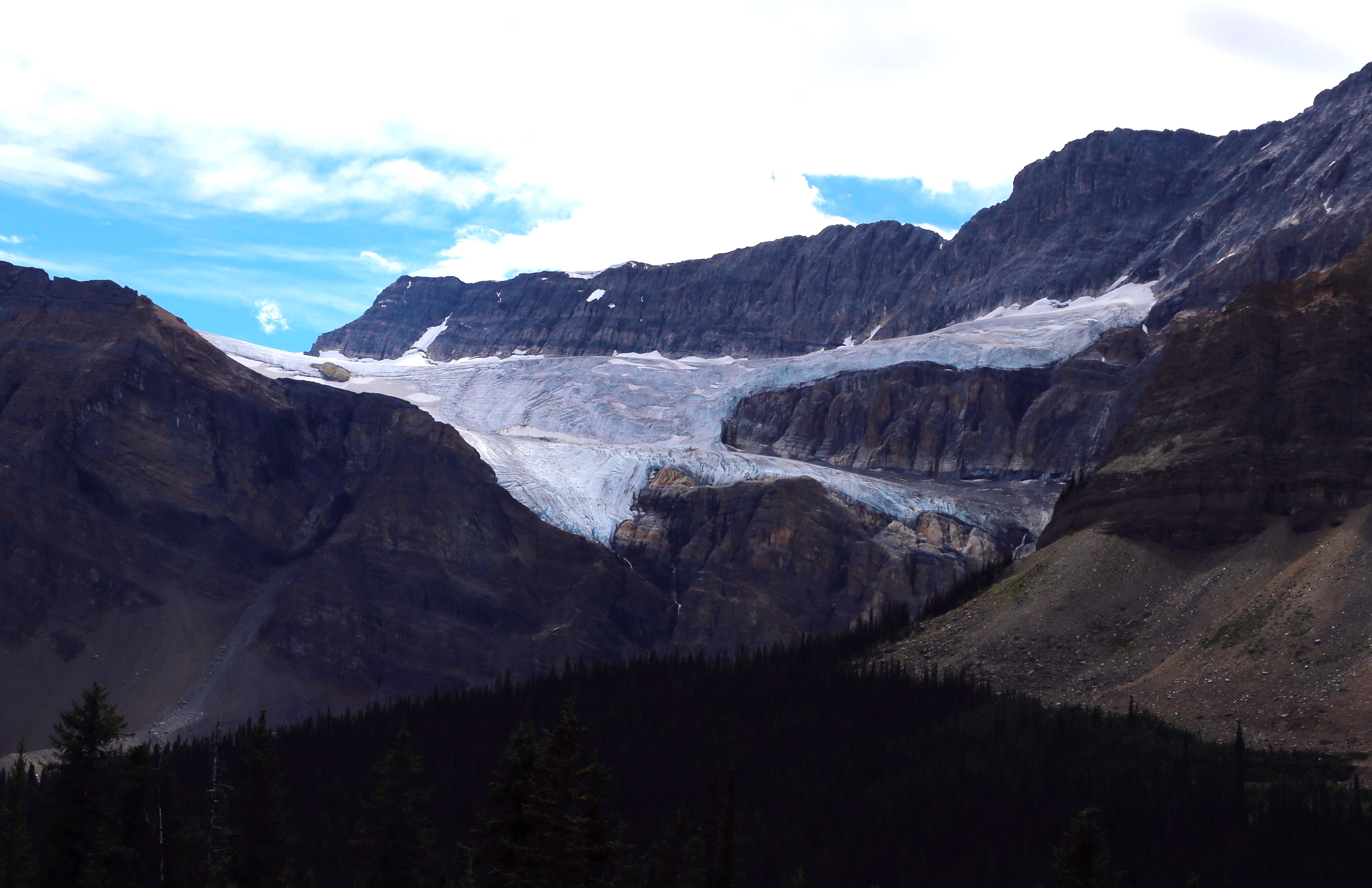
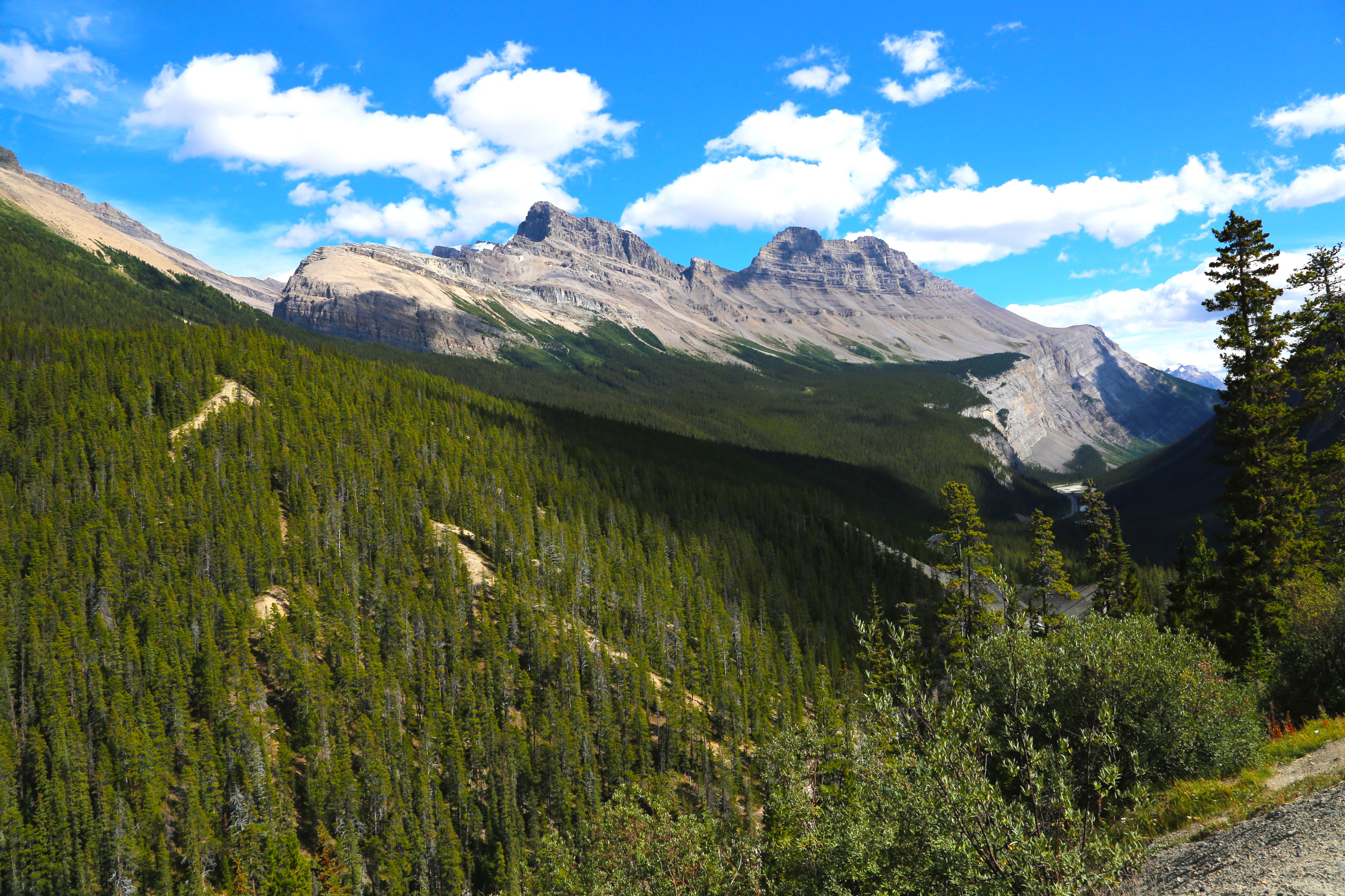
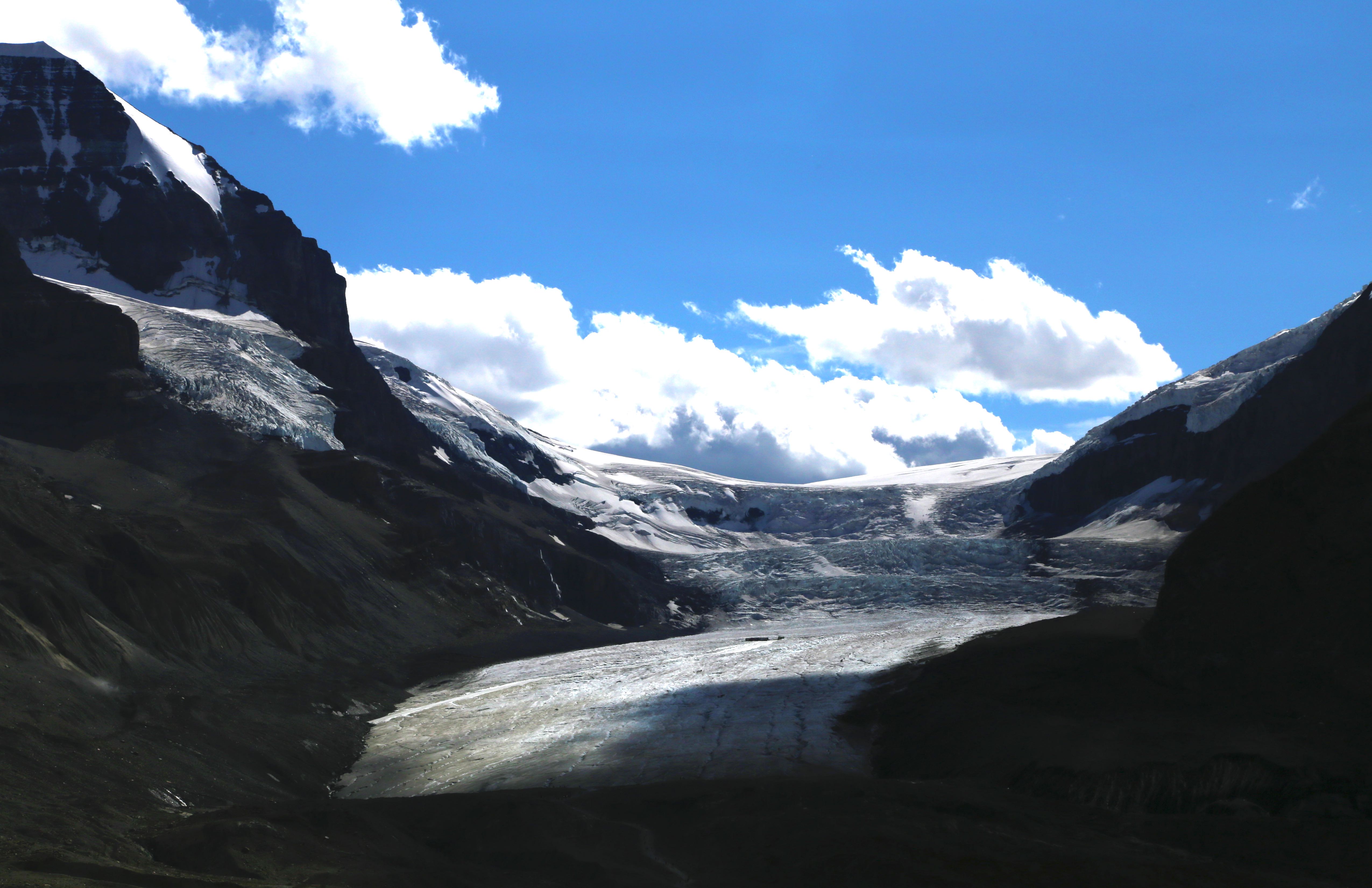
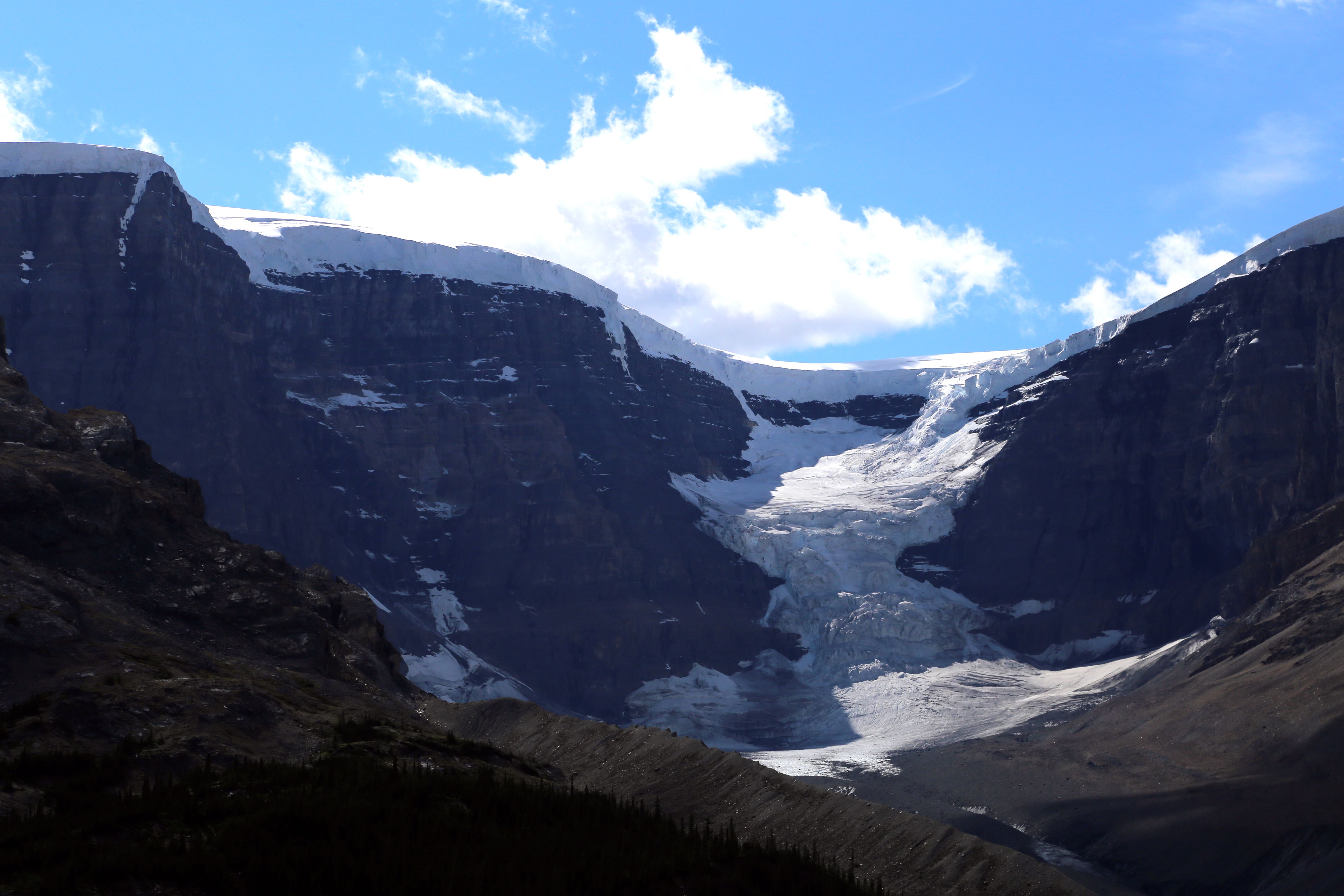
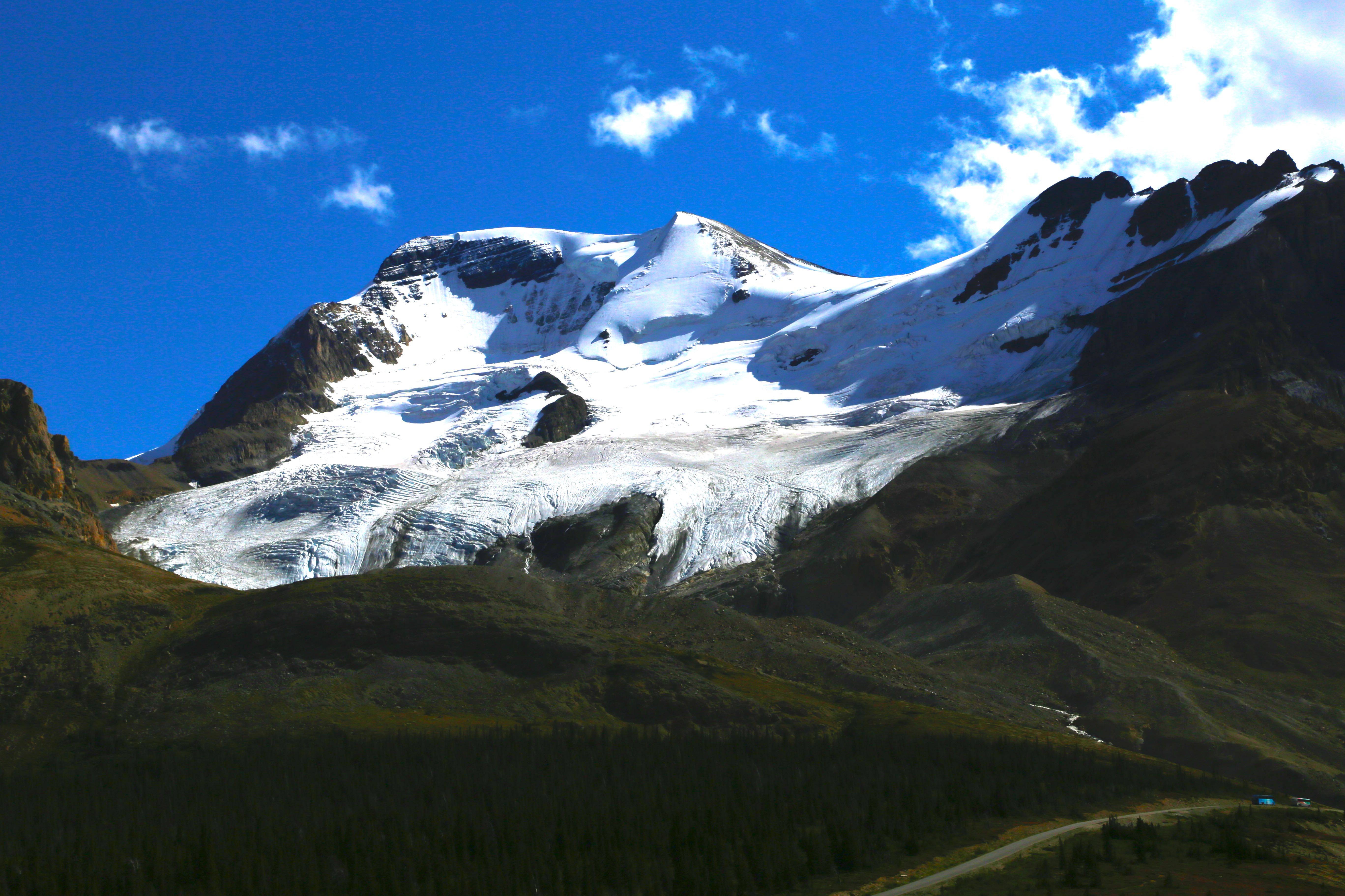
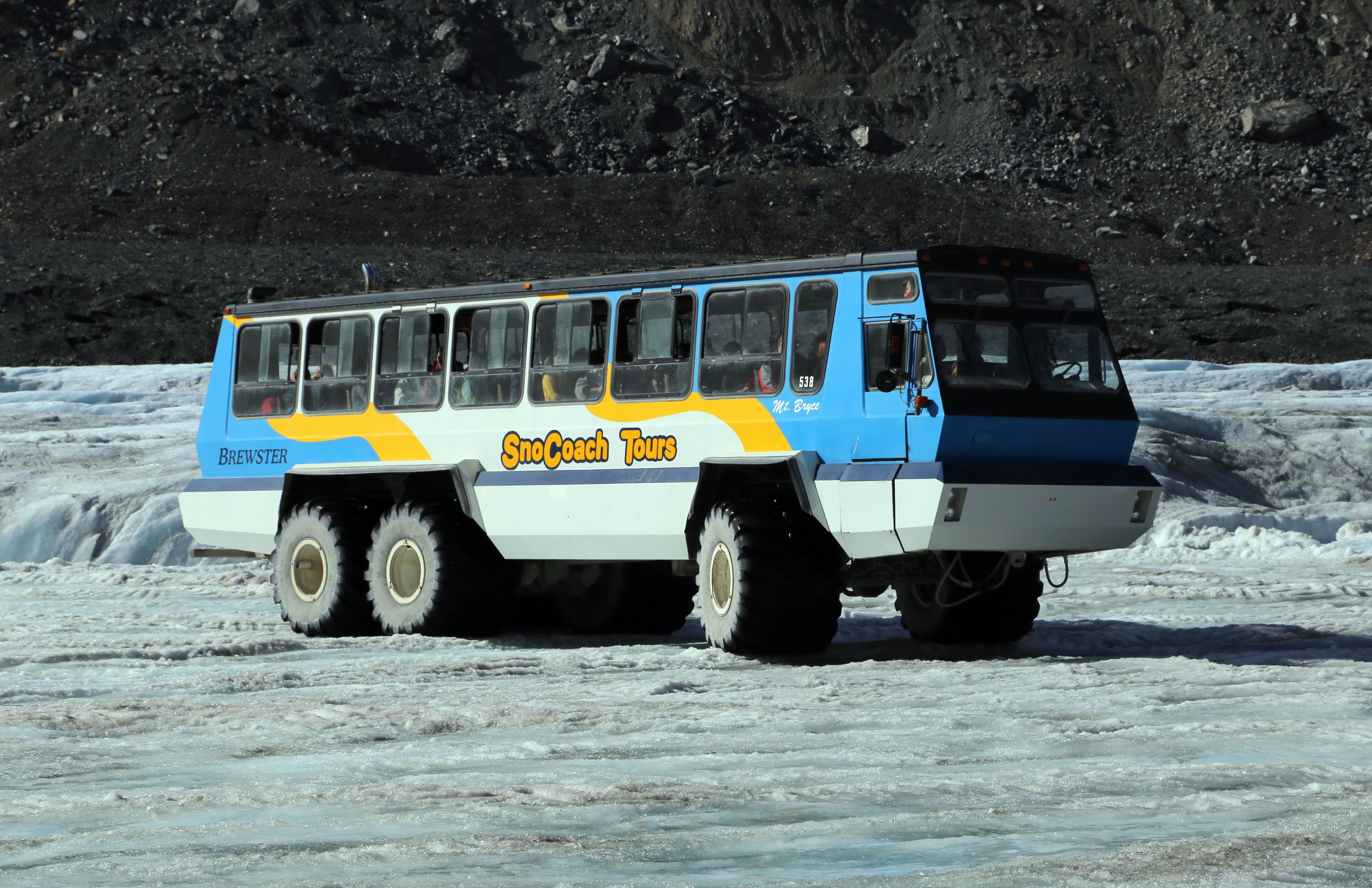
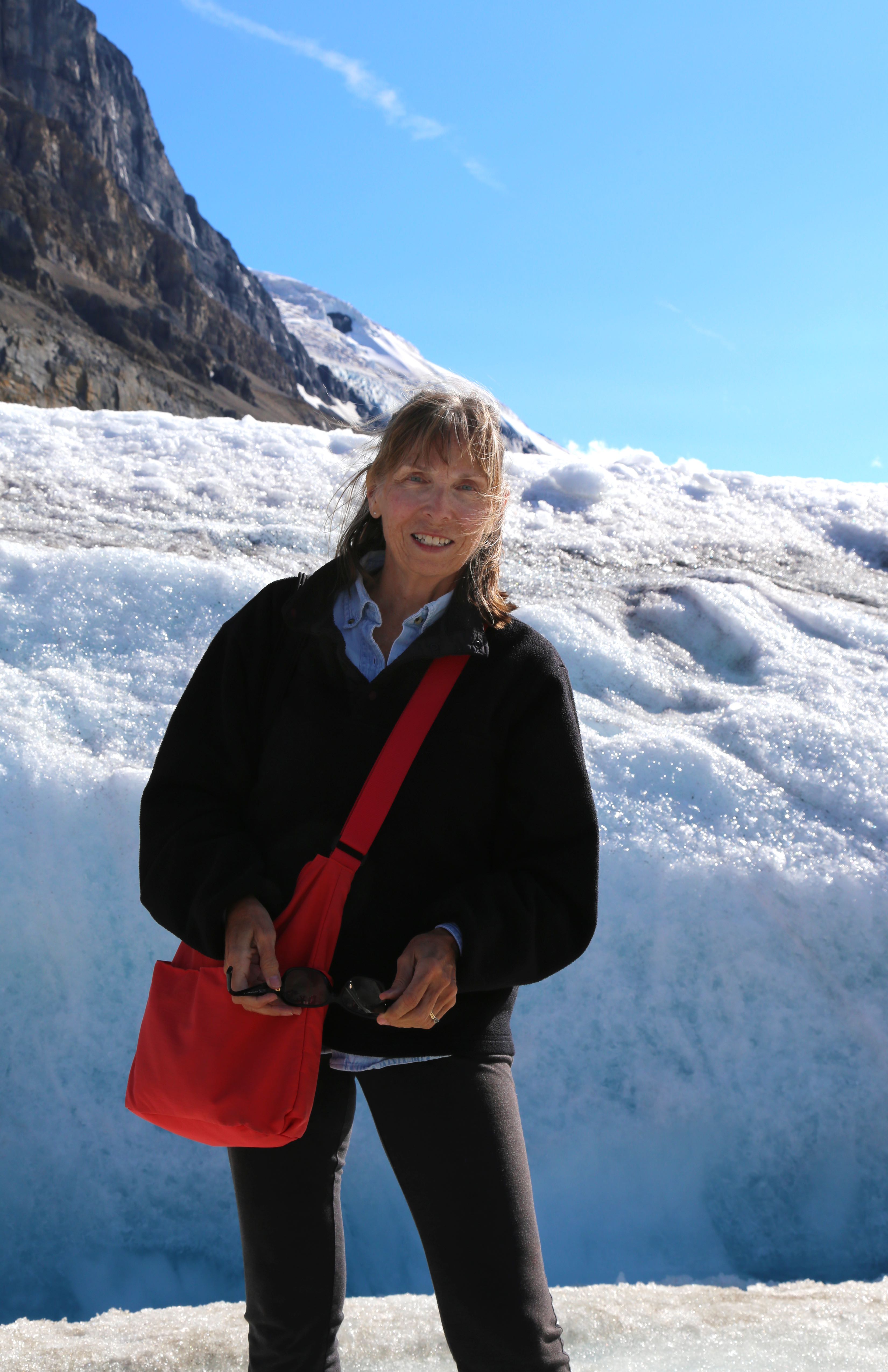
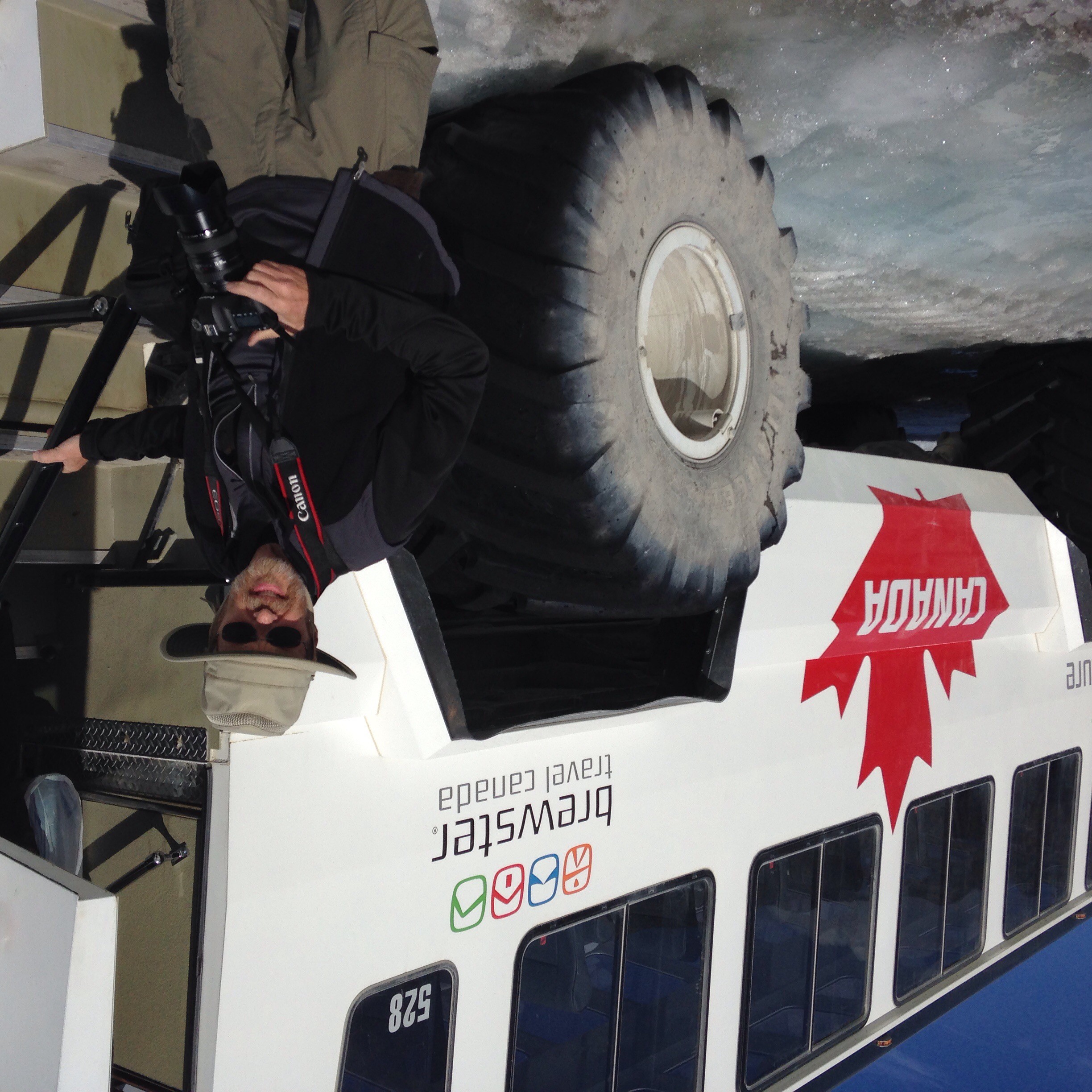
We had just arrive in Banff, Canada in the last update. Banff is my favorite spot of all places visited on our RV travels so far. The incredible mountains; Lake Louise; the Icefields Parkway, with more than 40 glaciers and countless mountains between Banff and Jasper; walking on a glacier, with more than 250′ of ice below us; being introduced to the importance of carrying bear spray while hiking; hiking the continental divide on the top of mountains; the welcoming and international feel of the town itself…..
Along Icefield Parkway, Banff National Park and Jasper National ParkAlong Icefield Parkway, Banff National Park and Jasper National ParkAlong Icefield Parkway, Banff National Park and Jasper National ParkAlong Icefield Parkway, Banff National Park and Jasper National ParkAlong Icefield Parkway, Banff National Park and Jasper National ParkAlong Icefield Parkway, Banff National Park and Jasper National ParkAlong Icefield Parkway, Banff National Park and Jasper National ParkAlong Icefield Parkway, Banff National Park and Jasper National ParkAlong Icefield Parkway, Banff National Park and Jasper National ParkAlong Icefield Parkway, Banff National Park and Jasper National ParkAlong Icefield Parkway, Banff National Park and Jasper National ParkAlong Icefield Parkway, Banff National Park and Jasper National ParkAlong Icefield Parkway, Banff National Park and Jasper National ParkAlong Icefield Parkway, Banff National Park and Jasper National ParkAlong Icefield Parkway, Banff National Park and Jasper National ParkAlong Icefield Parkway, Banff National Park and Jasper National ParkAlong Icefield Parkway, Banff National Park and Jasper National ParkAlong Iceland Parkway, Banff National Park and Jasper National ParkGlacier on Icefield Parkway, Banff National Park and Jasper National ParkTransportation to/from walk on glacierWalking on GlacierSteve boarding the bus from trip to glacier provides context for size of bus
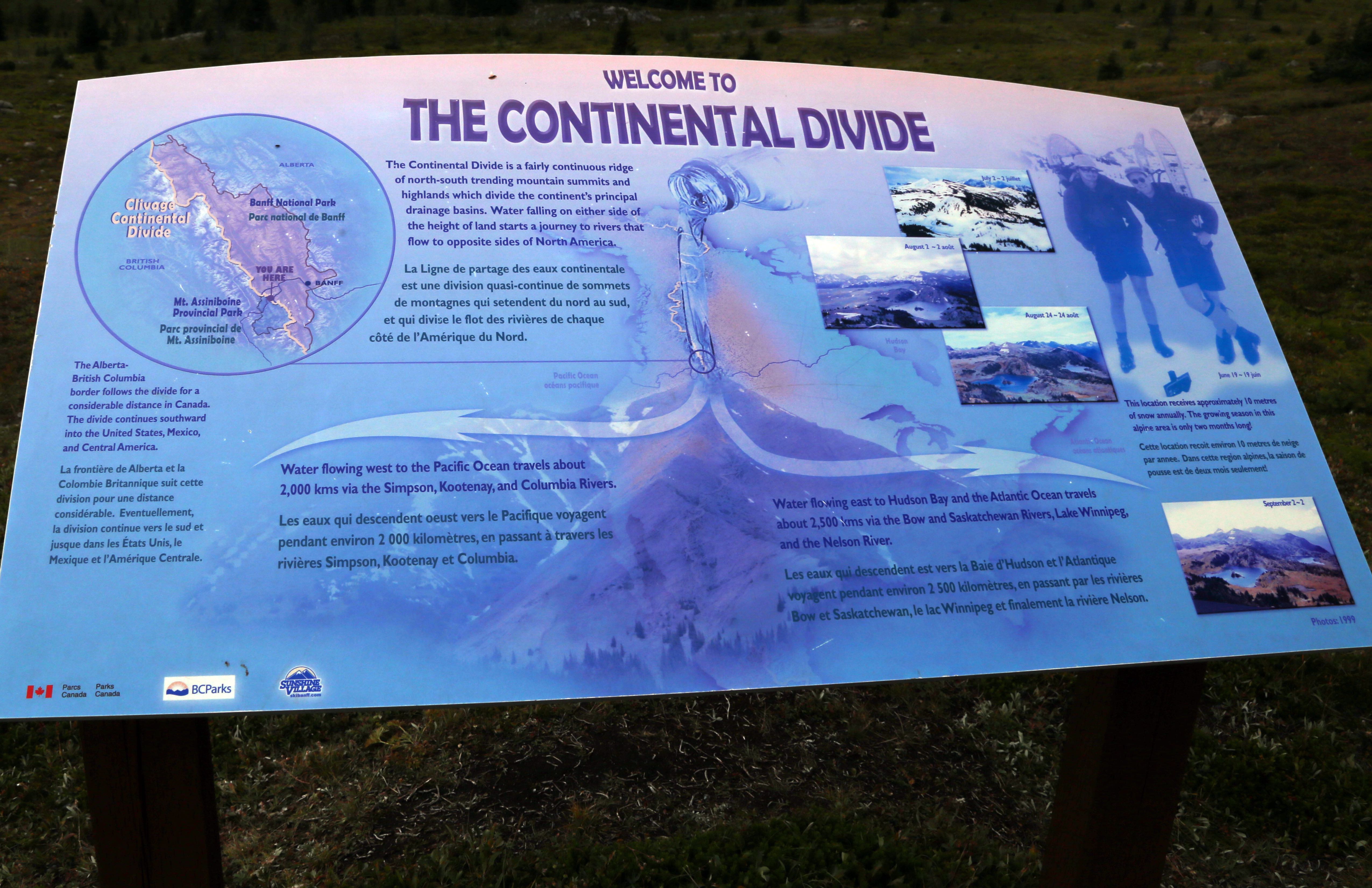
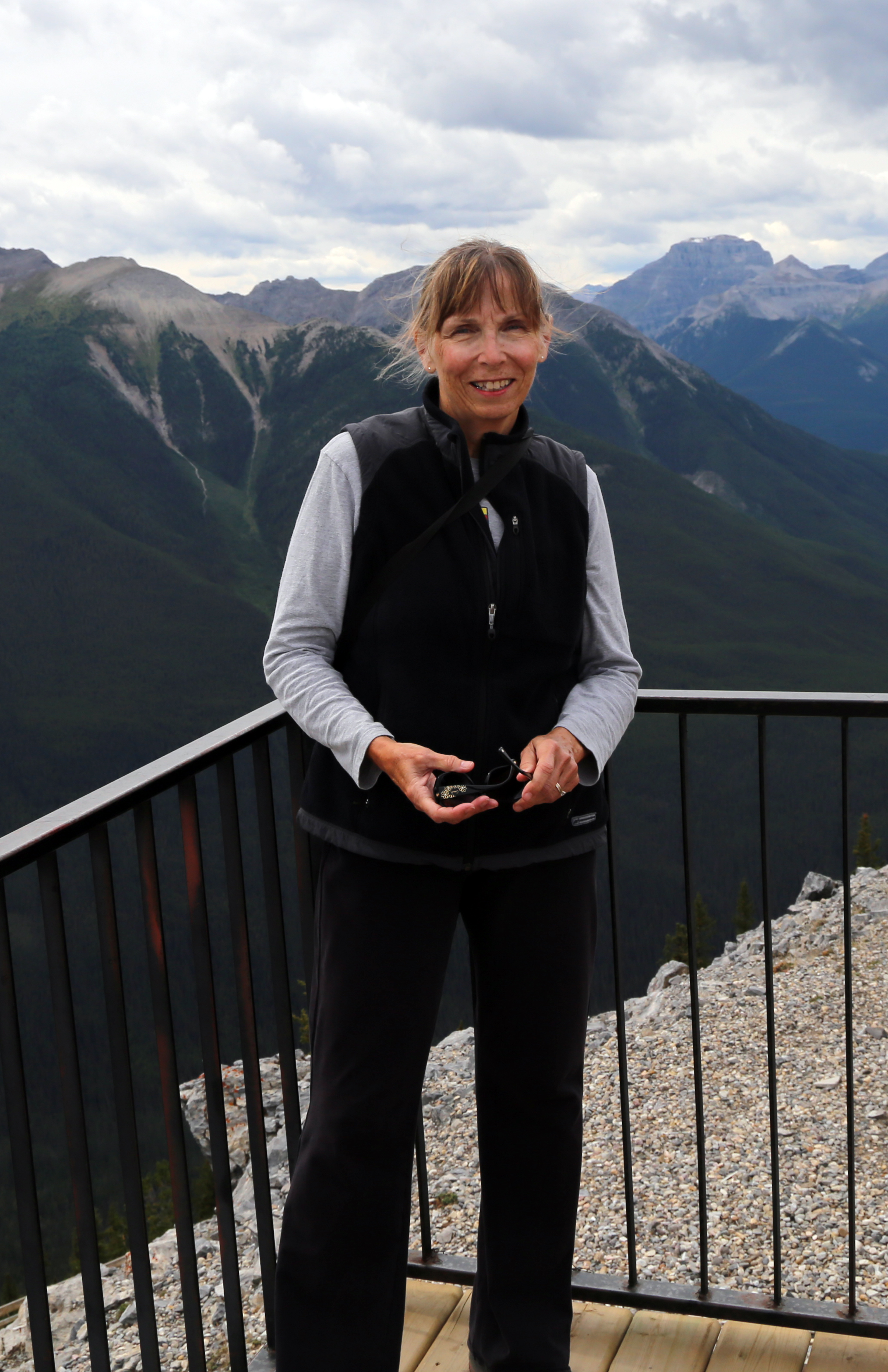
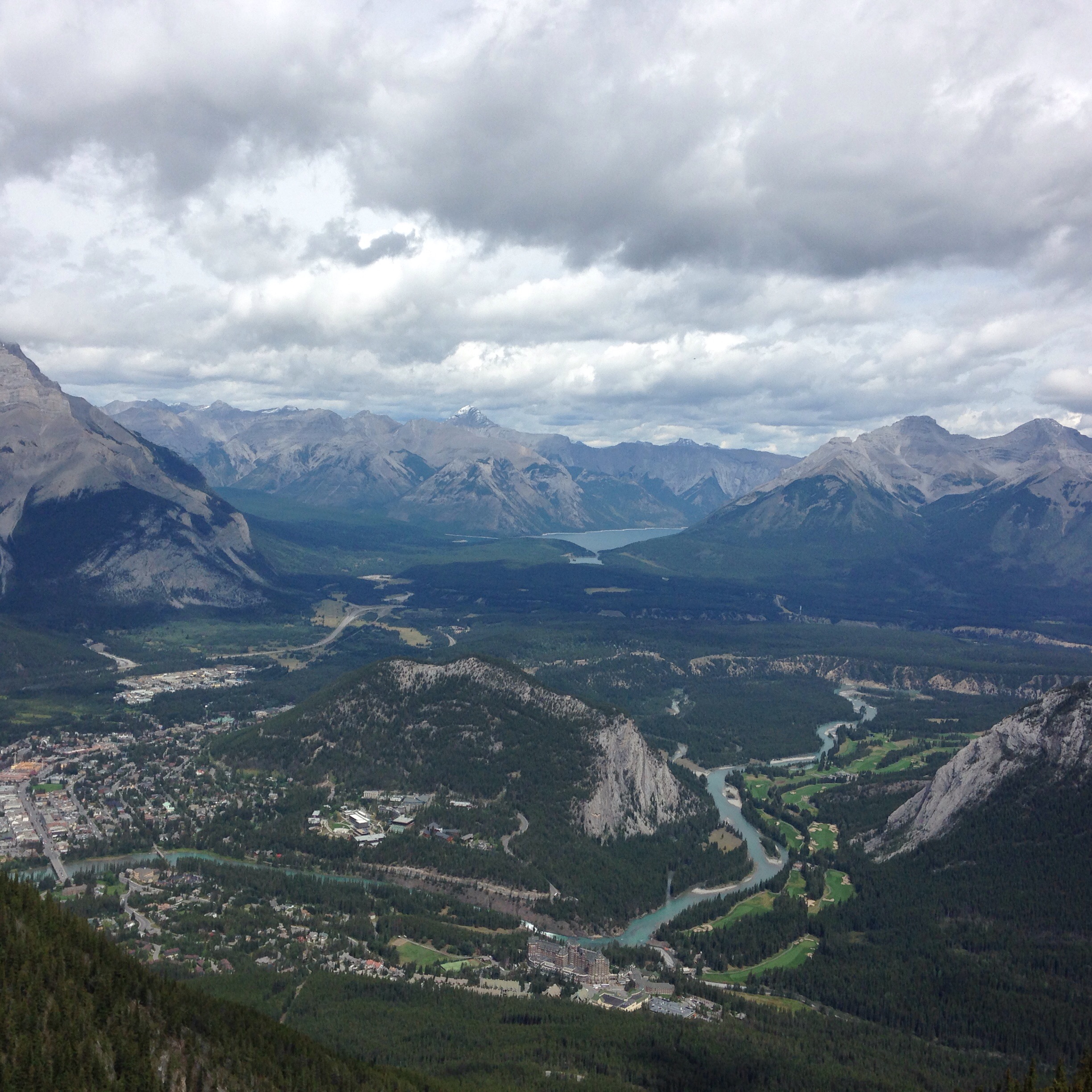
Two favorite hikes: 1. One was up Mount Sulphur, just outside Banff. We could have taken the tram up and back, but decided we’d hike up and tram down. Up 5.5 KM, with many switchbacks. Painfully learned the importance of taking a break to snack on a rigorous hike – we were both drained by the time we reached the top. Large visitor center on top, along with an observation tower another 1.5 KM away. Breath-taking views of Banff from on top. 45 minute wait for the tram back down and shared to ride back with a grandfather/granddaughter from Alberta area. Fun to hear their perspective on the area, weather….. Starved by the time we got back to the RV! 2. Mt. Sunshine – a large ski area outside Banff. We took the bus up 6+KM and then hiked around the summit, walking over the continental divide, the point where water flows either West to the Pacific or East to the Atlanta. Also crossed into British Columbia from Alberta on hike. Many trails around meadows and lakes, hiking approximately 5KM. Shirt-sleeve weather!
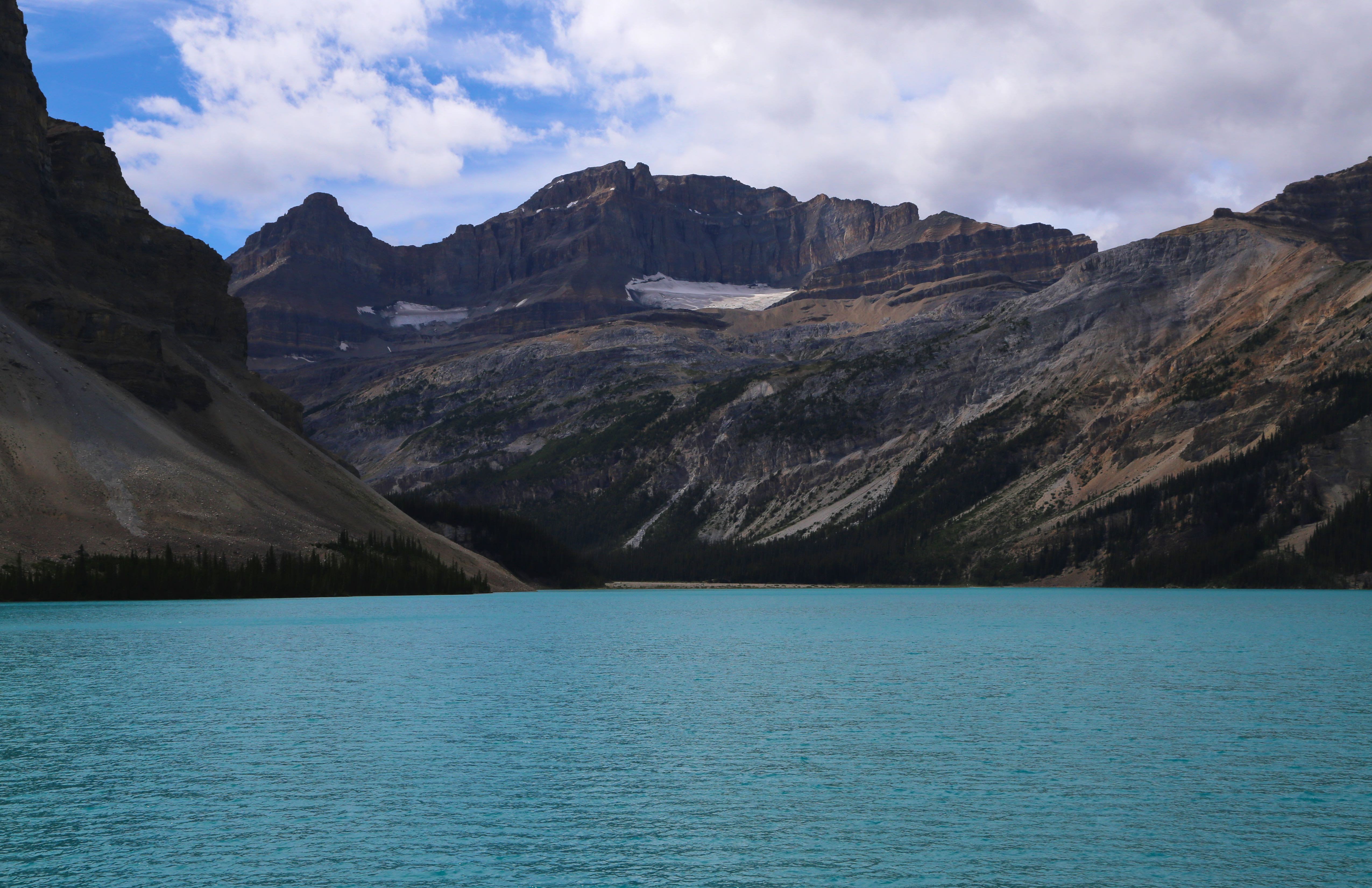
Simpson Point at Albert/British Columbia Border on the Continental DivideView At the Intersection of Alberta, British Columbia and The Continental DivideJoan at Cosmic Ray Station on Sulphur MountainView of Banff from Mt Sulfur. Hiked 5.5 km, up 655 km in elevation. Took tram down from hereLake Louise, with its ‘green/gray’ water and glacier in the background
We love Banff so much, we plan to re-visit it again around the June 2016 timeframe. Maybe with family guests??
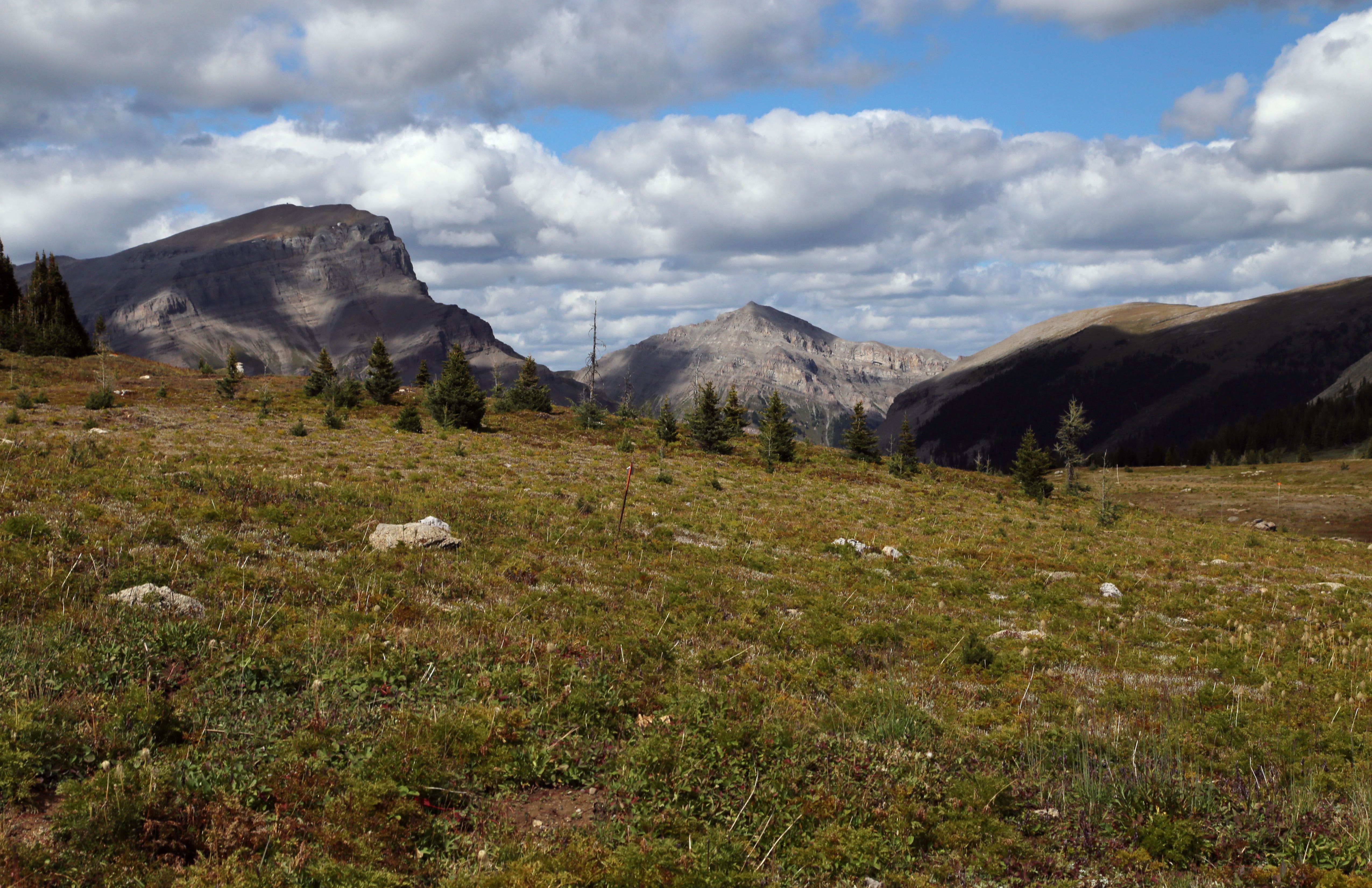
Waterton Lakes Park, the Canadian side of Glacier national park and a couple of hours south of Banff. Incredible mountains, many lakes, but sadly, it was filled with smoke from the many fires burning in Washington, Idaho, Oregon, etc…. Many great hikes, with the most memorable to Forum Lake, a 5+ mile hike up to a sub-alpine lake surrounded on three sides by a rock wall. And two very scenic parkways in the Park: Akamina, which ends 16 KM at Cameron Lake and Red Rock, a beautiful 15 KM road. Many hikes off both parkways. And we visited the Bison Paddock just about every day to drive among the bison….
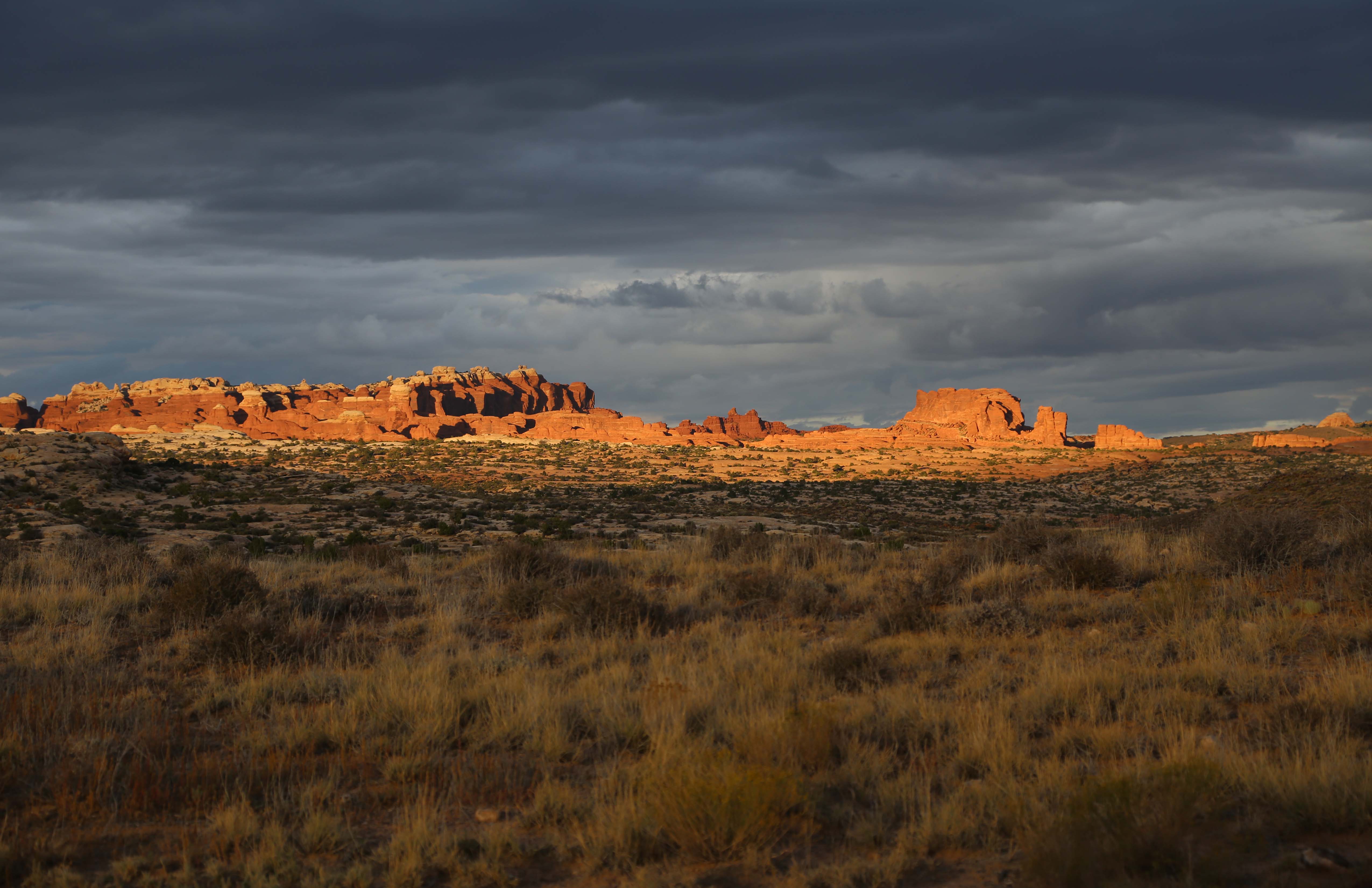
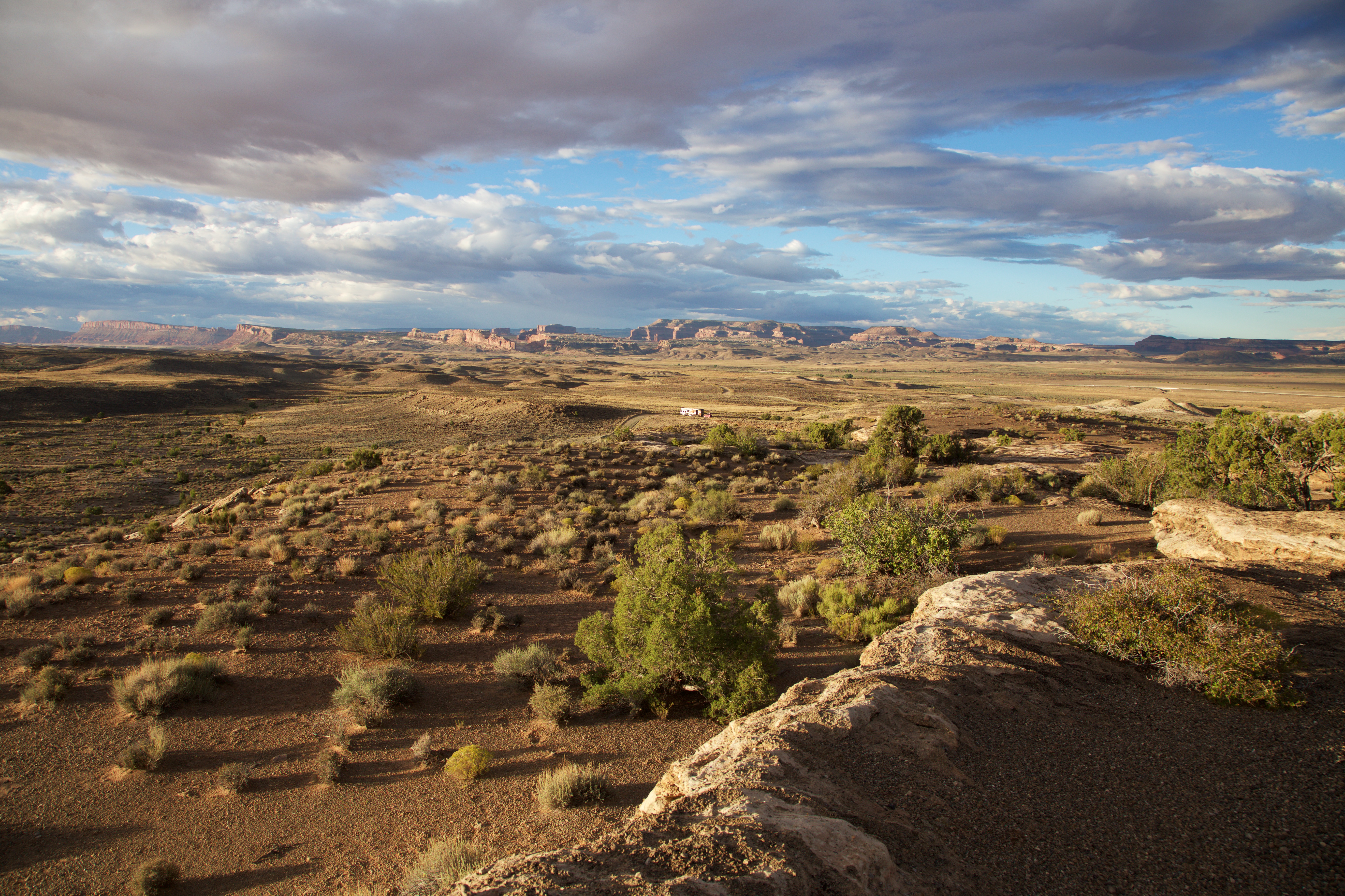
Joan and I occasionally try boondocking, that is, camping someplace without hookups. Awhile back we were traveling from Yellowstone to Grand Junction, CO and decided to spend a night just outside of the Arches National Park in a parking lot used for mountain biking. It was the Klondike Bluffs North Parking lot and sounded like a nice place to spend the night. We had the mile marker so we proceeded to the location and, although the road didn’t fit the description and the map preceding the entrance indicated the road was for 4 X 4 vehicles, we proceeded up the hill. After all, we did have four wheel drive, it’s just that they’re all on the same axle. The trip up the hill was uneventful, fortunately there was no oncoming traffic. We saw a nice spot at the top of the hill with a beautiful view:
View from Boondocking Campsite
But of course we kept going, the grass is always greener. Unfortunately the road conditions deteriorated with the road washed out in several places, but with no room to turn around we had to keep going. Eventually we came to an intersection with a helpful sign indicating that camping was not allowed beyond this point and we unhooked the car and turned around. We went back to the first spot we saw and moved in.
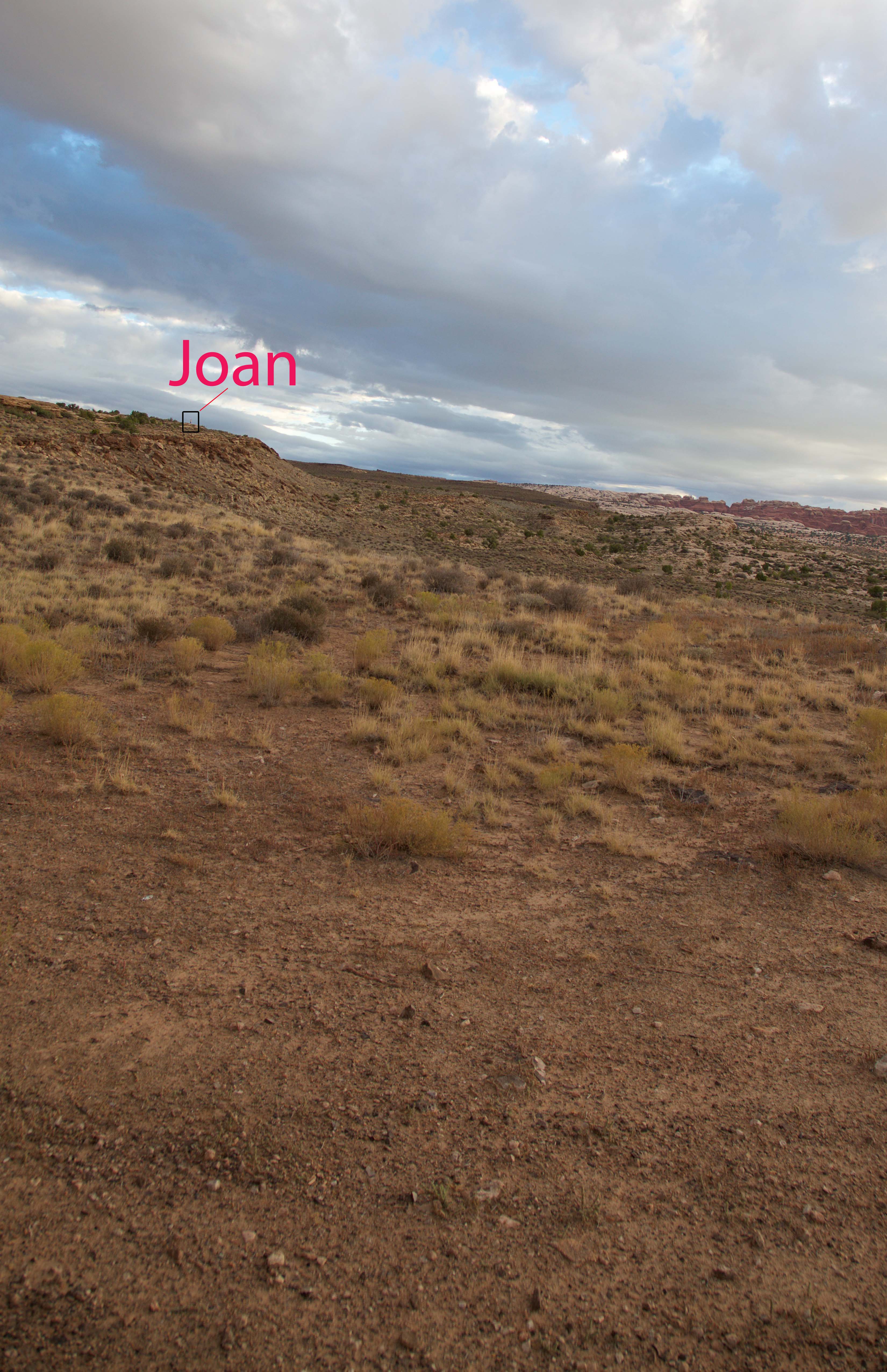
The next morning, as usual, Joan was up well before me and went out for a walk at about 6:30. Because we had no phone service she woke me up and handed me a walkie talkie indicating she would call me if she needed help. I went back to sleep. About 45 minutes later I was awoken by Joan on the walkie talkie asking me if I was awake. Since I now was, I asked her what she needed. She asked me to take a picture of her up on the hill behind the motorhome. I grabbed my camera opened a window and leaned out. I saw nobody. Joan explained where she was and I took a couple of pictures. I put a box around her and put her name above it so you can find her (you may need to click on the photo a couple of times to enlarge it enough to see her):
Joan on Mesa
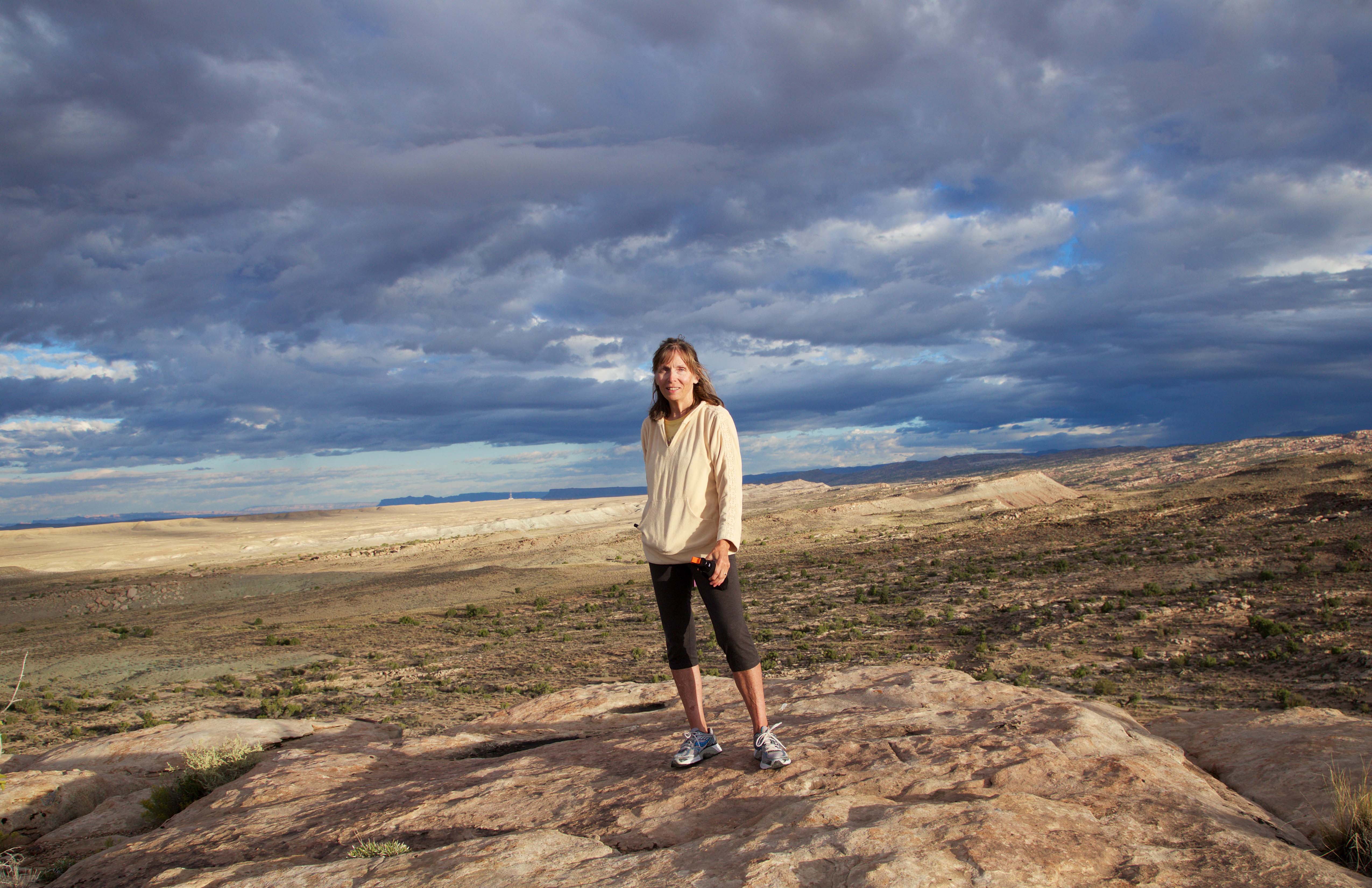
Being wide awake now I decided to join her. When I found her I took her picture:
Joan on Mesa with Bear Spray
When we looked back toward the motorhome, I took this picture (you may need to click on the photo a couple of times to enlarge it enough to see the motorhome, it’s in the center of the picture):
Motorhome and Car from Mesa
Later that morning we drove slowly back down the hill and onto the main road. As we headed up the main road we noticed a sign for the North Klondike Bluffs mountain biking area with a road that matched the description we had. We had to find a truck wash on the way to our next campsite to clean off all the mud and muck that has splashed up on the motorhome while off-roading, but it was a great adventure. I’m kind of glad we didn’t find the right place.
We arrived yesterday in Banff, Canada, which is located in the province of Alberta and a tad east of the continental divide. Our campground, Tunnel Mountain (Village II), is surrounded by towering mountains and located a couple of kilometers above the town of Banff, a European-feeling village, bustling right now from all of us summer visitors. (Although, with all of the ski slopes in the area, maybe this isn’t peak visitor season??) Our trip to Banff was from Spokane, WA, with a one night stay over in Cranbrook, British Columbia. Kootenay National Park was our entry way to Banff National Park and the entrance was spectacular – we had to drive through a thin opening between a wall of rocks, truly checking for outcrops to be sure we wouldn’t hit any!
And by the way, it’s 39 degrees right now at 830 a.m. A whole lot different than the 100 degrees we were seeing in Spokane, WA, just two days ago! As much as I love the cooler weather, think my body is saying ‘WTH’!
So to digress a bit….and reflect on the last two-three weeks…… Oregon and Utah are competing for my most favorite places so far on this trip…. And I think Oregon may have inched ahead…. The wild Oregon shoreline, with mountains dropping into the beaches, with sand dunes higher than 10 story buildings; Crater Lake, rimmed by mountain remnants and filled with incredible blue and pristine water; the mountains in central Oregon, the crazy Columbia River that borders WA where white caps crash over tops of boats and wind surfers abound; the Blue Mountains or ‘Swiss Alps of Oregon’ in the southeast; Hell’s Canyon, where there are over 100 twists and switchbacks on a 10 mile road stretch. One more – Oregon gas stations are required to pump gas for you! Yep…Oregon has my heart.
Our travels since Florence, Oregon:
– Crater Lake – hard to describe the blue color of the lake; unlike any other blue water color I’ve ever seen before. With no streams entering or leaving lake, the water is pristine; and unlike other lakes formed from volcanic eruption, there are little remnant gases which can cloud the water. And the few fish types in the lake (salmon, trout and crayfish) were introduced by man, with the salmon and trout having morphed into their own species. The ride around the rim is beautiful and provides many views of the lake and two islands. We hiked a trail with many switchbacks to one of the highest points on the rim…. Some of the drop-offs sure caught my breath!
– Bend/Sisters area is located in central Oregon and is surrounded by several mountain peaks that tower more than 10,000 feet – the three sisters, Mt. Jefferson, Mt. Washington. We drove the Mckenzie Pass, which is open only during the summer, and visited the lava fields and observatory, all of which are around 5200 feet in elevation. The temperatures were in the low 100’s most of time here. To keep cool, we drove to Mt. Hood, a bit north of where we were staying, and hiked the east side for 2 1/2 hours in the woods to a beautiful 40′ wide falls with a 100′ drop that sprayed us and other hikers with cool water.
– A memorable overnight stay along the confluence of the Columbia and the John Day River, on our way to the Wallowas, part of the Blue Mountains in eastern Oregon. Our site at LePage Park was right along the John Day River, with the Columbia River right around the corner. Here we met Sheriff James, who was pulling in his boat from checking the waterways, and who surprised us with an offer to take us out for a boat ride on the Columbia. What a ride – we were hit with 25+ knot winds and white cap swells. Going into the wind, James opened up the engine and we flew. After 10 minutes or so, he turned the boat around and let us know the downwind ride home would be rougher… And he was right! The boat lifted out of the water and then slammed down repeatedly. I’m holding onto the bar and bracing myself best I could and turned around to see Steve with an incredible smile and taking pictures with his one free hand.
– Wallowa State Park in the Blue Mountains. Our drive here was through much smoke-filled air. Two large fires in the area, one we saw off in the distance. The campground is surrounded by sky reaching mountains on three sides. We took a tram up 4,000 feet to the top of Mt. Howard. This area is considered the ‘Swiss Alps’ of Oregon. We hiked for 2 hours on the top of the mountain. At nearly 9,000 feet, we were sure feeling the upward parts of the hike. Snow was on a couple of the mountain peaks to the west. While on top, we were able to do an interpretive hike with a ranger, who pointed out plants unique to this area, talked about the history of the area, the weather norms…. This area only received 25% of its normal snowfall during this past winter.
– Our ride from Wallowa area to Lewiston, Idaho gave me pause much of the way. We talked with our reliable trucker adviser, Jason, as well as the local ranger and some locals about the best way to Lewiston. All thought we wouldn’t have a problem going through Hell’s Gate as long as we took it slow. Didn’t inspire confidence! Over one ten mile stretch of this road there were 100 curvy turns and switchbacks, with another ten miles only having 90 of these. At points on the road, you could see cars traveling above or below us a couple of thousand feet… Steve did a great job!!
– Lewiston, Idaho – first time in Idaho! The campground was on the Snake River and the water was incredibly warm – warm enough to go in and get wet.
– Spokane, WA – so much to say about our visit here. So great to see my sister, Geri, her husband, Mike, and families of Jason and Janelle. We stayed with Geri and Mike at their house, parking the RV on the street in front of their house. Many RV and personal chores accomplished here and Geri and Mike were so helpful, besides making us feel so welcomed. We were going to find place to wash the very dirty RV but Mike convinced us we could do it at their house. Two hours later and with almost closing down the street, we did! Four very tired and wet people! So many fun activities – kayaking the Little Spokane River, hiking the foothills around Spokane, hiking around Coeur d’Alene, making/eating great dinners, having coffee every morning, playing corn hole, ladder ball and way too much Mexican Train (especially since I came in last most of the time!). It was so hard to leave….. We left behind one item (camera charger) and Mike surprised us by showing up at the truck stop in Post Falls, with the charger in hand…. Definitely left a piece of my heart in Spokane.
And here we are in beautiful, breathe-taking Banff…… More to come…
One last comment….. How forest fires are part of the lives of those living in CA, OR, WA and western Canada. It is so much drier here than the east. It doesn’t take much, a spark from a lawn mower, a flick of a cigarette, lightning, to cause great damage. We have seen and felt the smoke. Scary and something I never really thought much about before this trip.
It’s been almost two weeks since the last post. And I realize the more time that goes by between posts, the harder it it is to post….so many events, themes, feelings, etc…. So here goes……
Just about the end of July and we are now developing a rhythm, cadence in our ‘on the road’ life. I’m up early, usually walking first thing in the morning, sometimes doing yoga/mat routines. Breakfast together once Steve is up. Steve stays up later, appreciating his alone time well after I’ve gone to bed. Travel days start earlier, preparing the RV and ourselves for anywhere from 4 to 7 or so hours of road time. The day after traveling, based on hook-up services, may entail laundry, clean-up, grocery shopping, getting a read of what we want to do in the new area and usually a good walk to wind down from the drive. The remaining days are spent experiencing the new area and people around us, as well the keeping up with routine chores. We are still on an RV learning curve, trying to figure out how to correctly auto start the generator (which kept self starting at 2:30 a.m., the first time we tried this), how to get the door locks to work, figuring out how to connect the grill to the RV propane tank, getting the RV GPS lady to talk loud enough and not be overriden by a radio we hadn’t even turned on……. There’s still lots on our list to get to…..
In terms of travel, we have now made our way to Florence, Oregon, arriving Wednesday, July 22. After leaving Avila Beach, CA, we spent 3-4 days at the Lake Del Valle campground in Livermore, CA, which is about an hour southeast of San Francisco. From Livermore, we traveled to Samoa, CA, a remote location on a peninsula in northwestern CA….and then to here, Florence. California was beginning to feel like our second home. We had been there for a month. Very beautiful state, with incredible diversity of climates, terrain, views.
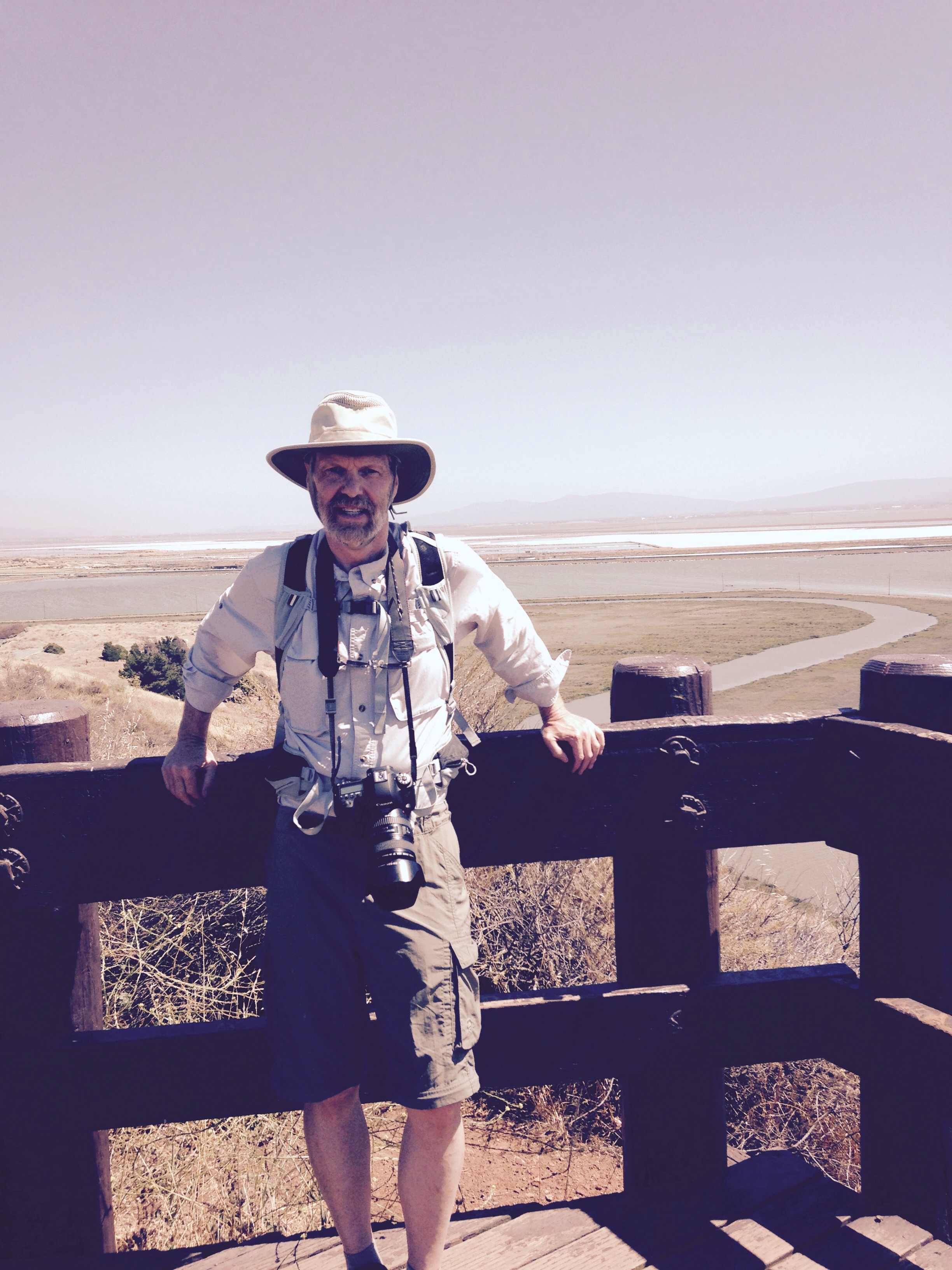
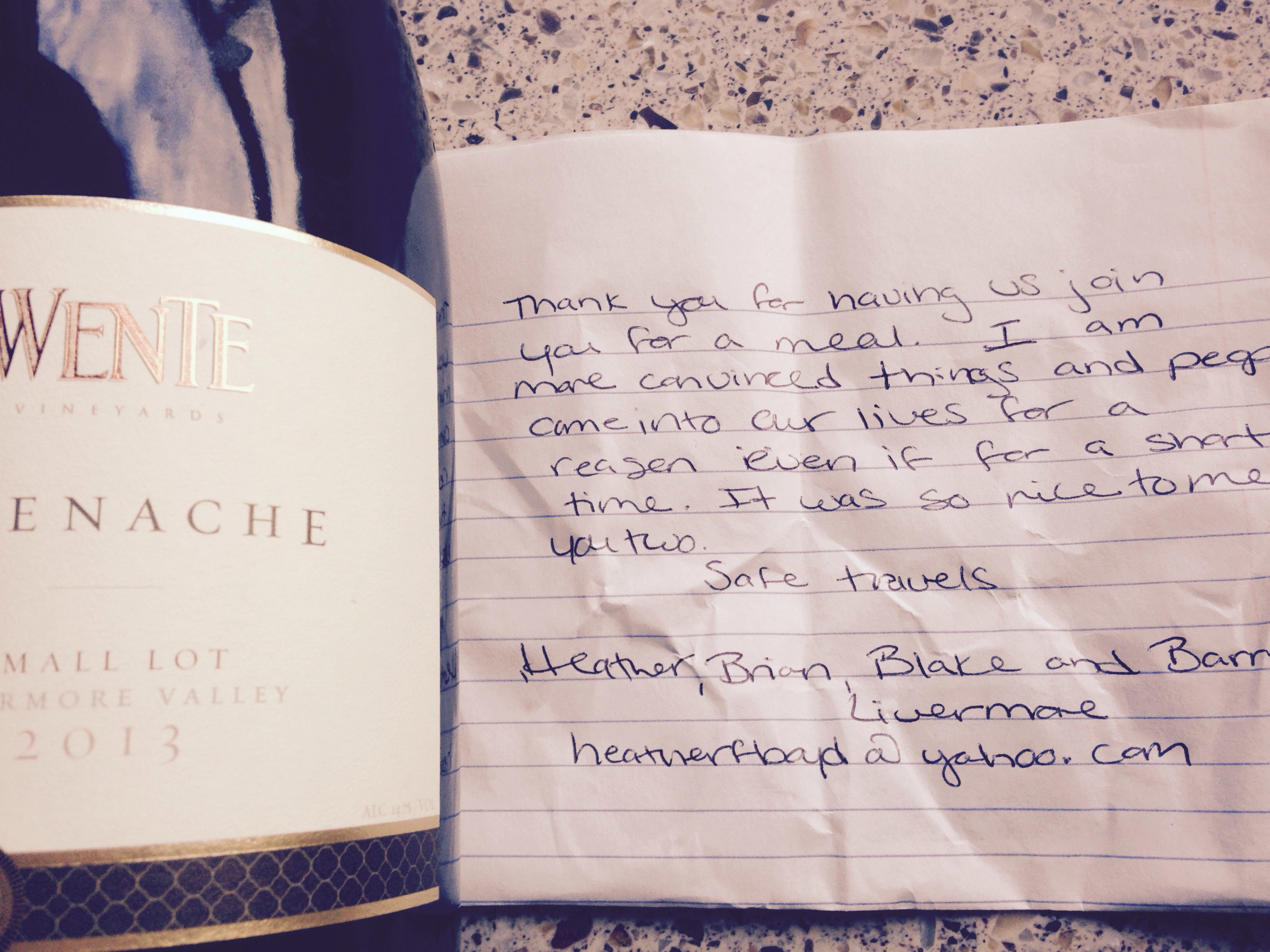
Lake Del Valle campground is located at the bottom of a steep canyon, foothills surrounding it on all sides. No cellular, no internet here! The days started later and ended early. Wonderful campground with spacious camp sites, many trails and a large lake with two beaches. Several nights we went up to the peaks of the overlooking foothills to catch extraordinary sunsets. We visited the Don Edwards San Francisco Bay Wildlife Refuge, located on the southern and eastern side of the bay. Many sloughs (rhymes with ‘you’) here that are used to capture salt from the bay water. Great trails/views. Our last night at the campground, we shared dinner with Heather and her son, Bartlett…… I continue to be amazed by the wonderful people we meet along the way. Heather and Bartlett felt like family by the end of the evening….
Samoa, CA has a first come, first serve campground and the county campground folks told us we wouldn’t have problem getting a spot because it’s so remote, so cold and dry camping (no hook ups) was the only option. And we didn’t have a problem! The campground was a large lot including a boat launch and building with restrooms and showers, directly overlooking Humboldt Bay. Approximately 1/2 mile west was the ocean and 1/2 mile south was the jetty and inlet connecting ocean to bay, so water all around. Most mornings were shrouded in fog, with the sun generally burning through by midday. Temps reached high 60’s/low 70’s. Getting out from under the blankets in the morning was hard – raw and cold! And a quick story about our trip to Samoa…… We were supposed to keep the San Francisco Bay to our west. Somehow we found ourselves going over the Oakland/San Francisco bay bridge, putting us right in downtown San Francisco with a 40′ rig towing a car, never mind paying the $25 to go over the bridge!! Fortunately our GPS lady was able to give us a fairly quick way to turn ourselves around……
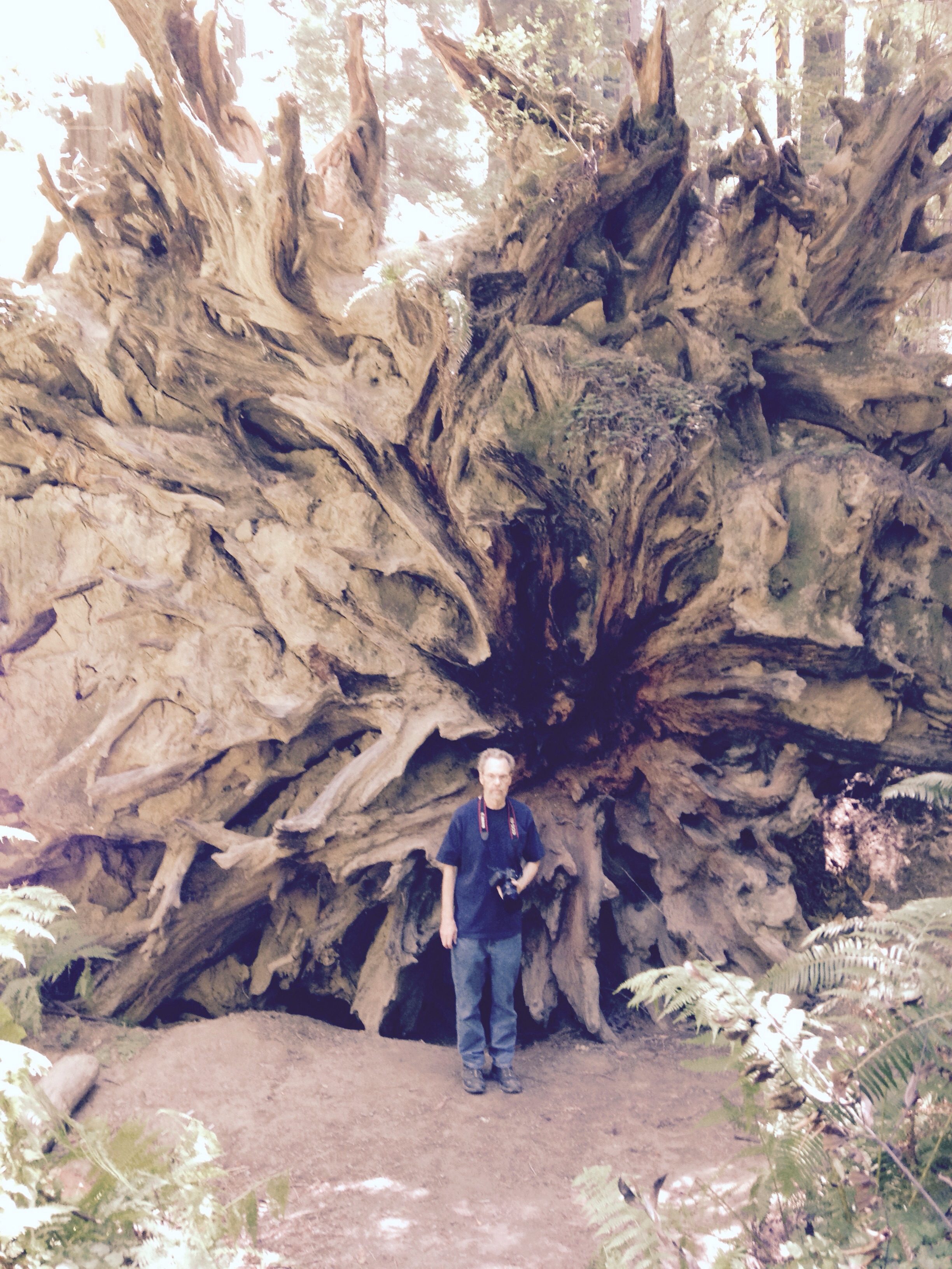
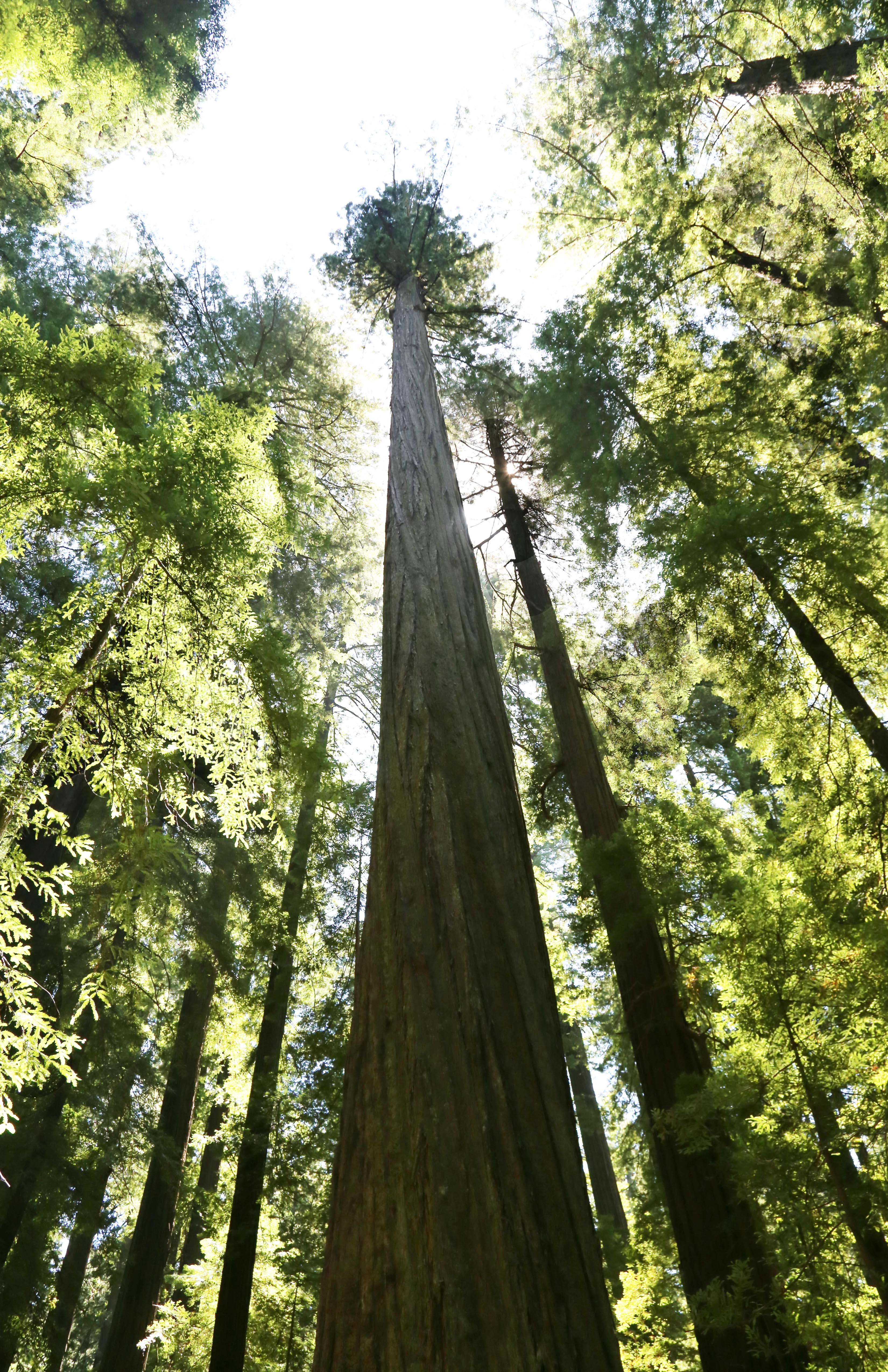
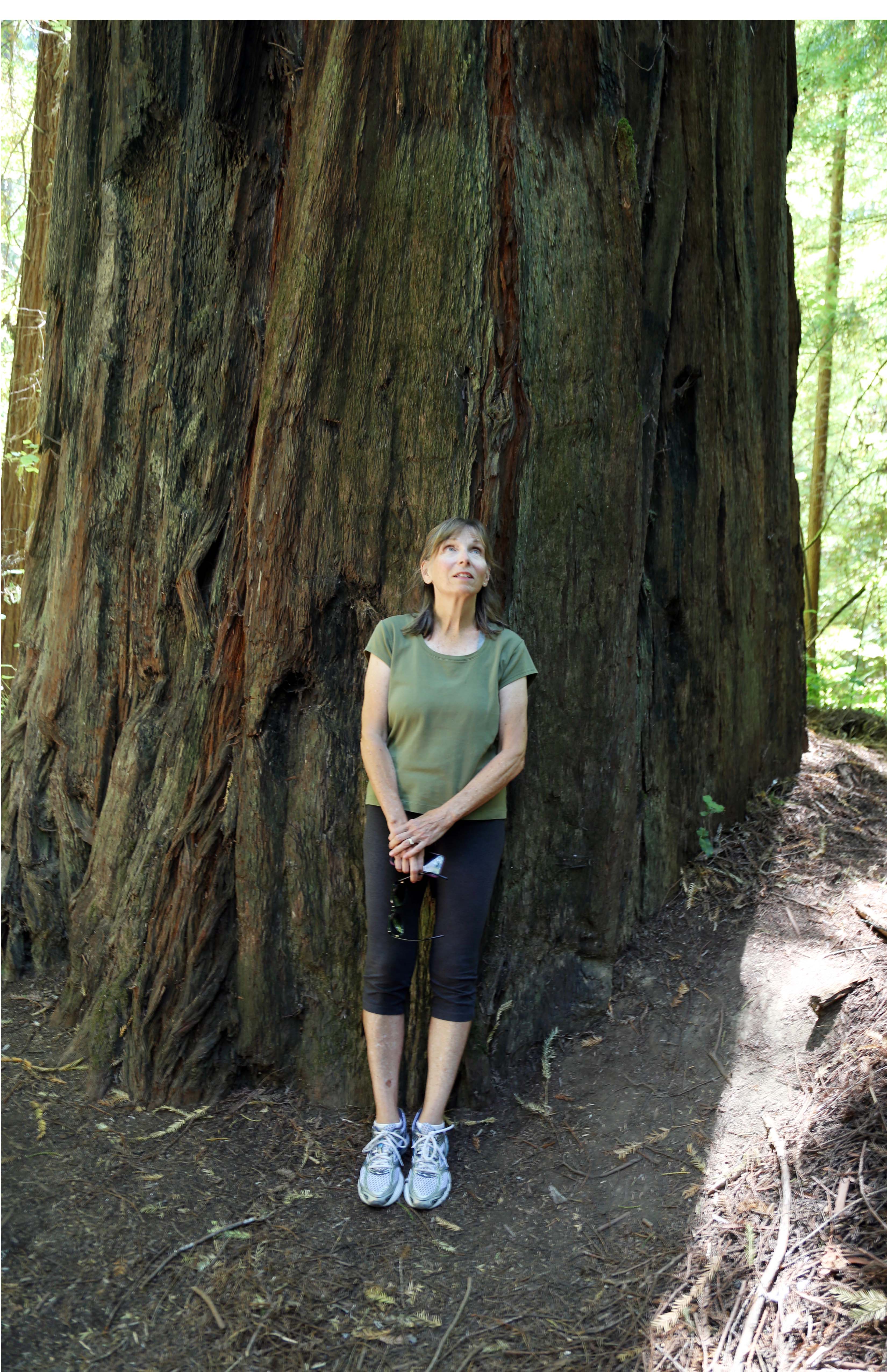
One of the most beautiful spots we have visited so far was while at Samoa – the National Redwood Park and driving the ‘Avenue of the Giants’, a 30+ mile long road through these magnificent trees. Some of these redwoods are considered ancient relics, standing in place for over a 1,000 years. Many well over 300′ tall; they are so immense that they live in 3 climatic zones at once. And these redwoods help create their own microclimate, with one tree releasing up to 500 gallons of water into the air per day from its leaves. Incredible!
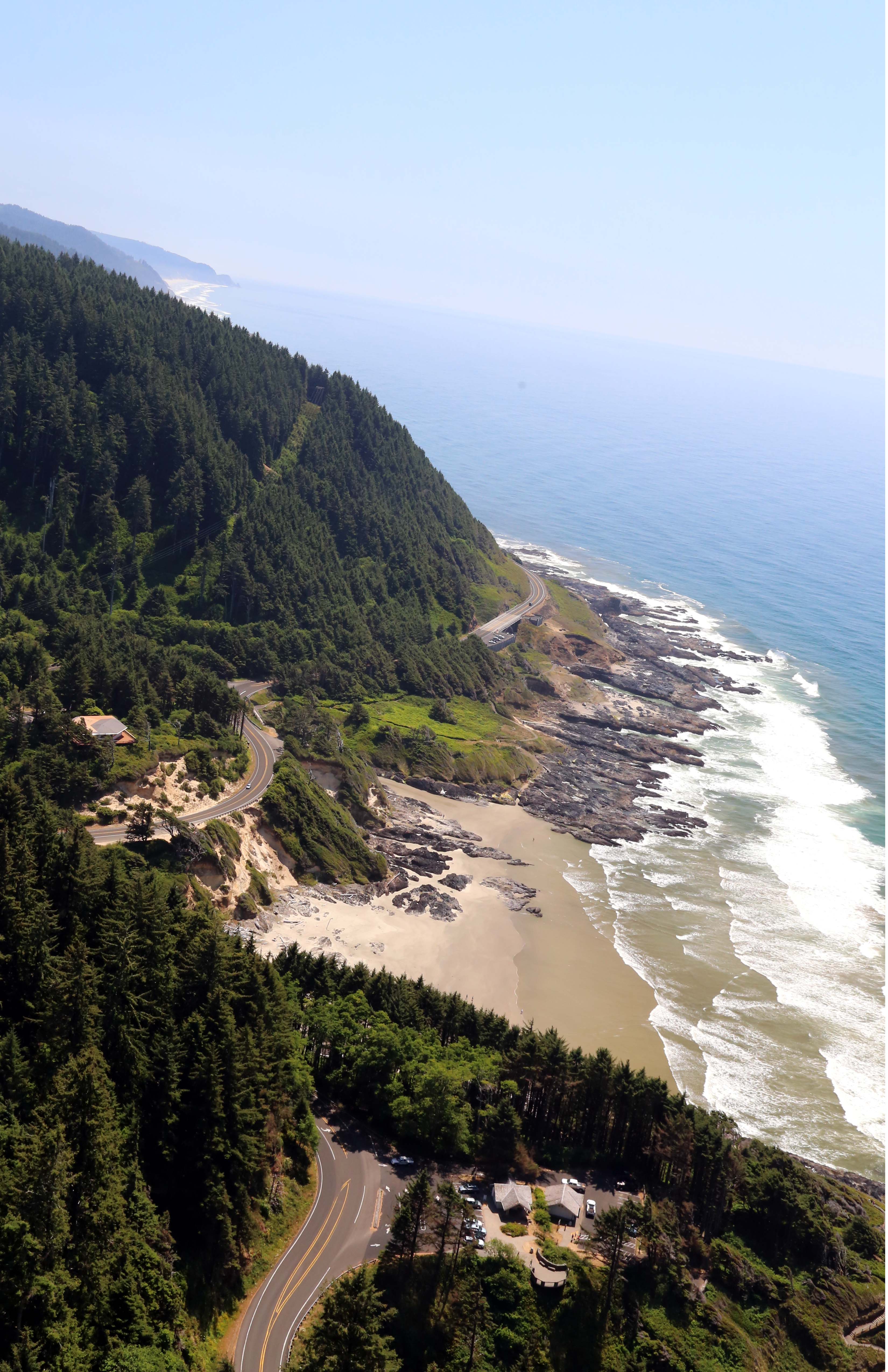
We are now on the southern coastline of Oregon, in Florence. The trip here was a roller coaster ride, buffeted by windy ocean gusts, traveling on curvy 101 highway which is carved into mountains that drop to the ocean, rock slide warnings, up and down foothills…. This area has the largest expanse of coastal sand dunes in North America. Some dunes are more than 300 feet high. The sand dune at the back end of our campground towers over the trees. Much dune buggy use here.
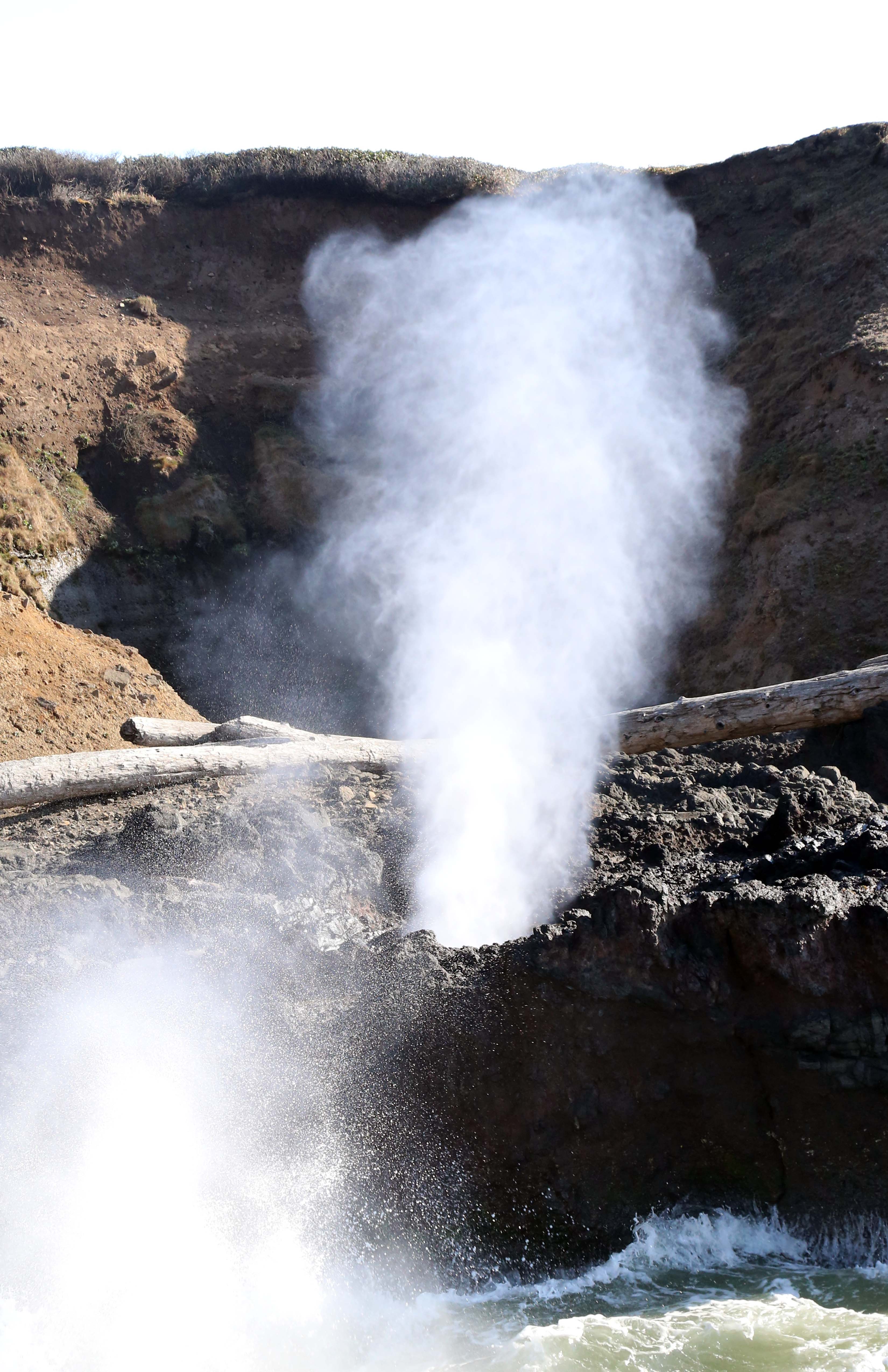
We spent one day traveling highway 101 north, visiting Cape Haceta light house, where I spotted a grey whale; Cape Perpetua, a large forested headland; Newport, with a wonderful gluten free grocery and deli…and all the towns in between. At Cape Perpetua, we hiked down to ‘spouting horn’, where ocean waves pushed under the rocks cause salt water flumes to explode up through the rocks. Devil’s Churn, also on our hike, is an area with a long crack in the coastal rock where waves smash into each other as they come and go. The visitor center overlooks all of this area and provides indoor and outdoor viewing of the ocean way below. About 800 feet further above the visitor center is another trail that loops around the mountain top and leads to a stone shelter built by the CCC in the 1930’s.
Tomorrow we leave the ocean area and head to Crater Lake. I’ll be heading over tonight after dinner to say good-bye to the ocean. Most rest of our trip will be inland from here.
Learnings:
– don’t trust google maps! Think there is a gremlin inside that enjoys getting travelers to wrong places and in tight spots
– if ever on the west coast, travel some portion of Highway 101. Much of this highway follows the ocean from CA, through OR and into WA, I believe
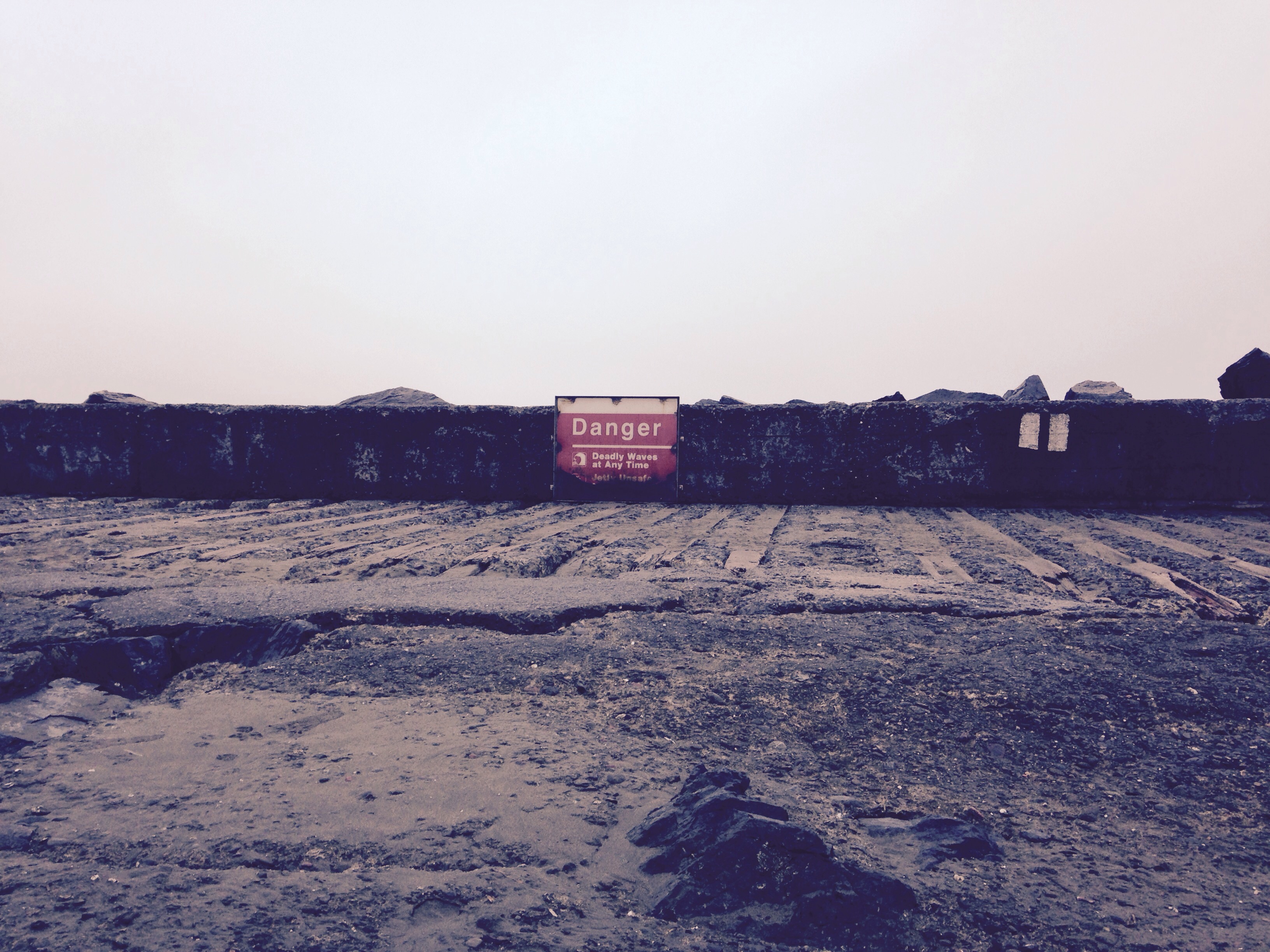
– new warning sign encountered walking on jetties the last few days ‘Dangerous – Killer Waves’. Sure makes you keep an eye on the ocean
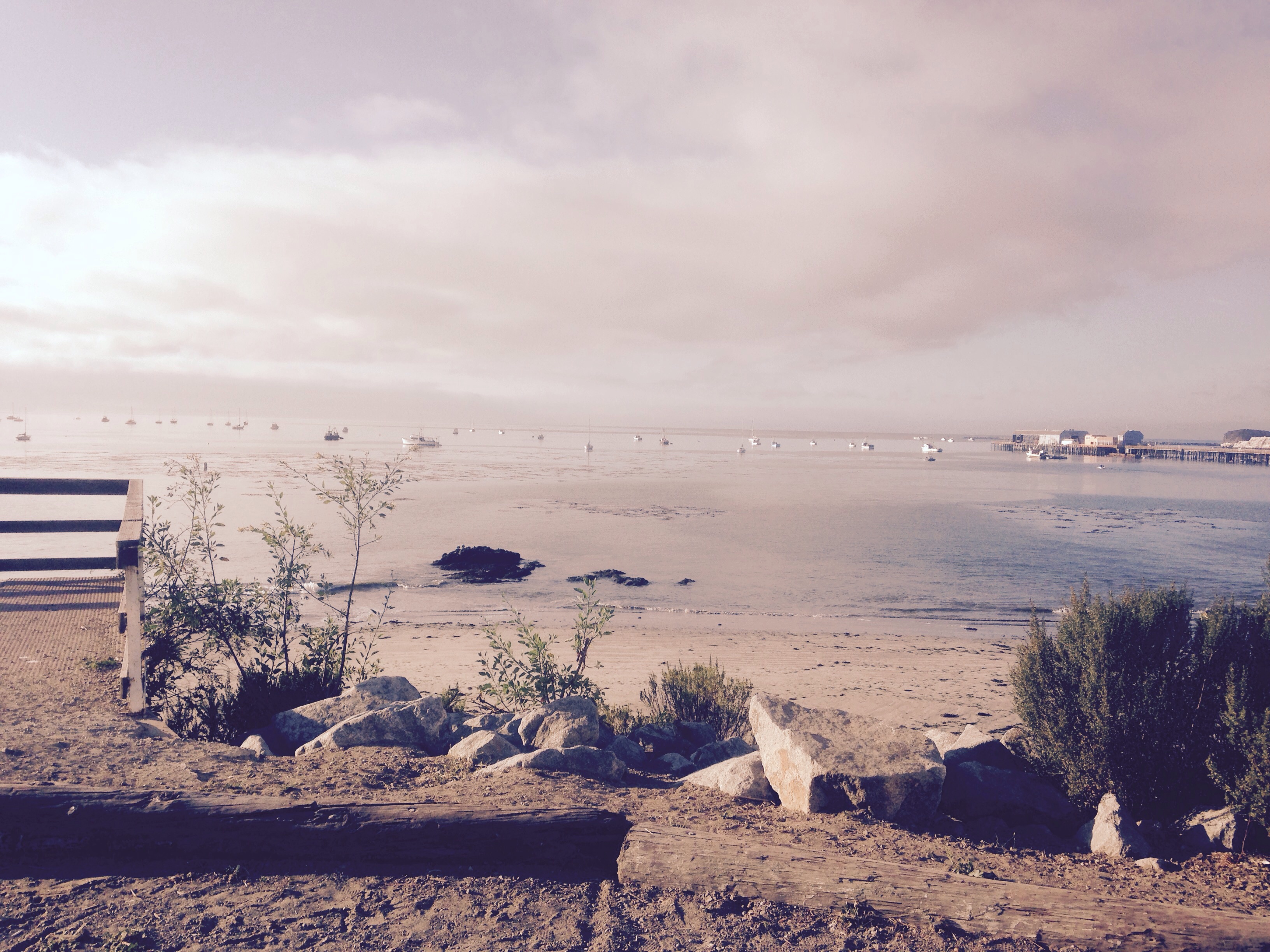
Our Camper on Avila Beach
View of lake Del Valle from top of foothill
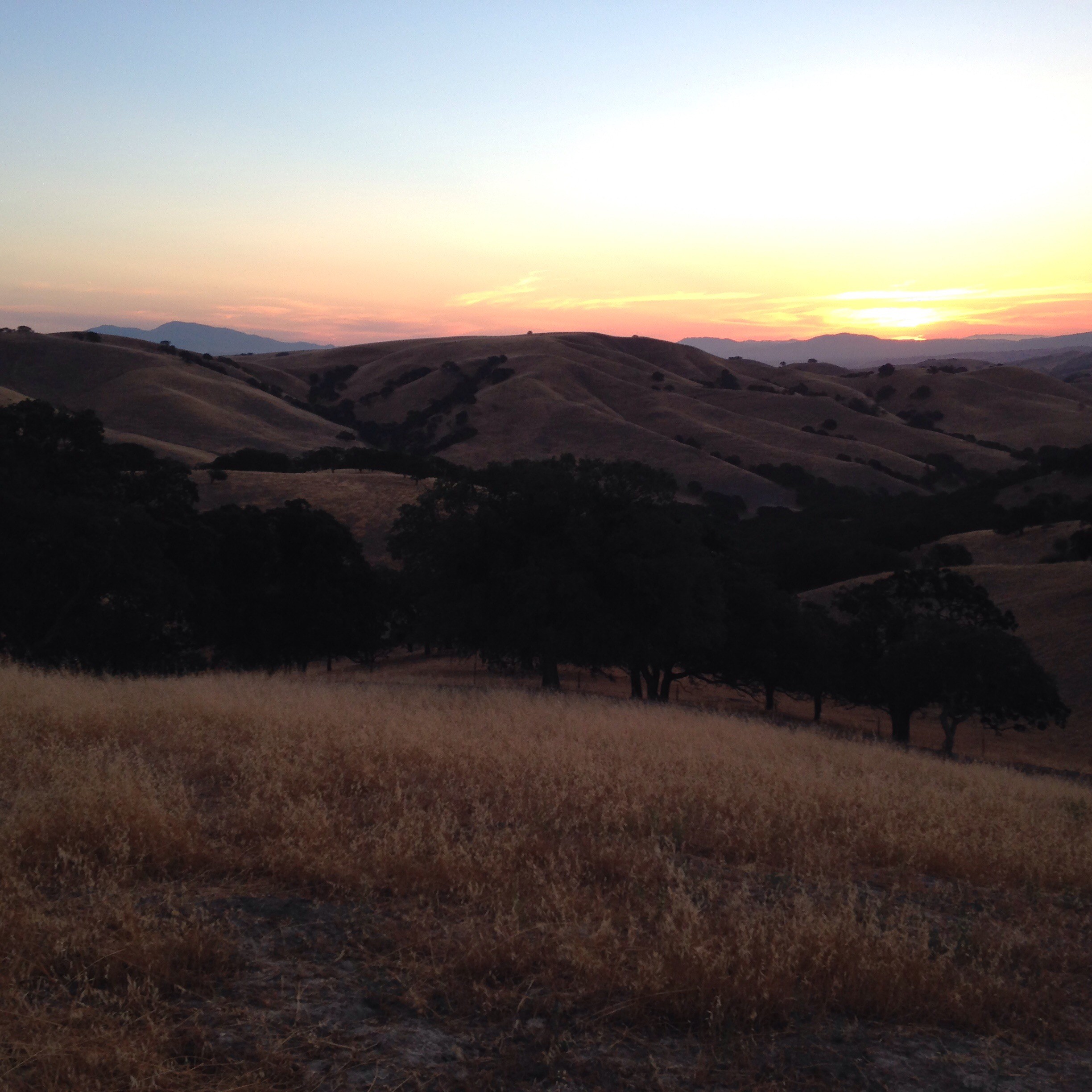
Sunset from top of foothills at Lake Del Valle
Steve with sloughs (rhymes with you) from Don Edwards SF Bay national Wildlife Refugei
Thank you note, accompanying bottle of wine gift… Sharing time, dinner and conversation with Heather and Bartlett at Lake Del Valle
Warning of deadly waves at Samoa jetty
Steve standing in front of topple redwood tree root. Immense!
Redwood trees
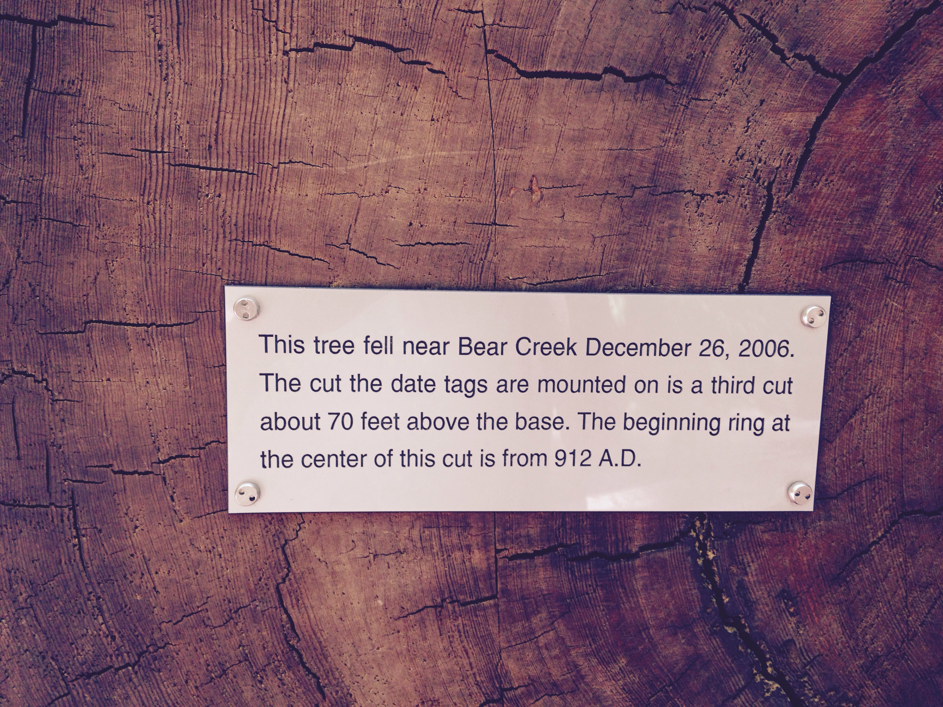
Statement about age of redwood tree
Joan Looking Up at Redwoods
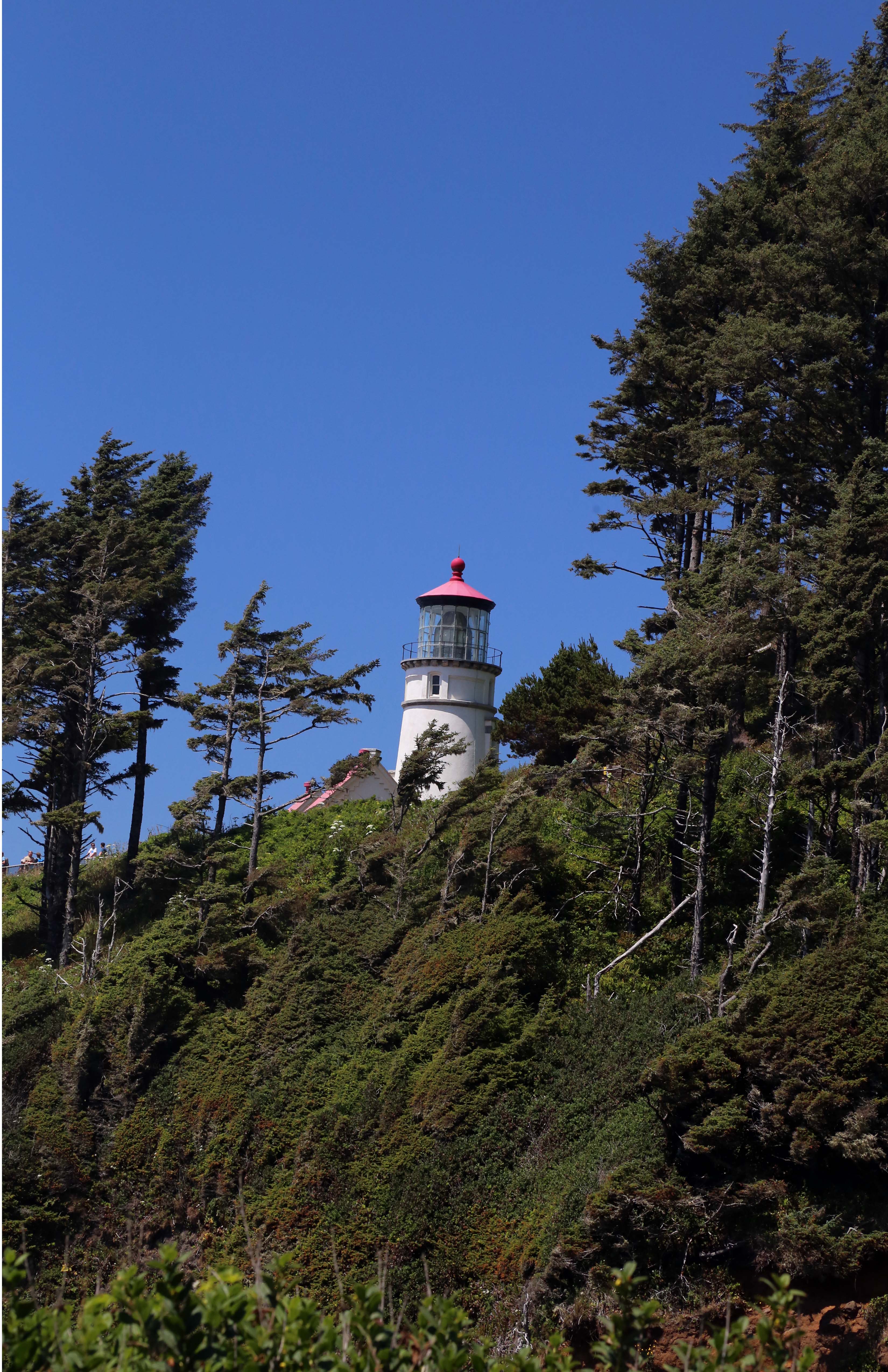
Cape Haceta lighthouse
Salt water fountain caused by force of ocean waves. Spouting Horn at Cape Perpetua, OR
Salt water flume at Cape Perpetua, OR
View of Oregon Coastline with Highway 101 Etched into Hills
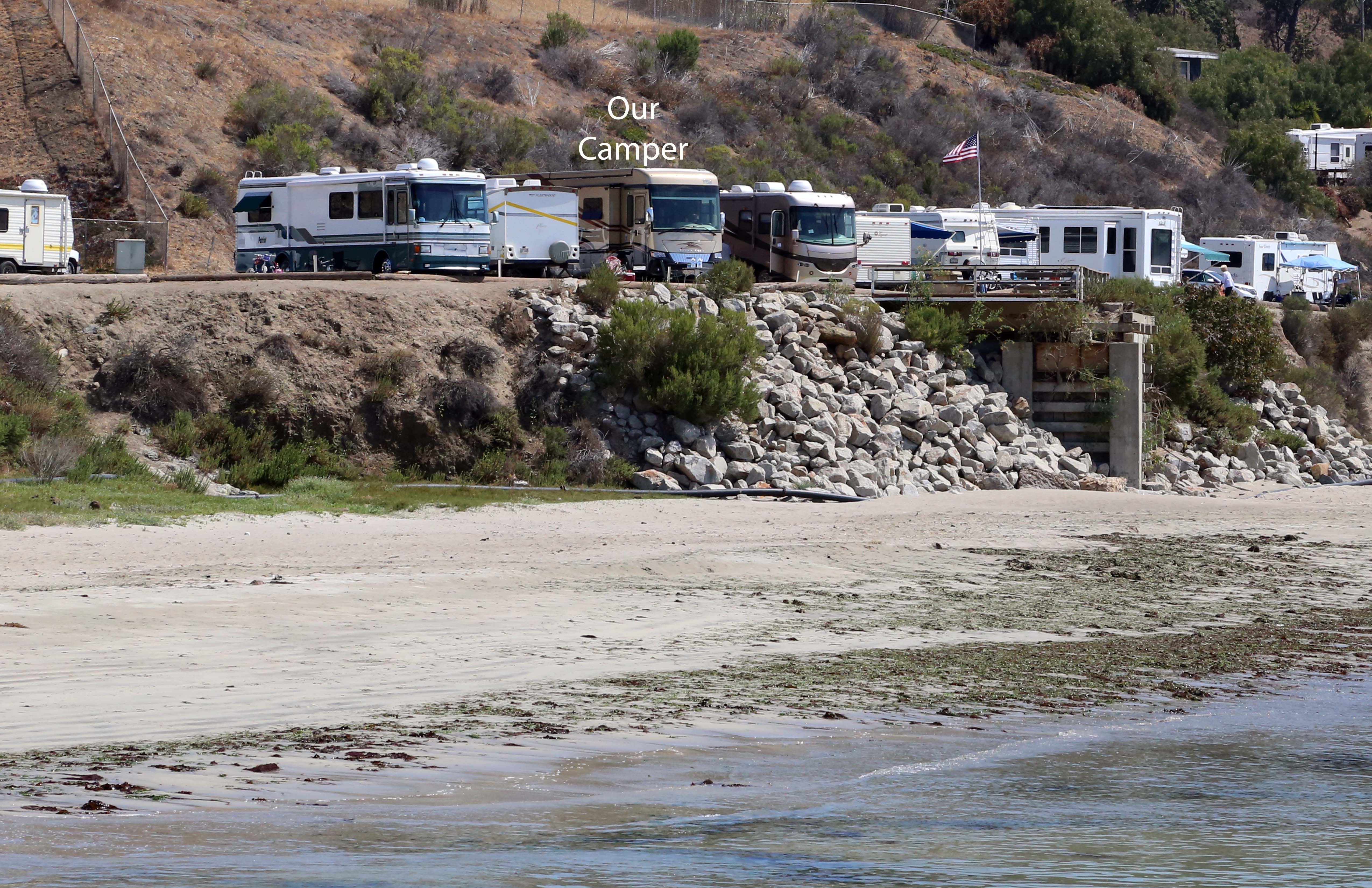
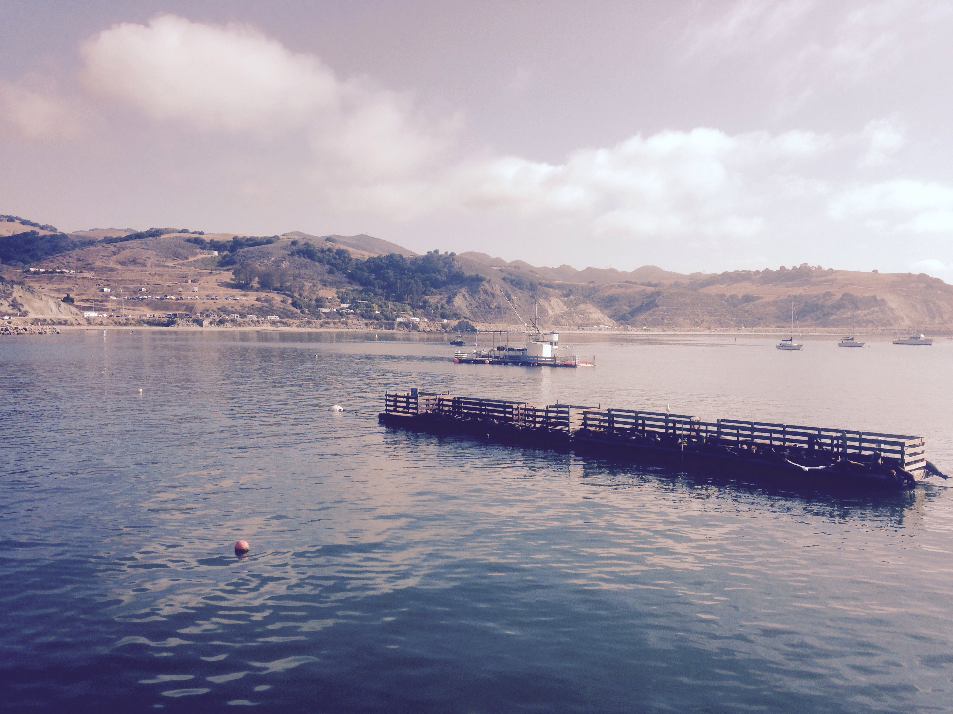
Several campground moves since the last update in early July. And we regained Internet (and cellular) connection yesterday, after many days with out, as we landed in Avila Beach, CA. This is our first time ‘dry camping’, no water, electricity and/or sewer hook ups, as well as our first time camping right on the ocean, just 20 yards in front of our windshield.
To digress for a moment….. WIFI is a constant challenge and I’ve come to appreciate an hour or so over a cup of coffee at coffee houses that have free WIFI. Far fewer campgrounds have WIFI than do. To be able to upload pictures, download a library book to my kindle, post pictures/comments to Facebook, get/send emails, etc..is no longer taken for granted.
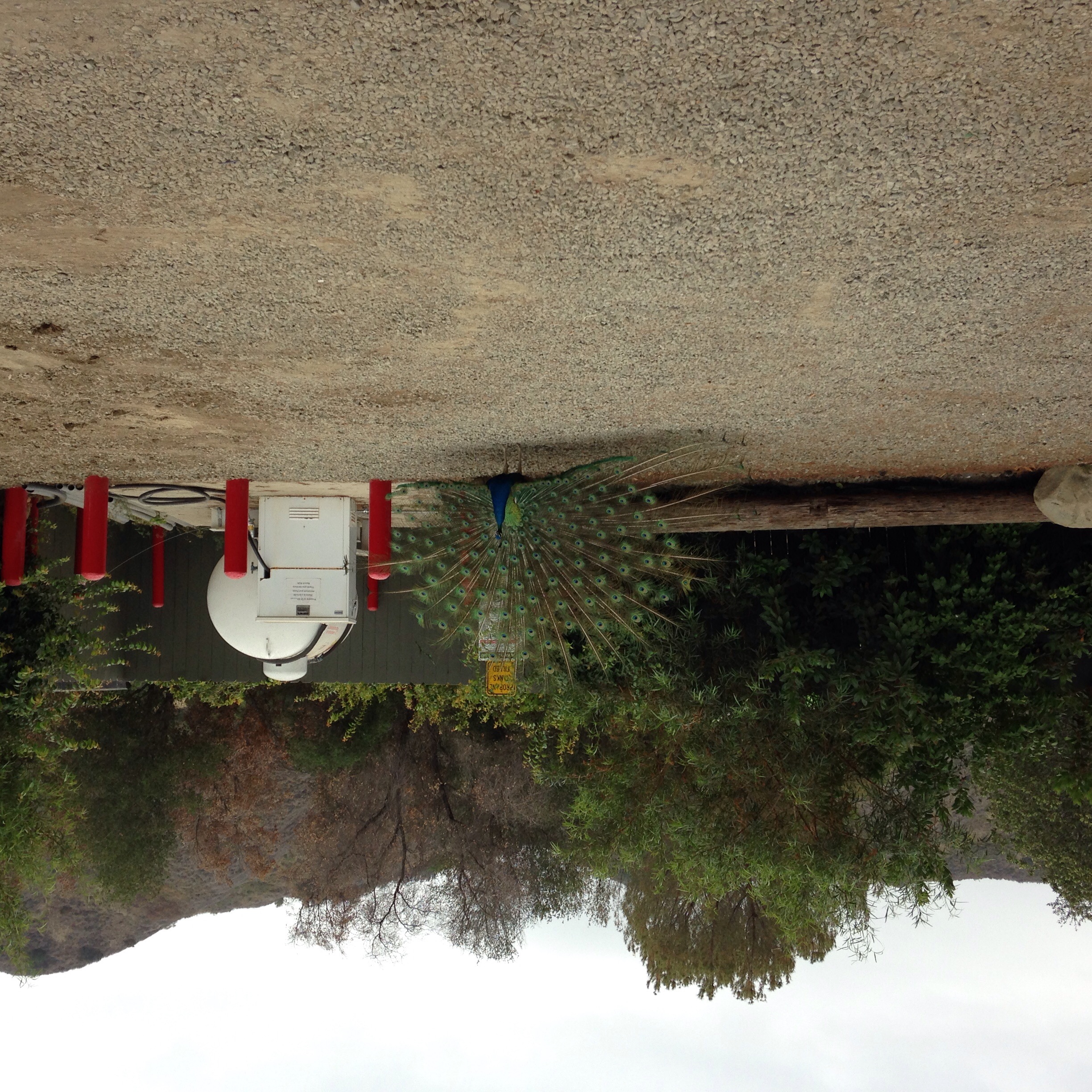
Each new campground generally takes us one night to adjust to new sounds. At the Ventura campground, it was the sounds of free range peacocks; at Tapo Canyon, one of my favorite spots to date, it was the eerie coyote cries right outside our window; and here at Avila Beach, the bronchitis-sounding seal serenades. And a few comments on peacocks – we’ve now been in two locations where peacocks are part of the landscape, in trees, on houses, walking the roads. My first time seeing baby, fluffy peacocks…..
People connections meant much to me before being on the road and now mean even more. The calls/emails from family and friends warm my day. I’m working on this thought that ‘my absence is my presence’ for all the family and friend events that go on while we are away. And new interactions continue to amaze….a gift of mangos from a gal from Vietnam who asked to see what an RV looked like; a phone number and contact name for people in Oregon in case we needed help while visiting that area; a soon-to-be 4th grader who wanted to know whose handprints were on the back of my t-shirt and asked to put her hand on each…..
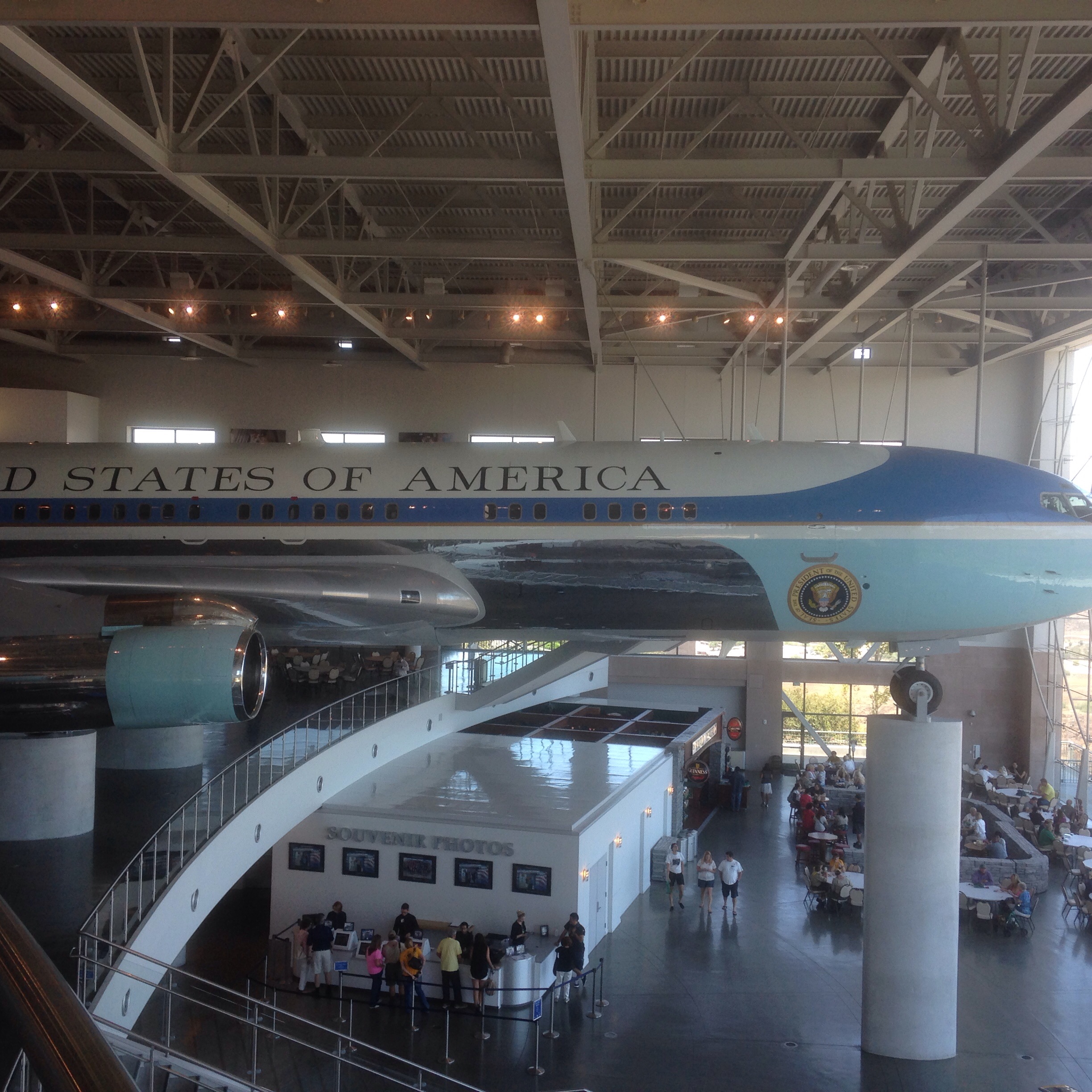
We spent several hours at the Ronald Reagan library located on top of a big hill overlooking Simi Valley. So impressive….the memorabilia, the review of history of that time, the incredible views from the library and a real, formerly used ‘Air Force One’ jet, as well as ‘Marine One’ helicopter open for boarding, right within the building!
Some recent learnings
– the importance of checking to see if that is a tan on my legs before going to bed
– never, ever, never leave large containers of mango juice free to roam the refrigerator, even though the refrigerator is locked while under travel. The repercussions of one falling out when first re-opening the refrigerator will never, ever be forgotten
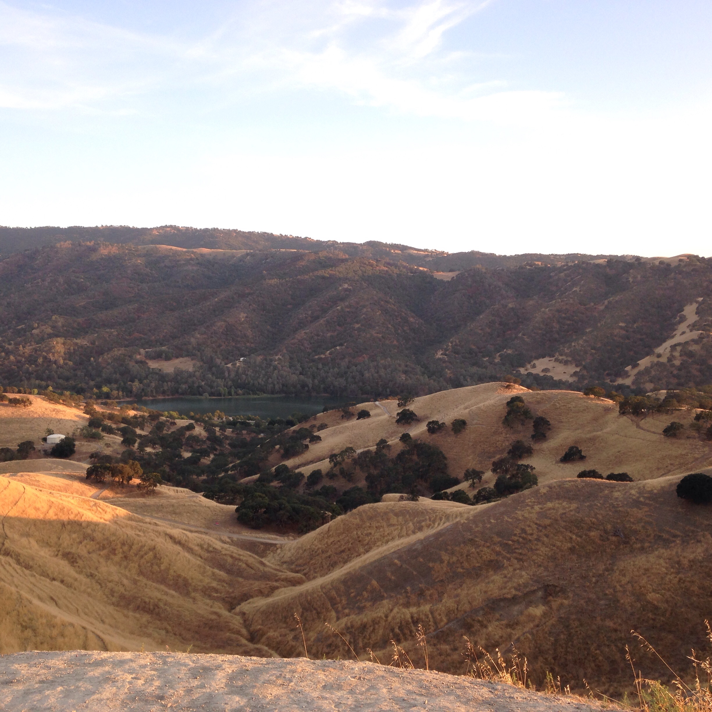
Lake Cachuma campground feels like home; we’ve been here 1 1/2 weeks. Campground neighbors change, mostly coming and going on weekends and lots of open space in the middle of the week. I suspect we’ll have a full house this July 4 weekend.
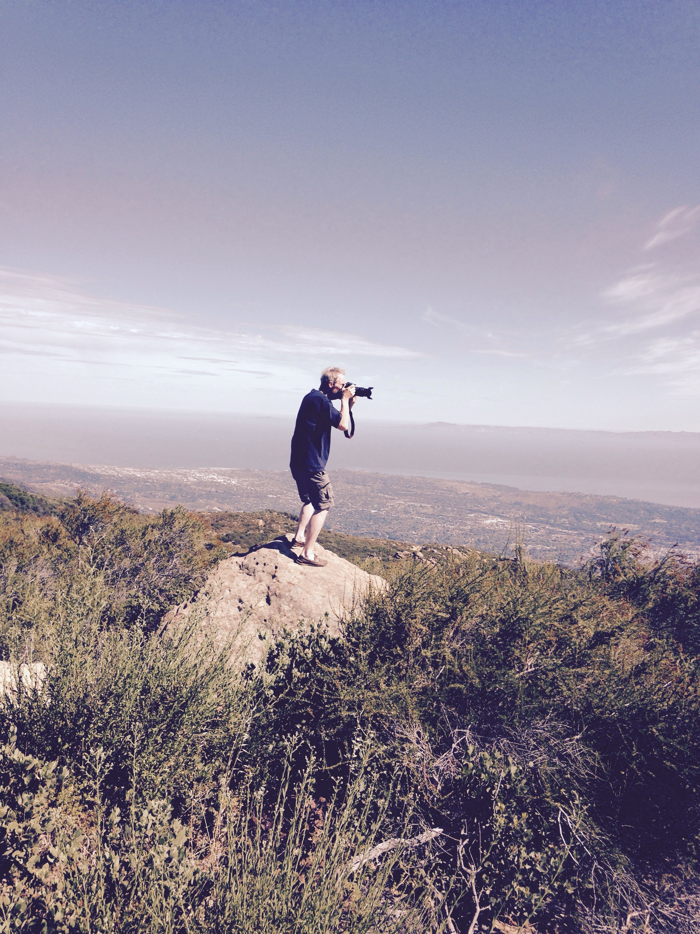
We continue to investigate the area. Twice we’ve driven El Camino Cielo, an incredible road that travels a mountain ridge, with one side overlooking Santa Barbara and the Channel Islands; the other side the San Padre national forest and canyons. Crazy switchbacks, drop offs, views and no guard rails on the road. On the second trip, we hooked the video camera to the windshield and memorialized the trip. Learning how to cut, edit and post a video clip next on the ‘to do’ list.
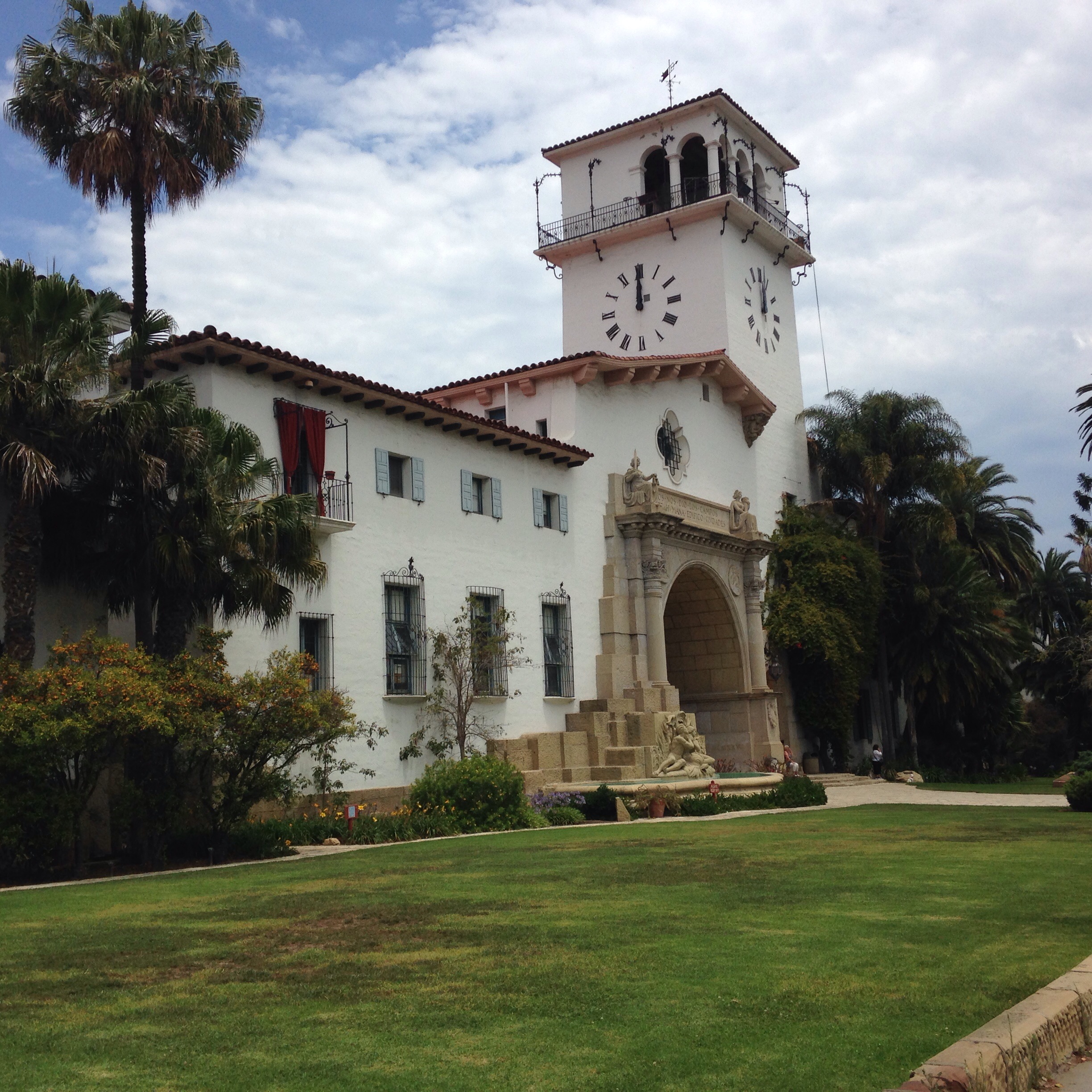
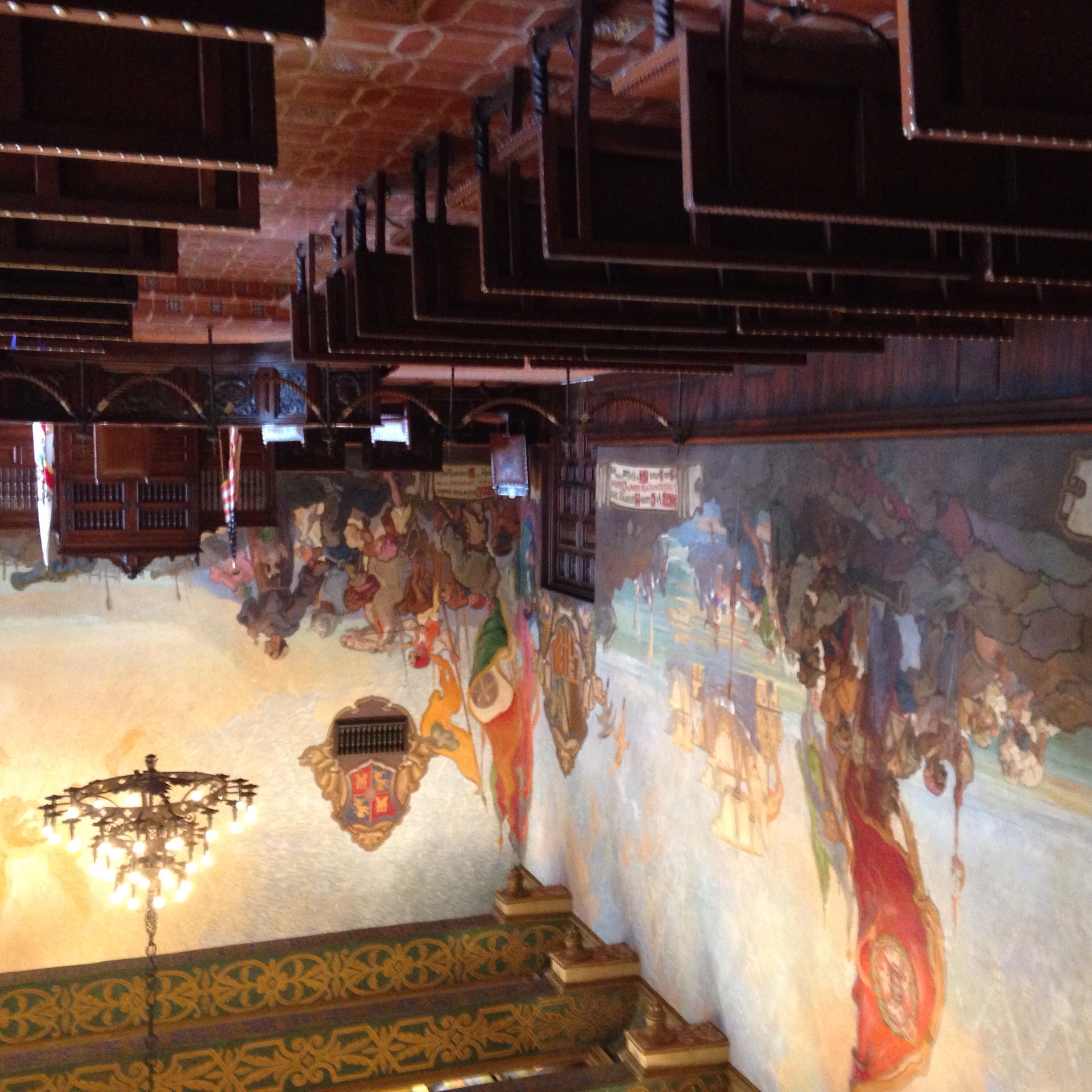
We spent a day in beautiful Santa Barbara, a town over the mountain and on the ocean. The Visitors Center staff provided many suggestions for places to visit. First, was lunch at an open air restaurant serving ‘rustic CA’ food in the historic area off State street. Yum – a red meat fix with lots of avocados for me; Steve munched a turkey burger loaded with cheese. Next was the court house, built in 1929, with beautiful wall murals, paintings and ceramic designs depicting history of the area. Open air hallways and courtyards throughout. We drove to and parked on Stearns Wharf, which juts well out into the ocean and houses many stores and restaurants. The wharf and beach area are busy with musicians, artists, swimmers, kayakers, paddle boarders, personal and commercial boats…. Round about way home via Costco, grocery store, gas station…. And once home, I realized the notebook I’ve been using as both a diary and list keeper for RV activities since we left CT was missing!! Steve, to the rescue, drove back to the grocery store and was able to retrieve it from ‘lost and found’ Big, big sigh of relief and many thanks to Steve.
A few days before going to Santa Barbara, the campground was hazy and contained smoke smell. Turns out there was a 300 acre forest fire in Lompoc, a town approximately 25 miles away. Fortunately the fire was contained within 24 hours…. With so little rain and water restrictions, any fire causes great concern.
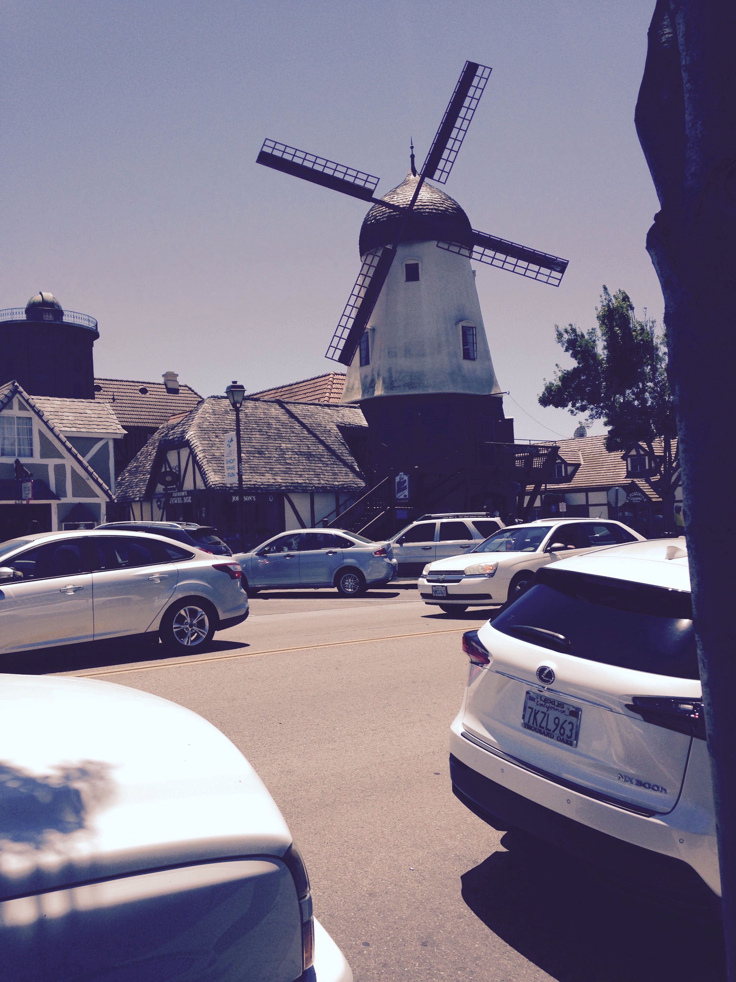
Another town nearby is Solvang, founded by Danes and with many connections still to Denmark. The town resembles a Danish village and includes an old fashion windmill, a replica of the ‘little mermaid’ and a great coffee shop with free coffee refills and WIFI.
From a two-hour ranger-led boat tour on lake Cachuma, we learned much about the local animals, plants, history, etc… This area (Santa Barbara county) has the most diverse plant life in the U.S., due to the varying terrain and ocean impact. Sequoia trees on the top of mountains that are over 4,800 feet up, chaparral and a wide range of trees, shrubs and flowers that live on the mountain sides, canyons and arrid areas. We saw a bald eagle, blue herons, red tail Hawks, Greebs (which remind me of the cormorants) and other birds. No mountain lions, deer or other 4 legged critters.
And a couple of side-bar comments:
– the campground is being patrolled this weekend by mounted Rangers, most likely due to the July 4 holiday. So cool to have a horse and rider stop by the campsite…
– should have checked the deck of cards I brought. Playing cribbage tonight with Steve found out there were only 50 cards! Oh well, only missing 2…….
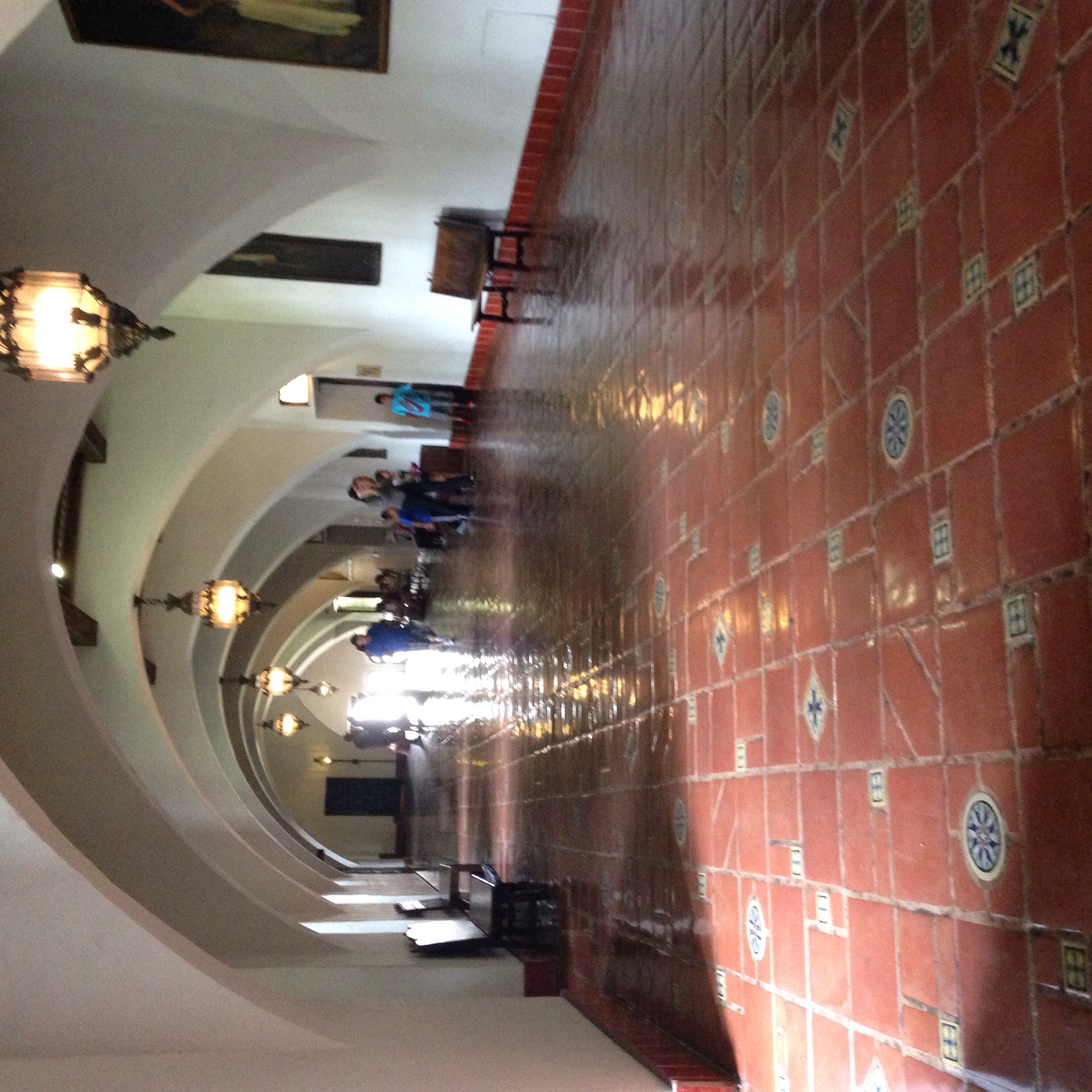
Santa Barbara courthouse
Art work in Santa Barbara court house
Hallway in Santa Barbara court house
Solvang, CA
Steve precariously taking picture from overlook of Santa Barbara on ridge road
View of Santa Barbara and Channel Islands from mountain ridge road